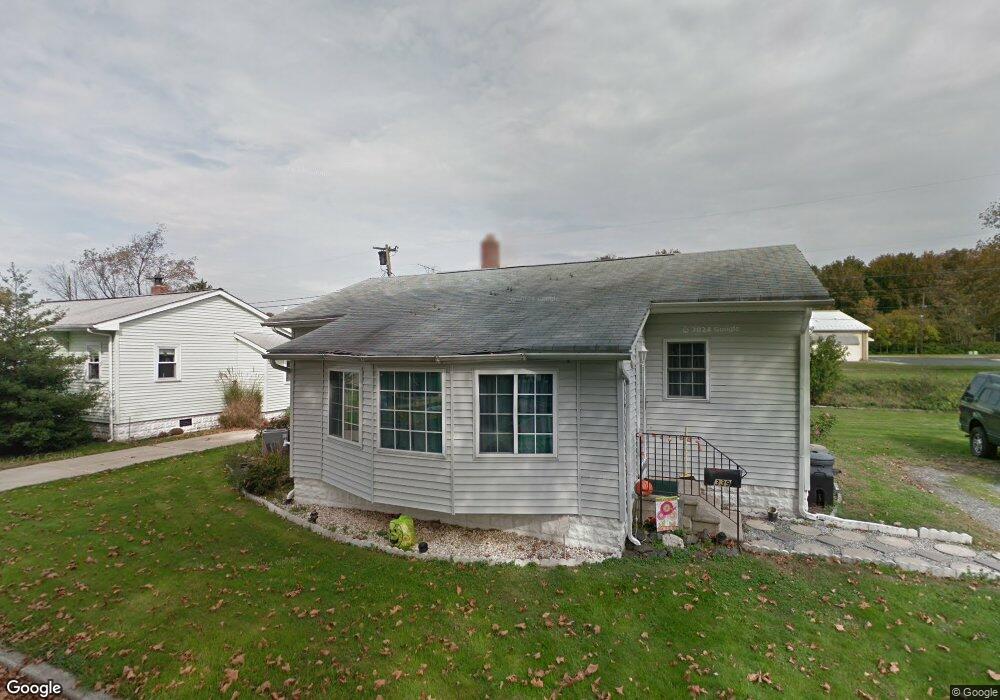
339 Taft Ave Penns Grove, NJ 08069
Estimated Value: $160,775 - $244,000
--
Bed
--
Bath
1,034
Sq Ft
$209/Sq Ft
Est. Value
About This Home
This home is located at 339 Taft Ave, Penns Grove, NJ 08069 and is currently estimated at $215,694, approximately $208 per square foot. 339 Taft Ave is a home located in Salem County with nearby schools including Lafayette-Pershing Elementary School, Paul W. Carleton Elementary School, and Field Street Elementary School.
Ownership History
Date
Name
Owned For
Owner Type
Purchase Details
Closed on
Aug 29, 1997
Sold by
Toulson Shirley H and Livesay David
Bought by
Whittaker Wallace R and Whittaker Eileen M
Current Estimated Value
Home Financials for this Owner
Home Financials are based on the most recent Mortgage that was taken out on this home.
Original Mortgage
$38,250
Outstanding Balance
$5,870
Interest Rate
7.36%
Mortgage Type
FHA
Estimated Equity
$209,824
Create a Home Valuation Report for This Property
The Home Valuation Report is an in-depth analysis detailing your home's value as well as a comparison with similar homes in the area
Home Values in the Area
Average Home Value in this Area
Purchase History
| Date | Buyer | Sale Price | Title Company |
|---|---|---|---|
| Whittaker Wallace R | $20,000 | West Jersey Title Agency |
Source: Public Records
Mortgage History
| Date | Status | Borrower | Loan Amount |
|---|---|---|---|
| Open | Whittaker Wallace R | $38,250 |
Source: Public Records
Tax History Compared to Growth
Tax History
| Year | Tax Paid | Tax Assessment Tax Assessment Total Assessment is a certain percentage of the fair market value that is determined by local assessors to be the total taxable value of land and additions on the property. | Land | Improvement |
|---|---|---|---|---|
| 2025 | $3,436 | $171,000 | $46,300 | $124,700 |
| 2024 | $3,318 | $93,200 | $35,000 | $58,200 |
| 2023 | $3,318 | $93,200 | $35,000 | $58,200 |
| 2022 | $3,122 | $93,200 | $35,000 | $58,200 |
| 2021 | $3,092 | $93,200 | $35,000 | $58,200 |
| 2020 | $3,119 | $93,200 | $35,000 | $58,200 |
| 2019 | $3,146 | $93,200 | $35,000 | $58,200 |
| 2018 | $3,420 | $108,600 | $40,700 | $67,900 |
| 2017 | $3,189 | $108,600 | $40,700 | $67,900 |
| 2016 | $3,072 | $108,600 | $40,700 | $67,900 |
| 2015 | $3,668 | $136,000 | $47,700 | $88,300 |
| 2014 | $3,472 | $136,000 | $47,700 | $88,300 |
Source: Public Records
Map
Nearby Homes