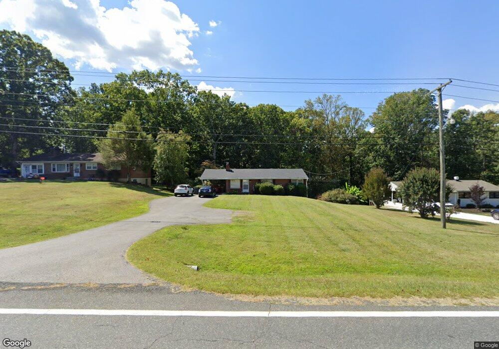
339 Winesap Rd Madison Heights, VA 24572
Estimated Value: $213,893 - $241,000
3
Beds
1
Bath
992
Sq Ft
$230/Sq Ft
Est. Value
About This Home
This home is located at 339 Winesap Rd, Madison Heights, VA 24572 and is currently estimated at $227,723, approximately $229 per square foot. 339 Winesap Rd is a home located in Amherst County with nearby schools including Elon Elementary School, Monelison Middle School, and Amherst County High School.
Ownership History
Date
Name
Owned For
Owner Type
Purchase Details
Closed on
Aug 8, 2022
Sold by
Jane Desotell Mary
Bought by
Desotell Amber N
Current Estimated Value
Purchase Details
Closed on
Dec 4, 2007
Sold by
Goff Brigitte and Blanhenship Brigitte Hartwig
Bought by
Goff Brigitte
Home Financials for this Owner
Home Financials are based on the most recent Mortgage that was taken out on this home.
Original Mortgage
$89,000
Interest Rate
6.21%
Mortgage Type
Seller Take Back
Create a Home Valuation Report for This Property
The Home Valuation Report is an in-depth analysis detailing your home's value as well as a comparison with similar homes in the area
Home Values in the Area
Average Home Value in this Area
Purchase History
| Date | Buyer | Sale Price | Title Company |
|---|---|---|---|
| Desotell Amber N | -- | None Listed On Document | |
| Goff Brigitte | -- | None Available |
Source: Public Records
Mortgage History
| Date | Status | Borrower | Loan Amount |
|---|---|---|---|
| Previous Owner | Goff Brigitte | $89,000 |
Source: Public Records
Tax History Compared to Growth
Tax History
| Year | Tax Paid | Tax Assessment Tax Assessment Total Assessment is a certain percentage of the fair market value that is determined by local assessors to be the total taxable value of land and additions on the property. | Land | Improvement |
|---|---|---|---|---|
| 2025 | $682 | $111,800 | $22,500 | $89,300 |
| 2024 | $682 | $111,800 | $22,500 | $89,300 |
| 2023 | $682 | $111,800 | $22,500 | $89,300 |
| 2022 | $682 | $111,800 | $22,500 | $89,300 |
| 2021 | $682 | $111,800 | $22,500 | $89,300 |
| 2020 | $682 | $111,800 | $22,500 | $89,300 |
| 2019 | $689 | $113,000 | $28,500 | $84,500 |
| 2018 | $689 | $113,000 | $28,500 | $84,500 |
| 2017 | $689 | $113,000 | $28,500 | $84,500 |
| 2016 | $689 | $113,000 | $28,500 | $84,500 |
| 2015 | $633 | $113,000 | $28,500 | $84,500 |
| 2014 | $633 | $113,000 | $28,500 | $84,500 |
Source: Public Records
Map
Nearby Homes
- 379 Winesap Rd
- 0 McIvor Ln
- 0 S Amherst Hwy Unit 362100
- 0 S Amherst Hwy Unit 336267
- 561 Oak Grove Dr
- 51 Patrick Ct
- 505 Royal Gardens Ct
- 124-138 Cedar Gate Rd
- 157 Old Country Rd
- 116 Winridge Dr
- 272 Dixie Airport Rd
- 687 Elon Rd
- 115 Morgan Rd
- 150 Glenwood Dr
- 327 Dixie Airport Rd
- 139 Grimes Dr
- 4123 S Amherst Hwy
- 621 Cedar Gate Rd
- 571 Dixie Airport Rd
- 235 Hundley Ln
- 347 Winesap Rd
- 333 Winesap Rd
- 336 Winesap Rd
- 330 Winesap Rd
- 110 Fairfax Cir
- 357 Winesap Rd
- 344 Winesap Rd
- 352 Winesap Rd
- 315 Winesap Rd
- 143 Nottingham Place
- 130 Fairfax Cir
- 157 Nottingham Place
- 311 Winesap Rd
- 133 Fairfax Cir
- 370 Winesap Rd
- 142 Fairfax Cir
- 147 Fairfax Cir
- 169 Nottingham Place
- 138 Nottingham Place
- 150 Fairfax Cir