Estimated Value: $403,000 - $416,000
About This Home
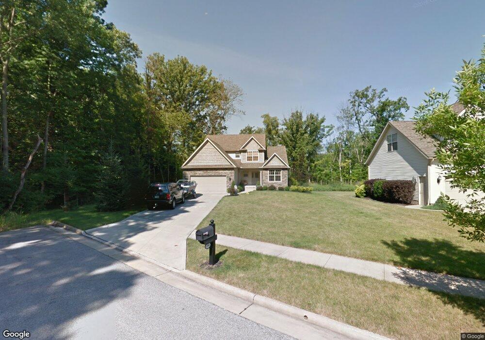
This home is located at 3390 Crown Pointe Dr, Stow, OH 44224 and is currently estimated at $410,785, approximately $352 per square foot. 3390 Crown Pointe Dr is a home located in Summit County with nearby schools including Stow-Munroe Falls High School and St Patrick Elementary School.
Ownership History
We collect this data history from publicly available records. To have your information removed, we recommend requesting removal directly through your county’s website.
Purchase Details
Home Financials for this Owner
Home Financials are based on the most recent Mortgage that was taken out on this home.Purchase Details
Home Financials for this Owner
Home Financials are based on the most recent Mortgage that was taken out on this home.Home Values in the Area
Average Home Value in this Area
Purchase History
We collect this data history from publicly available records. To have your information removed, we recommend requesting removal directly through your county’s website.
| Date | Buyer | Sale Price | Title Company |
|---|---|---|---|
| $245,004 | Land America-Lawyers Title | ||
| $51,200 | Land America/Lawyers Title |
Mortgage History
We collect this data history from publicly available records. To have your information removed, we recommend requesting removal directly through your county’s website.
| Date | Status | Borrower | Loan Amount |
|---|---|---|---|
| Open | $196,000 | ||
| Previous Owner | $178,950 |
Tax History
We collect this data history from publicly available records. To have your information removed, we recommend requesting removal directly through your county’s website.
| Year | Tax Paid | Tax Assessment Tax Assessment Total Assessment is a certain percentage of the fair market value that is determined by local assessors to be the total taxable value of land and additions on the property. | Land | Improvement |
|---|---|---|---|---|
| 2026 | $9,237 | $115,465 | $18,914 | $96,551 |
| 2025 | $8,125 | $115,465 | $18,914 | $96,551 |
| 2024 | $8,632 | $115,465 | $18,914 | $96,551 |
| 2023 | $13,480 | $115,465 | $18,914 | $96,551 |
| 2022 | $8,815 | $99,541 | $16,307 | $83,234 |
| 2021 | $8,871 | $99,541 | $16,307 | $83,234 |
| 2020 | $6,808 | $99,540 | $16,310 | $83,230 |
| 2019 | $6,302 | $81,890 | $16,140 | $65,750 |
| 2018 | $6,366 | $81,890 | $16,140 | $65,750 |
| 2017 | $5,589 | $81,890 | $16,140 | $65,750 |
| 2016 | $4,965 | $75,250 | $16,140 | $59,110 |
| 2015 | $5,589 | $75,250 | $16,140 | $59,110 |
| 2014 | $5,414 | $75,250 | $16,140 | $59,110 |
| 2013 | $4,909 | $75,880 | $16,140 | $59,740 |
Map
- 1314 Denise Dr
- 1271 Carol Dr
- 1262 Carol Dr
- 3591 Dayton Ave
- 511 Suzanne Dr
- 1312 Sunset Way Cir
- 391 Louise Ave
- 1265 W Main St
- 1295 Shady Lakes Dr
- 3069 Snowshoe Cir
- 3464 Hunters Crossing
- 1132 Windward Ln
- 1327 Chelton Dr
- 525 Irma St
- 3176 Wexford Blvd
- 1330 Chelton Dr
- 3338 Blessing Ln
- 759 Admore Dr
- 2917 Windsor Ct Unit 106
- 1180 Windward Ln
- 3382 Crown Pointe Dr
- 3374 Crown Pointe Dr
- 3366 Crown Pointe Dr
- 3358 Crown Pointe Dr
- 1327 Carol Dr
- 1330 Carol Dr
- 1319 Carol Dr
- 1323 Carol Dr
- 3350 Crown Pointe Dr
- 1326 Carol Dr
- 3342 Crown Pointe Dr
- 1315 Carol Dr
- 1315 Denise Dr
- 1313 Denise Dr
- 1322 Carol Dr
- 3334 Crown Pointe Dr
- 4612 Greenlawn Dr
- 4622 Greenlawn Dr
- 1317 Denise Dr
- 1311 Denise Dr
Ask me questions while you tour the home.