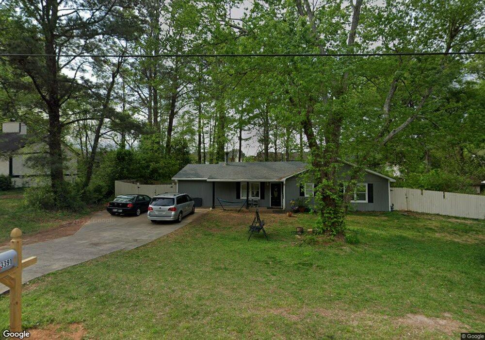
3391 Mustang Dr Powder Springs, GA 30127
Estimated Value: $271,000 - $279,000
3
Beds
1
Bath
1,208
Sq Ft
$229/Sq Ft
Est. Value
About This Home
This home is located at 3391 Mustang Dr, Powder Springs, GA 30127 and is currently estimated at $276,183, approximately $228 per square foot. 3391 Mustang Dr is a home located in Cobb County with nearby schools including Compton Elementary School, Tapp Middle School, and McEachern High School.
Ownership History
Date
Name
Owned For
Owner Type
Purchase Details
Closed on
May 19, 2011
Sold by
Federal Home Loan Mortgage Corporation
Bought by
Alvarado Miguel and Alvarado Veronica
Current Estimated Value
Purchase Details
Closed on
Apr 5, 2011
Sold by
Wells Fargo Bk Na
Bought by
Federal Home Loan Mortgage Corporation
Purchase Details
Closed on
Jun 6, 2007
Sold by
Powell James R
Bought by
Mcvey Ron
Home Financials for this Owner
Home Financials are based on the most recent Mortgage that was taken out on this home.
Original Mortgage
$106,300
Interest Rate
6.16%
Mortgage Type
New Conventional
Purchase Details
Closed on
Aug 29, 1995
Sold by
Mitchell Stephen L Jannece
Bought by
Powell James R
Create a Home Valuation Report for This Property
The Home Valuation Report is an in-depth analysis detailing your home's value as well as a comparison with similar homes in the area
Home Values in the Area
Average Home Value in this Area
Purchase History
| Date | Buyer | Sale Price | Title Company |
|---|---|---|---|
| Alvarado Miguel | $26,900 | -- | |
| Federal Home Loan Mortgage Corporation | -- | -- | |
| Wells Fargo Bk Na | $112,678 | -- | |
| Mcvey Ron | $106,300 | -- | |
| Powell James R | $64,000 | -- |
Source: Public Records
Mortgage History
| Date | Status | Borrower | Loan Amount |
|---|---|---|---|
| Previous Owner | Mcvey Ron | $106,300 | |
| Closed | Powell James R | $0 |
Source: Public Records
Tax History Compared to Growth
Tax History
| Year | Tax Paid | Tax Assessment Tax Assessment Total Assessment is a certain percentage of the fair market value that is determined by local assessors to be the total taxable value of land and additions on the property. | Land | Improvement |
|---|---|---|---|---|
| 2024 | $2,318 | $108,788 | $22,000 | $86,788 |
| 2023 | $1,332 | $88,052 | $14,000 | $74,052 |
| 2022 | $1,794 | $83,988 | $11,200 | $72,788 |
| 2021 | $1,180 | $55,924 | $11,200 | $44,724 |
| 2020 | $1,180 | $55,924 | $11,200 | $44,724 |
| 2019 | $783 | $37,800 | $10,000 | $27,800 |
| 2018 | $783 | $37,800 | $10,000 | $27,800 |
| 2017 | $583 | $29,844 | $8,000 | $21,844 |
| 2016 | $780 | $27,128 | $8,000 | $19,128 |
| 2015 | $752 | $25,528 | $6,400 | $19,128 |
| 2014 | $554 | $18,644 | $0 | $0 |
Source: Public Records
Map
Nearby Homes
- 3628 Hopkins Ct
- 0000 Hopkins Rd
- 3589 Hopkins Ct
- 3415 Hopkins Rd Unit 1
- 3666 Hopkins Ct Unit 1
- 3503 Ten Oaks Ct
- 0 Hopkins Rd Unit 10525343
- 3512 Hopkins Ct
- 3645 Ten Oaks Cir
- 3255 Caley Mill Dr
- 3259 Caley Mill Dr
- 3155 Thornbush Ct
- 3215 Rose Petal Ln
- 3501 Mustang Dr
- 3700 Ashley Woods Dr
- 3614 Josh Ct
- 3717 Lockerbie Ln
- 3602 Amanda Ct
- 3722 Lockerbie Ln
- 3401 Mustang Dr
- 3381 Mustang Dr
- 3602 Hopkins Ct
- 3598 Hopkins Ct
- 3600 Hopkins Ct
- 3596 Hopkins Ct Unit 3
- 3606 Hopkins Ct
- 3594 Hopkins Ct Unit 3
- 3608 Hopkins Ct Unit 3
- 3390 Mustang Dr Unit 1
- 3592 Hopkins Ct
- 3592 Hopkins Ct Unit 3592
- 3610 Hopkins Ct
- 3610 Hopkins Ct
- 3380 Mustang Dr Unit 1
- 3411 Mustang Dr
- 3612 Hopkins Ct
- 3371 Mustang Dr Unit 1
- 3588 Hopkins Ct Unit 2
- 3370 Mustang Dr