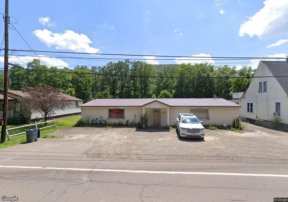
3394 State Route 414 Corning, NY 14830
Estimated Value: $72,000 - $83,000
3
Beds
2
Baths
2,400
Sq Ft
$32/Sq Ft
Est. Value
About This Home
This home is located at 3394 State Route 414, Corning, NY 14830 and is currently estimated at $77,998, approximately $32 per square foot. 3394 State Route 414 is a home with nearby schools including Winfield Street Elementary School, Corning-Painted Post Middle School, and Corning-Painted Post High School.
Ownership History
Date
Name
Owned For
Owner Type
Purchase Details
Closed on
Mar 5, 2025
Sold by
Glosser Joseph J
Bought by
Hulse Holdings Llc
Current Estimated Value
Home Financials for this Owner
Home Financials are based on the most recent Mortgage that was taken out on this home.
Original Mortgage
$72,000
Outstanding Balance
$71,637
Interest Rate
6.95%
Mortgage Type
Purchase Money Mortgage
Estimated Equity
$6,361
Create a Home Valuation Report for This Property
The Home Valuation Report is an in-depth analysis detailing your home's value as well as a comparison with similar homes in the area
Home Values in the Area
Average Home Value in this Area
Purchase History
| Date | Buyer | Sale Price | Title Company |
|---|---|---|---|
| Hulse Holdings Llc | $75,000 | None Available | |
| Hulse Holdings Llc | $75,000 | None Available |
Source: Public Records
Mortgage History
| Date | Status | Borrower | Loan Amount |
|---|---|---|---|
| Open | Hulse Holdings Llc | $72,000 | |
| Closed | Hulse Holdings Llc | $72,000 |
Source: Public Records
Tax History Compared to Growth
Tax History
| Year | Tax Paid | Tax Assessment Tax Assessment Total Assessment is a certain percentage of the fair market value that is determined by local assessors to be the total taxable value of land and additions on the property. | Land | Improvement |
|---|---|---|---|---|
| 2024 | $2,680 | $82,500 | $12,000 | $70,500 |
| 2023 | $2,706 | $82,500 | $12,000 | $70,500 |
| 2022 | $2,748 | $82,500 | $12,000 | $70,500 |
| 2021 | $2,832 | $78,000 | $12,100 | $65,900 |
| 2020 | $1,840 | $78,000 | $12,100 | $65,900 |
| 2019 | $2,818 | $78,000 | $12,100 | $65,900 |
| 2018 | $2,818 | $78,000 | $12,100 | $65,900 |
| 2017 | $3,080 | $77,000 | $13,200 | $63,800 |
| 2016 | $3,077 | $77,000 | $13,200 | $63,800 |
| 2015 | -- | $77,000 | $13,200 | $63,800 |
| 2014 | -- | $77,000 | $13,200 | $63,800 |
Source: Public Records
Map
Nearby Homes
- 22 Thorn St
- 67 Perry Ave
- 257 Bridge St
- 258 Sly Ave
- 235 Decatur St
- 307 Princeton Avenue Extension
- 14 Elm St
- 0 New York 414
- 25 Fero Ave
- 17 Earl St
- 179 Sly Ave
- 148 Seneca St
- 10387 Hamilton Rd
- 206 Pritchard Ave
- 210 Buffalo St
- 6 Jackson Cir
- 46 Roosevelt St
- 216 Sharwill Place
- 44 Roosevelt St
- 21 Houghton Cir
- 3394 New York 414
- 3392 State Route 414
- 3390 State Route 414
- 3398 State Route 414
- 3391 State Route 414
- 3386 State Route 414 Unit 88
- 3384 State Route 414
- 3378 State Route 414
- 3380 State Route 414
- 3376 State Route 414
- 3365 State Route 414
- 10651 Pinewood Ave
- 3348 Baker St
- 10649 Pinewood Ave
- 3364 Ingersoll St
- 3418 State Route 414
- 3349 Baker St
- 10647 Pinewood Ave Unit 202
- 10647 Pinewood Ave
- 3360 Ingersoll St