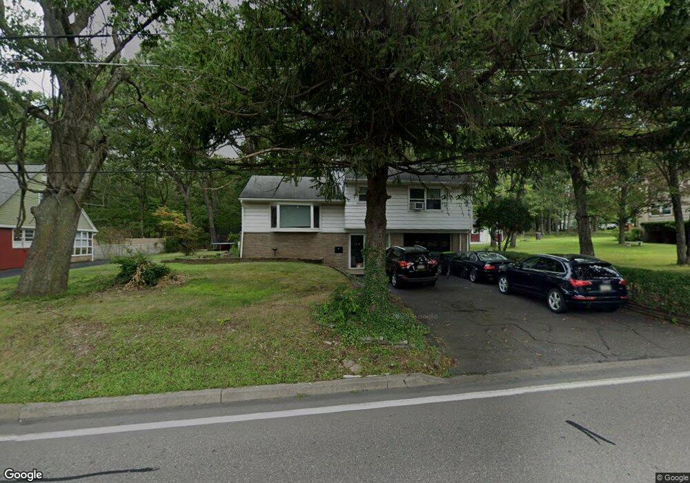
34 Airport Rd Hazleton, PA 18202
Estimated Value: $240,322 - $294,000
3
Beds
2
Baths
1,636
Sq Ft
$161/Sq Ft
Est. Value
About This Home
This home is located at 34 Airport Rd, Hazleton, PA 18202 and is currently estimated at $263,831, approximately $161 per square foot. 34 Airport Rd is a home located in Luzerne County with nearby schools including Hazleton Area High School, Immanuel Christian School, and Bishop Hafey Junior/Senior High School.
Ownership History
Date
Name
Owned For
Owner Type
Purchase Details
Closed on
Dec 17, 2021
Sold by
Gans Jr Ted J
Bought by
Arias Maritza C
Current Estimated Value
Home Financials for this Owner
Home Financials are based on the most recent Mortgage that was taken out on this home.
Original Mortgage
$148,800
Outstanding Balance
$136,857
Interest Rate
3.11%
Mortgage Type
New Conventional
Estimated Equity
$126,974
Purchase Details
Closed on
Feb 14, 2000
Sold by
Gans Ted J and Gans Betty Jane
Bought by
Zavitsky Deborah Ann and Miller Denise M
Create a Home Valuation Report for This Property
The Home Valuation Report is an in-depth analysis detailing your home's value as well as a comparison with similar homes in the area
Home Values in the Area
Average Home Value in this Area
Purchase History
| Date | Buyer | Sale Price | Title Company |
|---|---|---|---|
| Arias Maritza C | $186,000 | None Listed On Document | |
| Zavitsky Deborah Ann | -- | None Available |
Source: Public Records
Mortgage History
| Date | Status | Borrower | Loan Amount |
|---|---|---|---|
| Open | Arias Maritza C | $148,800 |
Source: Public Records
Tax History Compared to Growth
Tax History
| Year | Tax Paid | Tax Assessment Tax Assessment Total Assessment is a certain percentage of the fair market value that is determined by local assessors to be the total taxable value of land and additions on the property. | Land | Improvement |
|---|---|---|---|---|
| 2025 | $2,898 | $130,100 | $22,200 | $107,900 |
| 2024 | $2,764 | $130,100 | $22,200 | $107,900 |
| 2023 | $2,714 | $130,100 | $22,200 | $107,900 |
| 2022 | $2,690 | $130,100 | $22,200 | $107,900 |
| 2021 | $2,537 | $130,100 | $22,200 | $107,900 |
| 2020 | $2,494 | $130,100 | $22,200 | $107,900 |
| 2019 | $2,326 | $130,100 | $22,200 | $107,900 |
| 2018 | $2,241 | $130,100 | $22,200 | $107,900 |
| 2017 | $2,194 | $130,100 | $22,200 | $107,900 |
| 2016 | -- | $130,100 | $22,200 | $107,900 |
| 2015 | -- | $130,100 | $22,200 | $107,900 |
| 2014 | -- | $130,100 | $22,200 | $107,900 |
Source: Public Records
Map
Nearby Homes
- 25 Colony Dr
- The Standford Plan at Susquehanna Highlands
- The Frankford Plan at Susquehanna Highlands
- The Brookville Plan at College Crest Colony
- The Wakefield Plan at Susquehanna Highlands
- The Knoxville Plan at College Crest Colony
- The Austin Plan at College Crest Colony
- The Monterrey Plan at College Crest Colony
- The Newport Plan at College Crest Colony
- The Jamestown Plan at College Crest Colony
- The Burlington Plan at Monroe Manor - Single Family
- The Manhattan Plan at College Crest Colony
- The Vicksburg Plan at College Crest Colony
- The Edison Plan at College Crest Colony
- The Arlington Plan at College Crest Colony
- The Fenwick Plan at College Crest Colony
- The Monterrey Plan at Susquehanna Highlands
- The Winslow Plan at College Crest Colony
- The Monroe Plan at College Crest Colony
- The Lexington Plan at College Crest Colony
- 30 Airport Rd
- 38 Airport Rd
- 26 Airport Rd
- 24 W Hollywood Blvd
- 30 Forest Hill Rd
- 37 Airport Rd
- 44 Airport Rd
- 41 Airport Rd
- 256 Airport Rd
- 24 Airport Rd
- 14 S Hollywood Blvd
- 43 Airport Rd
- 20 S Hollywood Blvd
- 18 Airport Rd
- 48 Airport Rd
- 46 Forest Hill Rd
- 47 Airport Rd
- 5 Colony Dr
- 24 S Hollywood Blvd
- 14 Airport Rd