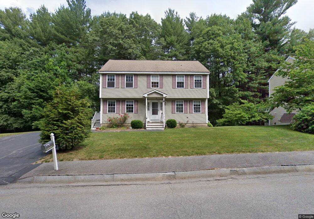
34 Anson St Lowell, MA 01854
Pawtucketville NeighborhoodEstimated Value: $629,000 - $669,000
3
Beds
3
Baths
2,066
Sq Ft
$313/Sq Ft
Est. Value
About This Home
This home is located at 34 Anson St, Lowell, MA 01854 and is currently estimated at $645,935, approximately $312 per square foot. 34 Anson St is a home located in Middlesex County with nearby schools including Joseph McAvinnue Elementary School, Charles W. Morey Elementary School, and Charlotte M. Murkland Elementary School.
Ownership History
Date
Name
Owned For
Owner Type
Purchase Details
Closed on
Nov 20, 1997
Sold by
Town&Country Rt and Paige Dennis M
Bought by
Trivedi Vidyut N and Trivedi Kishori
Current Estimated Value
Home Financials for this Owner
Home Financials are based on the most recent Mortgage that was taken out on this home.
Original Mortgage
$139,100
Outstanding Balance
$22,607
Interest Rate
7.17%
Mortgage Type
Purchase Money Mortgage
Estimated Equity
$623,328
Create a Home Valuation Report for This Property
The Home Valuation Report is an in-depth analysis detailing your home's value as well as a comparison with similar homes in the area
Home Values in the Area
Average Home Value in this Area
Purchase History
| Date | Buyer | Sale Price | Title Company |
|---|---|---|---|
| Trivedi Vidyut N | $146,500 | -- | |
| Trivedi Vidyut N | $146,500 | -- |
Source: Public Records
Mortgage History
| Date | Status | Borrower | Loan Amount |
|---|---|---|---|
| Open | Trivedi Vidyut N | $139,100 | |
| Closed | Trivedi Vidyut N | $139,100 |
Source: Public Records
Tax History Compared to Growth
Tax History
| Year | Tax Paid | Tax Assessment Tax Assessment Total Assessment is a certain percentage of the fair market value that is determined by local assessors to be the total taxable value of land and additions on the property. | Land | Improvement |
|---|---|---|---|---|
| 2025 | $6,061 | $528,000 | $170,100 | $357,900 |
| 2024 | $6,155 | $516,800 | $158,900 | $357,900 |
| 2023 | $5,924 | $477,000 | $138,200 | $338,800 |
| 2022 | $5,388 | $424,600 | $125,600 | $299,000 |
| 2021 | $5,043 | $374,700 | $109,300 | $265,400 |
| 2020 | $4,886 | $365,700 | $111,500 | $254,200 |
| 2019 | $4,768 | $339,600 | $98,200 | $241,400 |
| 2018 | $4,737 | $329,200 | $93,500 | $235,700 |
| 2017 | $4,703 | $315,200 | $85,000 | $230,200 |
| 2016 | $4,691 | $309,400 | $79,200 | $230,200 |
| 2015 | $4,396 | $284,000 | $77,600 | $206,400 |
| 2013 | $4,200 | $279,800 | $97,500 | $182,300 |
Source: Public Records
Map
Nearby Homes
- 20 Sandy Ln
- 3 Louis Farm Rd Unit 3
- 6 Louis Farm Rd Unit 6
- 1335 Varnum Ave
- 1401 Pawtucket Blvd Unit 10
- 1461 Pawtucket Blvd Unit 12
- 101 Laurie Ln
- 49 Coburn Dr
- 15 Dowling Dr
- 33 Kennedy Dr Unit 33
- 139 Wellman Ave Unit 139
- 271 Wellman Ave
- 202 Wellman Ave
- 739 Wellman Ave
- 406 Wellman Ave
- 348 Wellman Ave
- 1975 Middlesex St Unit 2
- 1975 Middlesex St Unit 51
- 2 Walter G Wiede St Unit 7
- 527 Pawtucket Blvd Unit 304
- 1 Anson St
- 26 Anson St
- 44 Anson St
- 54 Anson St
- 14 Anson St
- 15 Trotting Park Rd
- 27 Trotting Park Rd
- 33 Trotting Park Rd
- 39 Trotting Park Rd
- 37 Trotting Park Rd
- 55 Trotting Park Rd
- 61 Trotting Park Rd
- 1154 Varnum Ave
- 1142 Varnum Ave
- 71 Trotting Park Rd
- 5 Pine Tree Ln
- 77 Trotting Park Rd
- 7 Sandy Ln
- 28 Sandy Ln
- 1132 Varnum Ave