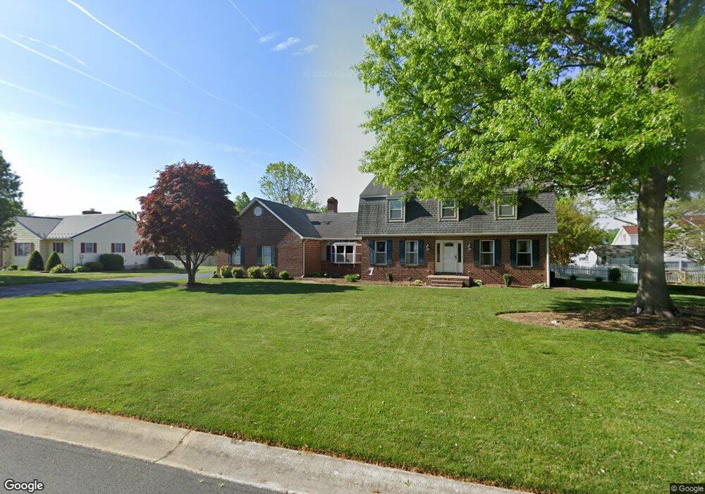
34 Applewood Dr Dover, DE 19901
Highland Acres NeighborhoodEstimated Value: $462,328 - $487,000
4
Beds
3
Baths
2,764
Sq Ft
$173/Sq Ft
Est. Value
About This Home
This home is located at 34 Applewood Dr, Dover, DE 19901 and is currently estimated at $478,832, approximately $173 per square foot. 34 Applewood Dr is a home located in Kent County with nearby schools including Allen Frear Elementary School, F. Niel Postlethwait Middle School, and Caesar Rodney High School.
Ownership History
Date
Name
Owned For
Owner Type
Purchase Details
Closed on
Jul 15, 2022
Sold by
Lord Elwood W
Bought by
Zura Michael and Zura Tiffany
Current Estimated Value
Home Financials for this Owner
Home Financials are based on the most recent Mortgage that was taken out on this home.
Original Mortgage
$435,000
Outstanding Balance
$414,351
Interest Rate
5.23%
Mortgage Type
VA
Estimated Equity
$64,481
Purchase Details
Closed on
Aug 1, 1987
Bought by
Lord Elwood W
Create a Home Valuation Report for This Property
The Home Valuation Report is an in-depth analysis detailing your home's value as well as a comparison with similar homes in the area
Home Values in the Area
Average Home Value in this Area
Purchase History
We collect this data history from publicly available records. To have your information removed, we recommend requesting removal directly through your county’s website.
| Date | Buyer | Sale Price | Title Company |
|---|---|---|---|
| Zura Michael | $435,000 | None Listed On Document | |
| Lord Elwood W | $26,000 | -- |
Source: Public Records
Mortgage History
We collect this data history from publicly available records. To have your information removed, we recommend requesting removal directly through your county’s website.
| Date | Status | Borrower | Loan Amount |
|---|---|---|---|
| Open | Zura Michael | $435,000 |
Source: Public Records
Tax History
| Year | Tax Paid | Tax Assessment Tax Assessment Total Assessment is a certain percentage of the fair market value that is determined by local assessors to be the total taxable value of land and additions on the property. | Land | Improvement |
|---|---|---|---|---|
| 2025 | $2,093 | $399,300 | $90,400 | $308,900 |
| 2024 | $2,057 | $399,300 | $90,400 | $308,900 |
| 2023 | $2,797 | $91,600 | $13,800 | $77,800 |
| 2022 | $2,149 | $91,600 | $13,800 | $77,800 |
| 2021 | $2,221 | $91,600 | $13,800 | $77,800 |
| 2020 | $2,169 | $91,600 | $13,800 | $77,800 |
| 2019 | $2,084 | $91,600 | $13,800 | $77,800 |
| 2018 | $2,010 | $91,600 | $13,800 | $77,800 |
| 2017 | $1,953 | $91,600 | $0 | $0 |
| 2016 | $1,757 | $91,600 | $0 | $0 |
| 2015 | $1,195 | $91,600 | $0 | $0 |
| 2014 | $1,335 | $91,600 | $0 | $0 |
Source: Public Records
Map
Nearby Homes
- 266 Stone Ridge Dr
- 83 Homestead Dr
- 13 Crown Cir
- 25 Meadow Glen Dr
- 66 Homestead Dr
- 71 Westview Ave
- 102 N High Hill Rd
- 111 W High Hill Rd
- 34 Birkdale Way
- 79 Oakcrest Dr
- 45 N Fairfield Dr
- 17 Chadwick Dr
- 81 Jillian Ct
- 213 Sandhill Way
- 22 Howell St
- 178 Roundabout Trail
- 45 W Fairfield Dr
- 89 S Shore Dr
- 175 Roundabout Trail
- 6 Crossley Dr
Your Personal Tour Guide
Ask me questions while you tour the home.