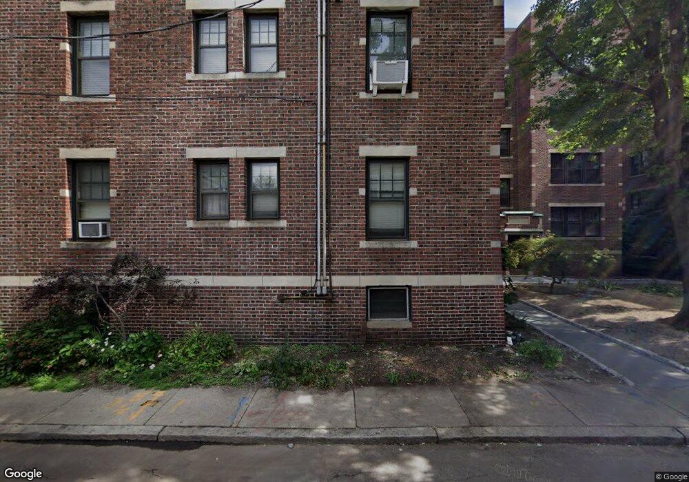
34 Ash St Unit 4 Cambridge, MA 02138
West Cambridge NeighborhoodEstimated Value: $607,000 - $733,000
1
Bed
1
Bath
570
Sq Ft
$1,183/Sq Ft
Est. Value
About This Home
This home is located at 34 Ash St Unit 4, Cambridge, MA 02138 and is currently estimated at $674,235, approximately $1,182 per square foot. 34 Ash St Unit 4 is a home located in Middlesex County with nearby schools including St Peter School, Buckingham Browne & Nichols School, and St. Paul's Choir School.
Ownership History
Date
Name
Owned For
Owner Type
Purchase Details
Closed on
Nov 30, 2011
Sold by
Brown Janice S
Bought by
Xu Feng
Current Estimated Value
Purchase Details
Closed on
Jul 30, 1999
Sold by
Est Downey Margaret W and White Elizabeth A
Bought by
Brown Janice S
Home Financials for this Owner
Home Financials are based on the most recent Mortgage that was taken out on this home.
Original Mortgage
$136,000
Interest Rate
7.61%
Mortgage Type
Purchase Money Mortgage
Purchase Details
Closed on
Oct 17, 1989
Sold by
Shushtari J Kevin
Bought by
Downey Margaret W
Create a Home Valuation Report for This Property
The Home Valuation Report is an in-depth analysis detailing your home's value as well as a comparison with similar homes in the area
Home Values in the Area
Average Home Value in this Area
Purchase History
| Date | Buyer | Sale Price | Title Company |
|---|---|---|---|
| Xu Feng | $337,000 | -- | |
| Brown Janice S | $170,000 | -- | |
| Downey Margaret W | $139,900 | -- |
Source: Public Records
Mortgage History
| Date | Status | Borrower | Loan Amount |
|---|---|---|---|
| Previous Owner | Downey Margaret W | $136,000 |
Source: Public Records
Tax History
| Year | Tax Paid | Tax Assessment Tax Assessment Total Assessment is a certain percentage of the fair market value that is determined by local assessors to be the total taxable value of land and additions on the property. | Land | Improvement |
|---|---|---|---|---|
| 2025 | $3,769 | $593,600 | $0 | $593,600 |
| 2024 | $3,367 | $568,800 | $0 | $568,800 |
| 2023 | $3,490 | $595,500 | $0 | $595,500 |
| 2022 | $3,508 | $592,600 | $0 | $592,600 |
| 2021 | $3,434 | $587,000 | $0 | $587,000 |
| 2020 | $3,374 | $586,700 | $0 | $586,700 |
| 2019 | $3,229 | $543,600 | $0 | $543,600 |
| 2018 | $3,134 | $498,200 | $0 | $498,200 |
| 2017 | $2,924 | $450,600 | $0 | $450,600 |
| 2016 | $2,727 | $390,100 | $0 | $390,100 |
| 2015 | $2,696 | $344,800 | $0 | $344,800 |
| 2014 | $2,651 | $316,300 | $0 | $316,300 |
Source: Public Records
Map
Nearby Homes
- 5 Brewer St Unit 5
- 992 Memorial Dr Unit 106
- 985 Memorial Dr Unit 603
- 985 Memorial Dr Unit 303
- 12 Gerry St Unit 12
- 986 Memorial Dr Unit 404
- 984 Memorial Dr Unit 984-503
- 130 Mount Auburn St Unit 309
- 14 Concord Ave Unit 624
- 22 Concord Ave Unit 11
- 1010 Memorial Dr Unit 6F
- 50 Follen St Unit 306
- 44 Garden St
- 16 Chauncy St Unit 53
- 153 Brattle St
- 172 Brattle St
- 2 Avon St Unit 6
- 84 Garden St
- 11 Wright St Unit 1
- 33 Everett St
- 34 Ash St Unit 404
- 34 Ash St Unit B1
- 34 Ash St Unit 16
- 34 Ash St Unit 15
- 34 Ash St Unit 14
- 34 Ash St Unit 13
- 34 Ash St Unit 12
- 34 Ash St Unit 11
- 34 Ash St Unit 10
- 34 Ash St Unit 9
- 34 Ash St Unit 8
- 34 Ash St Unit 7
- 34 Ash St Unit 6
- 34 Ash St Unit 5
- 34 Ash St Unit 3
- 34 Ash St Unit 2
- 34 Ash St Unit 1
- 34 Ash St Unit 203/AKA 6
- 34 Ash St Unit 303
- 34 Ash St Unit 104
Your Personal Tour Guide
Ask me questions while you tour the home.