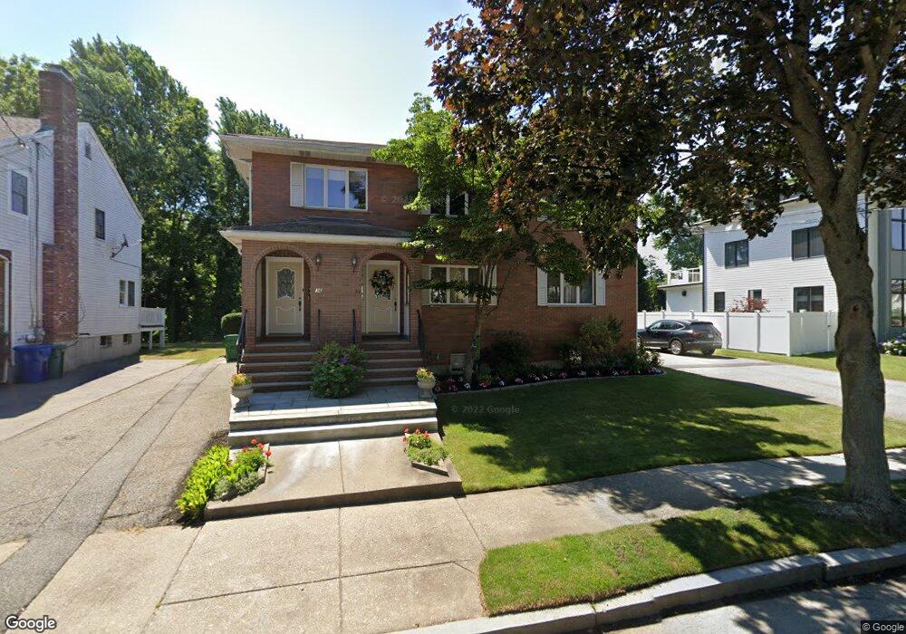
34 Ashmont Ave Unit 36 Newton, MA 02458
Nonantum NeighborhoodEstimated Value: $1,763,896 - $2,143,000
8
Beds
5
Baths
4,960
Sq Ft
$387/Sq Ft
Est. Value
About This Home
This home is located at 34 Ashmont Ave Unit 36, Newton, MA 02458 and is currently estimated at $1,917,724, approximately $386 per square foot. 34 Ashmont Ave Unit 36 is a home located in Middlesex County with nearby schools including Lincoln-Eliot Elementary School, Bigelow Middle School, and Newton North High School.
Ownership History
Date
Name
Owned For
Owner Type
Purchase Details
Closed on
Sep 30, 2022
Sold by
Palumbo Nt
Bought by
Susan Palumbo T
Current Estimated Value
Purchase Details
Closed on
Dec 22, 2014
Sold by
Palumbo Susan
Bought by
Palumbo Nt
Create a Home Valuation Report for This Property
The Home Valuation Report is an in-depth analysis detailing your home's value as well as a comparison with similar homes in the area
Home Values in the Area
Average Home Value in this Area
Purchase History
| Date | Buyer | Sale Price | Title Company |
|---|---|---|---|
| Susan Palumbo T | -- | None Available | |
| Palumbo Nt | -- | -- |
Source: Public Records
Tax History Compared to Growth
Tax History
| Year | Tax Paid | Tax Assessment Tax Assessment Total Assessment is a certain percentage of the fair market value that is determined by local assessors to be the total taxable value of land and additions on the property. | Land | Improvement |
|---|---|---|---|---|
| 2025 | $13,595 | $1,387,200 | $686,200 | $701,000 |
| 2024 | $13,145 | $1,346,800 | $666,200 | $680,600 |
| 2023 | $12,968 | $1,273,900 | $534,400 | $739,500 |
| 2022 | $12,408 | $1,179,500 | $494,800 | $684,700 |
| 2021 | $11,643 | $1,082,100 | $453,900 | $628,200 |
| 2020 | $11,297 | $1,082,100 | $453,900 | $628,200 |
| 2019 | $10,568 | $1,011,300 | $424,200 | $587,100 |
| 2018 | $11,024 | $1,018,900 | $397,200 | $621,700 |
| 2017 | $10,395 | $934,800 | $364,400 | $570,400 |
| 2016 | $9,759 | $857,600 | $334,300 | $523,300 |
| 2015 | $9,305 | $801,500 | $312,400 | $489,100 |
Source: Public Records
Map
Nearby Homes
- 22-24 Emerald St
- 3 Ashmont Ave
- 49 Hawthorn St
- 42-44 Judkins St
- 11 Murphy Ct
- 188-190 Adams St
- 77 Court St Unit 205
- 158 Adams St
- 53 West St
- 86 West St
- 34 West St Unit A
- 12-14 Middle St
- 168 Walnut St
- 286 Nevada St Unit 286
- 282 Nevada St Unit 282
- 324 Adams St Unit 2
- 48 Harvard St Unit 1
- 290 Watertown St Unit 3
- 290 Watertown St Unit 4
- 230 Bellevue St Unit 1
- 36 Ashmont Ave Unit 2
- 36 Ashmont Ave
- 28-30 Ashmont Ave
- 28 Ashmont Ave Unit 30
- 28 Ashmont Ave Unit 28
- 30 Ashmont Ave Unit 30
- 30 Ashmont Ave
- 42 Ashmont Ave
- 42 Ashmont Ave Unit 42
- 42 Ashmont Ave Unit 1
- 40 Ashmont Ave
- 40 Ashmont Ave Unit 40
- 46 Ashmont Ave Unit 1
- 31 Emerald St
- 25 Emerald St
- 35 Emerald St
- 33 Emerald St Unit 35
- 31 Ashmont Ave
- 25 Ashmont Ave
- 25 Ashmont Ave Unit 1