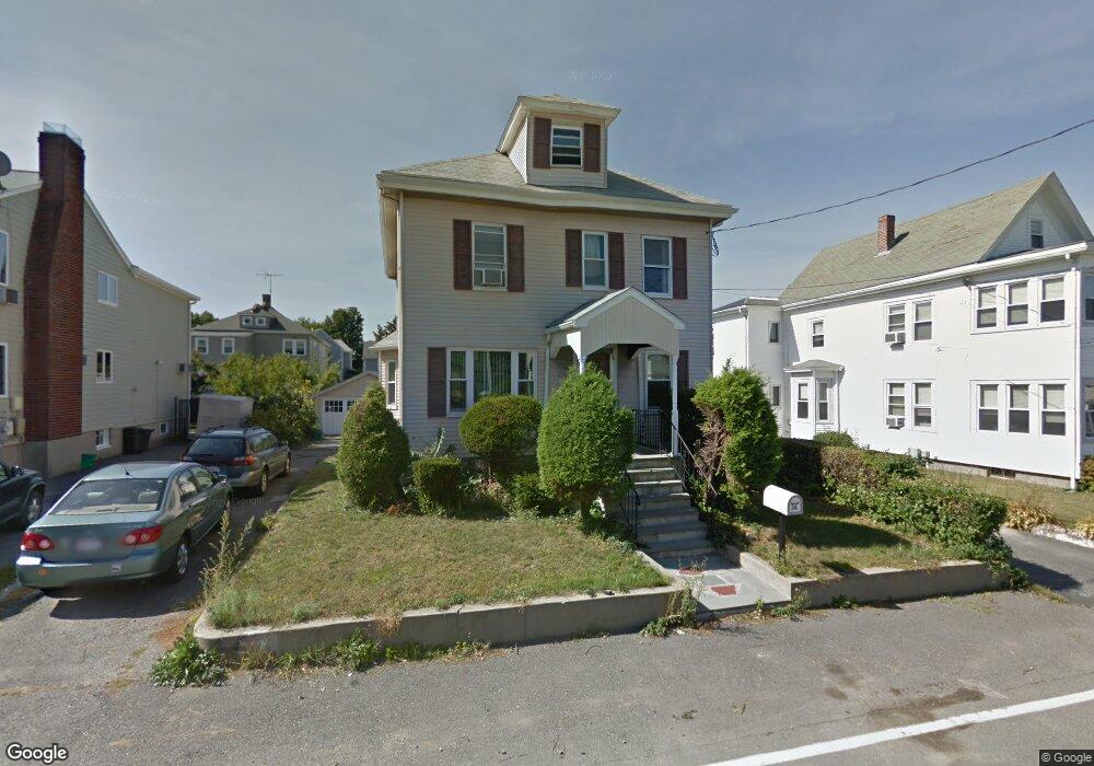
34 Baker St Belmont, MA 02478
Belmont Center NeighborhoodEstimated Value: $1,126,000 - $1,427,000
3
Beds
2
Baths
1,576
Sq Ft
$829/Sq Ft
Est. Value
About This Home
This home is located at 34 Baker St, Belmont, MA 02478 and is currently estimated at $1,306,595, approximately $829 per square foot. 34 Baker St is a home located in Middlesex County with nearby schools including Mary Lee Burbank Elementary School, Winthrop L Chenery Middle School, and Belmont High School.
Ownership History
Date
Name
Owned For
Owner Type
Purchase Details
Closed on
Sep 9, 2004
Sold by
Busa Daniel R
Bought by
Brun-Cottan Catherine and Brun-Cottan Georges
Current Estimated Value
Home Financials for this Owner
Home Financials are based on the most recent Mortgage that was taken out on this home.
Original Mortgage
$440,300
Interest Rate
6.08%
Mortgage Type
Purchase Money Mortgage
Purchase Details
Closed on
Mar 27, 1998
Sold by
Hamilton Marguerite K
Bought by
Harrison David F and Feltner Lisa J
Home Financials for this Owner
Home Financials are based on the most recent Mortgage that was taken out on this home.
Original Mortgage
$153,600
Interest Rate
6.96%
Mortgage Type
Purchase Money Mortgage
Create a Home Valuation Report for This Property
The Home Valuation Report is an in-depth analysis detailing your home's value as well as a comparison with similar homes in the area
Home Values in the Area
Average Home Value in this Area
Purchase History
| Date | Buyer | Sale Price | Title Company |
|---|---|---|---|
| Brun-Cottan Catherine | $518,000 | -- | |
| Harrison David F | $192,000 | -- |
Source: Public Records
Mortgage History
| Date | Status | Borrower | Loan Amount |
|---|---|---|---|
| Open | Harrison David F | $392,500 | |
| Closed | Brun-Cottan Catherine | $440,300 | |
| Previous Owner | Harrison David F | $153,600 |
Source: Public Records
Tax History Compared to Growth
Tax History
| Year | Tax Paid | Tax Assessment Tax Assessment Total Assessment is a certain percentage of the fair market value that is determined by local assessors to be the total taxable value of land and additions on the property. | Land | Improvement |
|---|---|---|---|---|
| 2025 | $11,960 | $1,050,000 | $765,000 | $285,000 |
| 2024 | $10,412 | $986,000 | $763,000 | $223,000 |
| 2023 | $10,892 | $969,000 | $765,000 | $204,000 |
| 2022 | $11,725 | $851,000 | $659,000 | $192,000 |
| 2021 | $11,725 | $1,016,000 | $856,000 | $160,000 |
| 2020 | $9,581 | $871,000 | $685,000 | $186,000 |
| 2019 | $7,586 | $650,000 | $448,000 | $202,000 |
| 2018 | $4,091 | $586,000 | $384,000 | $202,000 |
| 2017 | $11,111 | $554,000 | $352,000 | $202,000 |
| 2016 | $6,833 | $544,000 | $343,000 | $201,000 |
| 2015 | $6,308 | $489,000 | $306,000 | $183,000 |
Source: Public Records
Map
Nearby Homes
- 48 Hamilton Rd
- 46 Hamilton Rd
- 73 Trowbridge St Unit 73A
- 73 Trowbridge St Unit 73B
- 48 Concord Ave
- 4 Merrill Ave
- 15 Sunset Rd
- 93 Griswold St Unit 93
- 95 Griswold St Unit 95
- 55 S Normandy Ave
- 23 Loomis St Unit 23
- 118 Blanchard Rd
- 105 Watson Rd
- 63 Loomis St Unit 63
- 248 School St
- 38 Myrtle St
- 1 Spinney Terrace
- 66 Channing Rd
- 200 Claflin St
- 242 Claflin St
- 36 Baker St
- 28 Baker St Unit 30
- 30 Baker St
- 30 Baker St Unit n/a
- 28 Baker St Unit 1
- 30 Baker St Unit 30
- 28 Baker St Unit 28
- 24 Baker St Unit 26
- 24 Baker St Unit 2
- 29 Trowbridge St
- 40 Baker St Unit 42
- 33 Trowbridge St
- 29 Baker St Unit 31
- 31 Baker St
- 37 Trowbridge St Unit 1
- 44 Baker St Unit 44
- 44 Baker St
- 44 Baker St
- 44 Baker St Unit St
- 44 Baker St Unit SF