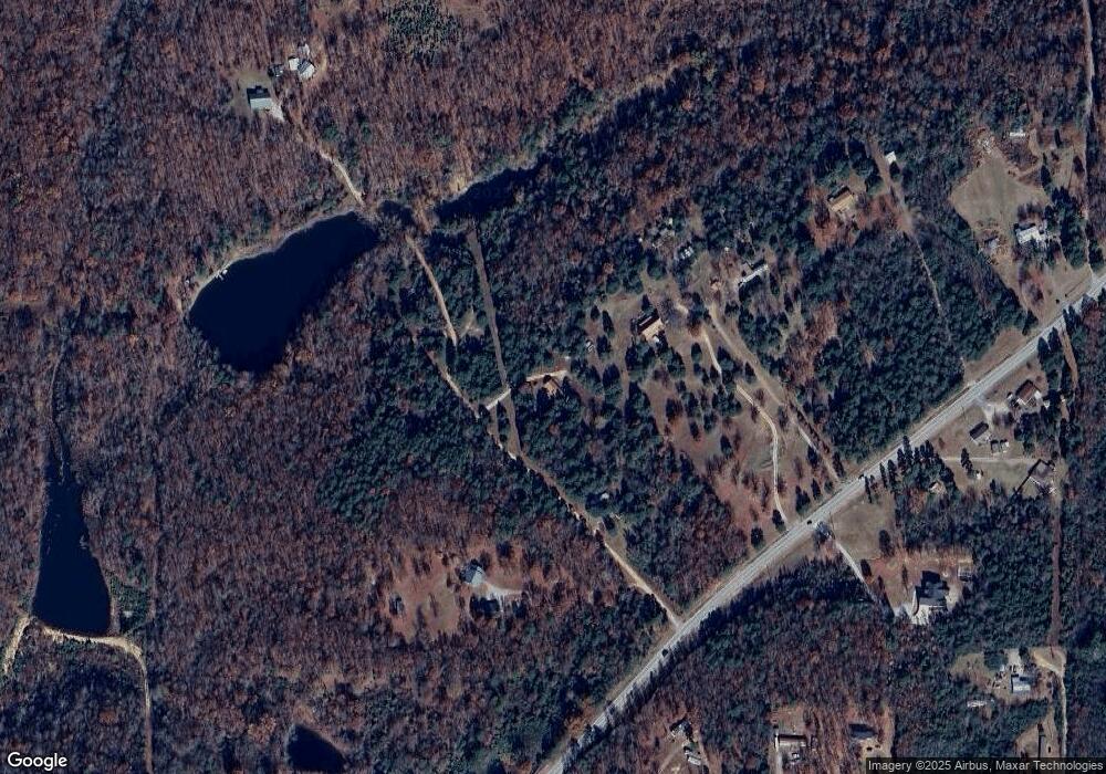
34 Bass Ln Locust Grove, AR 72550
Estimated Value: $102,000 - $264,000
--
Bed
--
Bath
1,200
Sq Ft
$153/Sq Ft
Est. Value
About This Home
This home is located at 34 Bass Ln, Locust Grove, AR 72550 and is currently estimated at $184,064, approximately $153 per square foot. 34 Bass Ln is a home with nearby schools including Concord Elementary School and Concord High School.
Ownership History
Date
Name
Owned For
Owner Type
Purchase Details
Closed on
Jul 22, 2022
Sold by
Stubbs Ronald and Stubbs Pauline
Bought by
Farr Shannon
Current Estimated Value
Home Financials for this Owner
Home Financials are based on the most recent Mortgage that was taken out on this home.
Original Mortgage
$42,432
Outstanding Balance
$40,418
Interest Rate
5.23%
Mortgage Type
New Conventional
Estimated Equity
$143,646
Purchase Details
Closed on
Dec 31, 2015
Sold by
First Service Bank
Bought by
Stubbs Ronald and Stubbs Paulene
Home Financials for this Owner
Home Financials are based on the most recent Mortgage that was taken out on this home.
Original Mortgage
$21,478
Interest Rate
3.98%
Mortgage Type
Commercial
Purchase Details
Closed on
May 24, 2008
Sold by
Sprouse Raymond B
Bought by
Arnold Clude C and Arnold Betty J
Purchase Details
Closed on
Oct 3, 2000
Bought by
Sprouse Raymond B
Purchase Details
Closed on
Jun 1, 1989
Bought by
Thomas Jake and Thomas Esther
Create a Home Valuation Report for This Property
The Home Valuation Report is an in-depth analysis detailing your home's value as well as a comparison with similar homes in the area
Home Values in the Area
Average Home Value in this Area
Purchase History
| Date | Buyer | Sale Price | Title Company |
|---|---|---|---|
| Farr Shannon | $38,000 | Professional Land Title | |
| Stubbs Ronald | $25,000 | Cornerstone Title | |
| Arnold Clude C | $18,000 | None Available | |
| Sprouse Raymond B | $8,000 | -- | |
| Thomas Jake | -- | -- |
Source: Public Records
Mortgage History
| Date | Status | Borrower | Loan Amount |
|---|---|---|---|
| Open | Farr Shannon | $42,432 | |
| Previous Owner | Stubbs Ronald | $21,478 |
Source: Public Records
Tax History Compared to Growth
Tax History
| Year | Tax Paid | Tax Assessment Tax Assessment Total Assessment is a certain percentage of the fair market value that is determined by local assessors to be the total taxable value of land and additions on the property. | Land | Improvement |
|---|---|---|---|---|
| 2024 | $410 | $20,822 | $3,300 | $17,522 |
| 2023 | $466 | $21,357 | $3,300 | $18,057 |
| 2022 | $290 | $21,357 | $3,300 | $18,057 |
| 2021 | $633 | $15,184 | $1,980 | $13,204 |
| 2020 | $633 | $15,184 | $1,980 | $13,204 |
| 2019 | $621 | $15,184 | $1,980 | $13,204 |
| 2018 | $573 | $15,184 | $1,980 | $13,204 |
| 2017 | $525 | $15,184 | $1,980 | $13,204 |
| 2016 | $477 | $11,445 | $1,980 | $9,465 |
| 2015 | $477 | $11,445 | $1,980 | $9,465 |
| 2014 | -- | $11,445 | $1,980 | $9,465 |
Source: Public Records
Map
Nearby Homes
- 827 Cartwright Rd
- 00 Cooper Rd
- 300 Peel Rd
- 00 Bullard Rd
- 000 Mountain View Rd
- 989 N Bayou Rd
- 0 Arrowhead Rd
- 155 Lower Yorktown Dr
- 155 Lower Yorktown Rd
- 0 Morrison Rd Unit 22320525
- 0 Morrison Rd Unit 25000640
- Lots 27/28 Lower Yorktown Dr
- 2624 Floral Rd
- Lots 27 & 28 Lower Yorktown Dr
- 0 Heber Springs Rd
- 120 Upper Yorktown Rd
- 0 Yorktown Unit 24-235
- 2540 Jamestown Lp
- 2540 Jamestown Loop
- 240 Oak Grove Rd
- 00 Bass Ln
- 5 Bass Ln
- 50 Bass Ln
- 16 Bass Ln
- 59 Radio Tower Rd
- 12350 Heber Springs Rd
- 12356 Heber Springs Rd
- 12322 Heber Springs Rd
- 130 Radio Tower Rd
- 15 Double F Rd
- 160 Radio Tower Rd
- 0 Heber Springs Rd Hwy Unit 18034651
- 11934 Heber Springs Rd
- 399 Radio Tower Rd
- 11750 Heber Springs Rd
- 404 Radio Tower Rd
- 459 Radio Tower Rd
- 355 Spinks Rd
- 299 Spinks Rd
- 000 Radio Tower Rd
