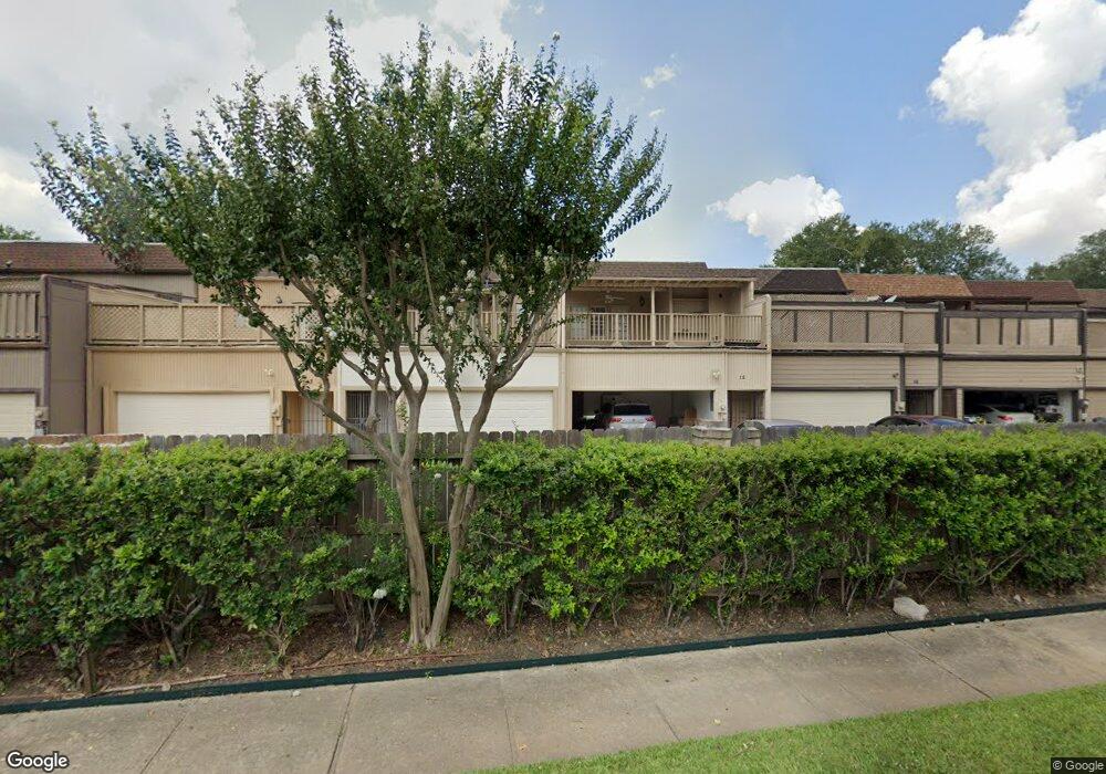
34 Bayou Pointe Dr Houston, TX 77063
Mid West NeighborhoodEstimated Value: $363,000 - $398,000
2
Beds
3
Baths
2,052
Sq Ft
$186/Sq Ft
Est. Value
About This Home
This home is located at 34 Bayou Pointe Dr, Houston, TX 77063 and is currently estimated at $382,423, approximately $186 per square foot. 34 Bayou Pointe Dr is a home located in Harris County with nearby schools including Walnut Bend Elementary School, Paul Revere Middle School, and Westside High School.
Ownership History
Date
Name
Owned For
Owner Type
Purchase Details
Closed on
Sep 17, 2001
Sold by
Murphy John D
Bought by
Alexander Lila
Current Estimated Value
Purchase Details
Closed on
Feb 3, 1999
Sold by
Murphy Jimmy W
Bought by
Murphy John D
Purchase Details
Closed on
Jul 10, 1997
Sold by
Russell Jane Ellen Nolte
Bought by
Murphy Jimmy W
Create a Home Valuation Report for This Property
The Home Valuation Report is an in-depth analysis detailing your home's value as well as a comparison with similar homes in the area
Home Values in the Area
Average Home Value in this Area
Purchase History
| Date | Buyer | Sale Price | Title Company |
|---|---|---|---|
| Alexander Lila | -- | -- | |
| Murphy John D | -- | -- | |
| Murphy Jimmy W | -- | -- |
Source: Public Records
Tax History Compared to Growth
Tax History
| Year | Tax Paid | Tax Assessment Tax Assessment Total Assessment is a certain percentage of the fair market value that is determined by local assessors to be the total taxable value of land and additions on the property. | Land | Improvement |
|---|---|---|---|---|
| 2025 | $635 | $366,649 | $60,000 | $306,649 |
| 2024 | $635 | $350,097 | $60,000 | $290,097 |
| 2023 | $502 | $354,702 | $60,000 | $294,702 |
| 2022 | $6,419 | $291,517 | $60,000 | $231,517 |
| 2021 | $6,308 | $270,641 | $53,400 | $217,241 |
| 2020 | $7,077 | $292,228 | $53,400 | $238,828 |
| 2019 | $8,180 | $323,281 | $55,800 | $267,481 |
| 2018 | $2,474 | $271,244 | $60,000 | $211,244 |
| 2017 | $10,002 | $424,015 | $110,000 | $314,015 |
| 2016 | $9,093 | $424,015 | $110,000 | $314,015 |
| 2015 | $3,452 | $350,104 | $110,000 | $240,104 |
| 2014 | $3,452 | $359,616 | $100,000 | $259,616 |
Source: Public Records
Map
Nearby Homes
- 45 Bayou Pointe Dr
- 9620 Doliver Dr
- 9632 Bayou Brook St
- 9618 Bayou Brook St
- 6 Gessner Rd
- 30 E Rivercrest Dr
- 9518 Bayou Brook St
- 2100 Tanglewilde St Unit 750
- 2100 Tanglewilde St Unit 169
- 2100 Tanglewilde St Unit 536
- 2100 Tanglewilde St Unit 402
- 2100 Tanglewilde St Unit 422
- 2100 Tanglewilde St Unit 625
- 2100 Tanglewilde St Unit 131
- 2100 Tanglewilde St Unit 455
- 2100 Tanglewilde St Unit 600
- 2100 Tanglewilde St Unit 299
- 2100 Tanglewilde St Unit 378
- 45 Patti Lynn Ln
- 3 Plantation Rd
- 33 Bayou Pointe Dr
- 35 Bayou Pointe Dr
- 32 Bayou Pointe Dr
- 31 Bayou Pointe Dr
- 36 Bayou Pointe Dr
- 30 Bayou Pointe Dr
- 37 Bayou Pointe Dr
- 29 Bayou Pointe Dr
- 15 Bayou Pointe Dr
- 16 Bayou Pointe Dr
- 17 Bayou Pointe Dr
- 14 Bayou Pointe Dr
- 18 Bayou Pointe Dr
- 13 Bayou Pointe Dr
- 38 Bayou Pointe Dr
- 28 Bayou Pointe Dr
- 19 Bayou Pointe Dr
- 12 Bayou Pointe Dr
- 39 Bayou Pointe Dr
- 27 Bayou Pointe Dr