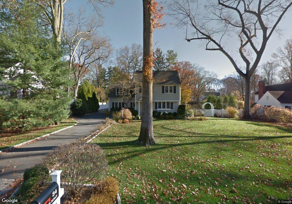
34 Birch Rd Darien, CT 06820
Estimated Value: $1,486,000 - $3,052,000
4
Beds
5
Baths
4,145
Sq Ft
$614/Sq Ft
Est. Value
About This Home
This home is located at 34 Birch Rd, Darien, CT 06820 and is currently estimated at $2,545,887, approximately $614 per square foot. 34 Birch Rd is a home located in Fairfield County with nearby schools including Ox Ridge Elementary School, Middlesex Middle School, and Darien High School.
Ownership History
Date
Name
Owned For
Owner Type
Purchase Details
Closed on
Jul 16, 1999
Sold by
Hoyda Bradford W and Stark Christine M
Bought by
Covello Anthony and Dianne Covello L
Current Estimated Value
Purchase Details
Closed on
Mar 31, 1997
Sold by
Wurzel Eric C
Bought by
Hoyda Bradford W and Stark Christine M
Purchase Details
Closed on
Apr 18, 1995
Sold by
Moore Howard and Moore Ann
Bought by
Wurzel Eric
Create a Home Valuation Report for This Property
The Home Valuation Report is an in-depth analysis detailing your home's value as well as a comparison with similar homes in the area
Home Values in the Area
Average Home Value in this Area
Purchase History
| Date | Buyer | Sale Price | Title Company |
|---|---|---|---|
| Covello Anthony | $592,500 | -- | |
| Hoyda Bradford W | $512,500 | -- | |
| Wurzel Eric | $426,500 | -- |
Source: Public Records
Mortgage History
| Date | Status | Borrower | Loan Amount |
|---|---|---|---|
| Open | Wurzel Eric | $250,000 | |
| Open | Wurzel Eric | $800,000 |
Source: Public Records
Tax History Compared to Growth
Tax History
| Year | Tax Paid | Tax Assessment Tax Assessment Total Assessment is a certain percentage of the fair market value that is determined by local assessors to be the total taxable value of land and additions on the property. | Land | Improvement |
|---|---|---|---|---|
| 2025 | $23,027 | $1,487,500 | $702,170 | $785,330 |
| 2024 | $21,851 | $1,487,500 | $702,170 | $785,330 |
| 2023 | $19,480 | $1,106,210 | $501,550 | $604,660 |
| 2022 | $19,060 | $1,106,210 | $501,550 | $604,660 |
| 2021 | $15,326 | $1,106,210 | $501,550 | $604,660 |
| 2020 | $18,098 | $1,106,210 | $501,550 | $604,660 |
| 2019 | $5,901 | $1,106,210 | $501,550 | $604,660 |
| 2018 | $14,804 | $1,150,380 | $511,490 | $638,890 |
| 2017 | $14,709 | $1,150,380 | $511,490 | $638,890 |
| 2016 | $18,141 | $1,150,380 | $511,490 | $638,890 |
| 2015 | $17,658 | $1,150,380 | $511,490 | $638,890 |
| 2014 | $17,267 | $1,150,380 | $511,490 | $638,890 |
Source: Public Records
Map
Nearby Homes
- 97 Richards Ave Unit B10
- 97 Richards Ave Unit E12
- 17 Pine Brook Ln Unit 17
- 7 Tommys Ln
- 20 Marianne Rd
- 29 Priscilla Rd
- 10 Stony Brook Rd
- 20 Locust Hill Rd
- 16 Donna Dr Unit 20
- 2 Rochelle Rd
- 9 Hollow Spring Rd
- 9 Arnold Ln
- 201 W Norwalk Rd
- 561 Middlesex Rd
- 40 Arnold Ln
- 10 Ledgebrook Dr Unit 1
- 24 Scribner Ave
- 8 Michael St
- 3 Edgewood St
- 24 Quaker Rd
- 36 Birch Rd
- 32 Birch Rd
- 4 Point o Woods Rd
- 30 Birch Rd
- 33 Birch Rd
- 6 Point o Woods Rd S
- 37 Birch Rd
- 39 Birch Rd
- 41 Birch Rd
- 9 Point o Woods Rd
- 31 Birch Rd
- 40 Birch Rd
- 10 Point o Woods Rd S
- 43 Birch Rd
- 29 Birch Rd
- 8 Point o Woods Rd
- 11 Point o Woods Rd
- 5 Point o Woods Rd S
- 7 Point o Woods Rd
- 24 Birch Rd