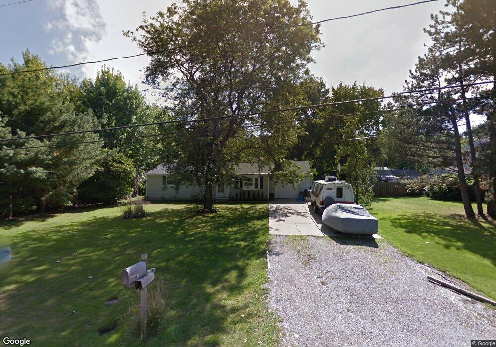
34 Bristol Ave Painesville, OH 44077
Estimated Value: $204,663 - $235,000
3
Beds
1
Bath
1,436
Sq Ft
$153/Sq Ft
Est. Value
About This Home
This home is located at 34 Bristol Ave, Painesville, OH 44077 and is currently estimated at $219,416, approximately $152 per square foot. 34 Bristol Ave is a home located in Lake County with nearby schools including Henry F. Lamuth Middle School, Riverside Junior/Senior High School, and Summit Academy Community School - Painesville.
Ownership History
Date
Name
Owned For
Owner Type
Purchase Details
Closed on
Apr 22, 2014
Sold by
Chafer Malcolm A and Chafer Mary A
Bought by
Chafer Malcolm A
Current Estimated Value
Purchase Details
Closed on
May 26, 1995
Sold by
Bendie Joseph M
Bought by
Chafer Malcolm A and Chafer Mary A
Create a Home Valuation Report for This Property
The Home Valuation Report is an in-depth analysis detailing your home's value as well as a comparison with similar homes in the area
Home Values in the Area
Average Home Value in this Area
Purchase History
| Date | Buyer | Sale Price | Title Company |
|---|---|---|---|
| Chafer Malcolm A | -- | None Available | |
| Chafer Malcolm A | $83,000 | -- |
Source: Public Records
Mortgage History
| Date | Status | Borrower | Loan Amount |
|---|---|---|---|
| Closed | Chafer Malcolm A | -- |
Source: Public Records
Tax History Compared to Growth
Tax History
| Year | Tax Paid | Tax Assessment Tax Assessment Total Assessment is a certain percentage of the fair market value that is determined by local assessors to be the total taxable value of land and additions on the property. | Land | Improvement |
|---|---|---|---|---|
| 2024 | -- | $58,830 | $19,420 | $39,410 |
| 2023 | $4,742 | $43,520 | $15,600 | $27,920 |
| 2022 | $2,561 | $43,520 | $15,600 | $27,920 |
| 2021 | $2,571 | $43,520 | $15,600 | $27,920 |
| 2020 | $2,533 | $37,850 | $13,570 | $24,280 |
| 2019 | $2,552 | $37,850 | $13,570 | $24,280 |
| 2018 | $2,479 | $34,380 | $13,450 | $20,930 |
| 2017 | $2,397 | $34,380 | $13,450 | $20,930 |
| 2016 | $2,318 | $34,380 | $13,450 | $20,930 |
| 2015 | $1,968 | $34,380 | $13,450 | $20,930 |
| 2014 | $2,000 | $34,380 | $13,450 | $20,930 |
| 2013 | $1,955 | $34,380 | $13,450 | $20,930 |
Source: Public Records
Map
Nearby Homes
- 43 Bristol Ave
- 396 Park Rd
- V/L Morgan Dr
- 500 Park Rd
- 67 Tanners Farm Dr
- 525 Morgan Dr
- 65 Tanners Farm Dr
- 5406 Pebble Creek Ln
- 1182 Dalton Dr
- 1172 Dalton Dr
- 30 Orton Rd
- 44 Grove Ave
- 58 Deerfield Dr
- 269 Hale Rd
- 108 Birch Dr
- 238 Radley Dr
- 4505 Lane Rd
- 0 N Ridge Rd Unit 5110949
- 1787 Muirfield Ln
- 65 Country Ln
- 24 Bristol Ave
- 31 Dorchester Dr
- 23 Dorchester Dr
- 45 Dorchester Dr
- 54 Bristol Ave
- 14 Bristol Ave
- 33 Bristol Ave
- 23 Bristol Ave
- 13 Dorchester Dr
- 53 Dorchester Dr
- 53 Bristol Ave
- 13 Bristol Ave
- 60 Bristol Ave
- 4 Bristol Ave
- 3 Dorchester Rd
- 3 Dorchester Dr
- 63 Dorchester Dr
- 34 Dorchester Dr
- 45 Bristol Ave
- 44 Dorchester Dr