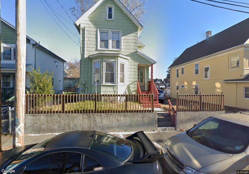
34 Brothwell St Bridgeport, CT 06605
West End-West Side NeighborhoodEstimated Value: $298,000 - $431,000
3
Beds
2
Baths
1,404
Sq Ft
$257/Sq Ft
Est. Value
About This Home
This home is located at 34 Brothwell St, Bridgeport, CT 06605 and is currently estimated at $360,266, approximately $256 per square foot. 34 Brothwell St is a home located in Fairfield County with nearby schools including James J. Curiale School, Bassick High School, and Catholic Academy of Bridgeport-St. Augustine Academy.
Ownership History
Date
Name
Owned For
Owner Type
Purchase Details
Closed on
Nov 24, 1976
Bought by
Nieves Claudio and Nieves Alicia
Current Estimated Value
Create a Home Valuation Report for This Property
The Home Valuation Report is an in-depth analysis detailing your home's value as well as a comparison with similar homes in the area
Home Values in the Area
Average Home Value in this Area
Purchase History
| Date | Buyer | Sale Price | Title Company |
|---|---|---|---|
| Nieves Claudio | -- | -- |
Source: Public Records
Mortgage History
| Date | Status | Borrower | Loan Amount |
|---|---|---|---|
| Closed | Nieves Claudio | $19,500 |
Source: Public Records
Tax History Compared to Growth
Tax History
| Year | Tax Paid | Tax Assessment Tax Assessment Total Assessment is a certain percentage of the fair market value that is determined by local assessors to be the total taxable value of land and additions on the property. | Land | Improvement |
|---|---|---|---|---|
| 2025 | $5,275 | $121,410 | $51,940 | $69,470 |
| 2024 | $5,275 | $121,410 | $51,940 | $69,470 |
| 2023 | $5,275 | $121,410 | $51,940 | $69,470 |
| 2022 | $5,275 | $121,410 | $51,940 | $69,470 |
| 2021 | $5,275 | $121,410 | $51,940 | $69,470 |
| 2020 | $4,880 | $90,390 | $31,470 | $58,920 |
| 2019 | $4,880 | $90,390 | $31,470 | $58,920 |
| 2018 | $4,915 | $90,390 | $31,470 | $58,920 |
| 2017 | $4,915 | $90,390 | $31,470 | $58,920 |
| 2016 | $4,915 | $90,390 | $31,470 | $58,920 |
| 2015 | $4,990 | $118,240 | $47,600 | $70,640 |
| 2014 | $4,990 | $118,240 | $47,600 | $70,640 |
Source: Public Records
Map
Nearby Homes
- 1373 Iranistan Ave
- 826 Norman St
- 60 Olive St
- 414 Wood Ave
- 592 Norman St Unit 594
- 1199 Iranistan Ave Unit 1201
- 566 Wood Ave
- 309 Pequonnock St
- 393 Laurel Ave Unit 203
- 393 Laurel Ave Unit 415
- 700 Laurel Ave
- 1872 North Ave Unit 1874
- 200 Harral Ave
- 697 Laurel Ave
- 357 Norman St
- 687 Wood Ave
- 670 Clinton Ave
- 533 Clinton Ave
- 113 Milne St Unit 115
- 184 Pacific St
- 24 Brothwell St Unit 26
- 46 Brothwell St
- 1431 Iranistan Ave Unit 1433
- 141 Benham Ave
- 147 Benham Ave
- 135 Benham Ave
- 155 Benham Ave
- 1451 Iranistan Ave
- 776 Norman St
- 762 Norman St
- 756 Norman St Unit 756
- 754 Norman St Unit 756
- 754 Norman St Unit 754
- 754 Norman St Unit 754-756
- 754 Norman St Unit 1
- 782 Norman St
- 782 Norman St
- 782 Norman St Unit 1227 Iranistan Av
- 768 Norman St Unit 770
- 768 Norman St Unit 1