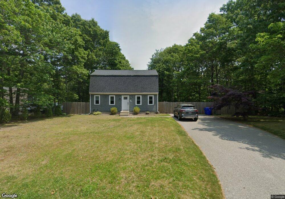
34 Chartwell Dr Bourne, MA 2532
Estimated Value: $557,718 - $627,000
3
Beds
2
Baths
1,201
Sq Ft
$485/Sq Ft
Est. Value
About This Home
This home is located at 34 Chartwell Dr, Bourne, MA 2532 and is currently estimated at $582,930, approximately $485 per square foot. 34 Chartwell Dr is a home located in Barnstable County with nearby schools including Bourne High School and Bridgeview Montessori School.
Ownership History
Date
Name
Owned For
Owner Type
Purchase Details
Closed on
Sep 24, 2020
Sold by
Fnma
Bought by
Stearns Daniel and Lyons Cori
Current Estimated Value
Home Financials for this Owner
Home Financials are based on the most recent Mortgage that was taken out on this home.
Original Mortgage
$296,400
Interest Rate
2.8%
Mortgage Type
New Conventional
Purchase Details
Closed on
Dec 21, 2018
Sold by
Covency Michael W and Nationstar Mortgage Llc
Bought by
Federal National Mortgage Association
Purchase Details
Closed on
Jun 15, 2010
Sold by
Coveney Michael W and Willis Sarah B
Bought by
Coveney Michael W and Coveney Sarah B
Home Financials for this Owner
Home Financials are based on the most recent Mortgage that was taken out on this home.
Original Mortgage
$275,642
Interest Rate
5.11%
Mortgage Type
Purchase Money Mortgage
Purchase Details
Closed on
Sep 21, 2006
Sold by
Radian Svcs Llc
Bought by
Coveney Michael W and Willis Sarah B
Purchase Details
Closed on
Oct 19, 2005
Sold by
Wells Fargo Bank Minn and Butler
Bought by
Wells Fargo Bank Na
Purchase Details
Closed on
Dec 9, 1996
Sold by
Marson Donald A
Bought by
Butler Charles W
Purchase Details
Closed on
Aug 23, 1994
Sold by
Weldon Pk Rt
Bought by
Marson Donald A
Create a Home Valuation Report for This Property
The Home Valuation Report is an in-depth analysis detailing your home's value as well as a comparison with similar homes in the area
Purchase History
| Date | Buyer | Sale Price | Title Company |
|---|---|---|---|
| Stearns Daniel | $312,000 | None Available | |
| Stearns Daniel | $312,000 | None Available | |
| Stearns Daniel | $312,000 | None Available | |
| Federal National Mortgage Association | $295,316 | -- | |
| Federal National Mortgage Association | $295,316 | -- | |
| Federal National Mortgage Association | $295,316 | -- | |
| Coveney Michael W | -- | -- | |
| Coveney Michael W | -- | -- | |
| Coveney Michael W | $268,900 | -- | |
| Radian Svcs Llc | -- | -- | |
| Wells Fargo Bank Na | $280,640 | -- | |
| Butler Charles W | $116,000 | -- | |
| Marson Donald A | $111,895 | -- | |
| Coveney Michael W | -- | -- | |
| Radian Svcs Llc | -- | -- | |
| Wells Fargo Bank Na | $280,640 | -- | |
| Butler Charles W | $116,000 | -- | |
| Marson Donald A | $111,895 | -- |
Source: Public Records
Mortgage History
| Date | Status | Borrower | Loan Amount |
|---|---|---|---|
| Previous Owner | Stearns Daniel | $296,400 | |
| Previous Owner | Coveney Michael W | $275,642 |
Source: Public Records
Tax History
| Year | Tax Paid | Tax Assessment Tax Assessment Total Assessment is a certain percentage of the fair market value that is determined by local assessors to be the total taxable value of land and additions on the property. | Land | Improvement |
|---|---|---|---|---|
| 2025 | $3,736 | $478,300 | $176,300 | $302,000 |
| 2024 | $3,680 | $458,900 | $167,900 | $291,000 |
| 2023 | $3,723 | $422,600 | $165,100 | $257,500 |
| 2022 | $3,537 | $350,500 | $146,100 | $204,400 |
| 2021 | $3,459 | $321,200 | $133,000 | $188,200 |
| 2020 | $3,371 | $313,900 | $131,700 | $182,200 |
| 2019 | $3,191 | $303,600 | $131,700 | $171,900 |
| 2018 | $2,945 | $279,400 | $125,500 | $153,900 |
| 2017 | $2,734 | $265,400 | $124,300 | $141,100 |
| 2016 | $2,661 | $261,900 | $124,300 | $137,600 |
| 2015 | $2,637 | $261,900 | $124,300 | $137,600 |
Source: Public Records
Map
Nearby Homes
- 0 State Rd
- 16 Ocean Pines Dr Unit B
- 11 Village Green Dr Unit B
- 17 Ridgehill Ln
- 8 Driftwood Ln
- 4 Andrew Rd
- 10 Tecumseh Rd
- 150 Herring Pond Rd
- 133 Phillips Rd
- 6 Aspen Rd Unit 6
- 6 Aspen Rd
- 7 Swamp Rd
- 30 Pawtuxet Rd
- 110 Valley Rd
- 11 Womponoag Rd
- 18 Gibbs Rd
- 40 Menotomy Rd
- 2 Womponoag Rd
- 8 Jillian Dr
- 92 Cliffside Dr Unit hole 2
- 34 Chart Well Dr
- 36 Chart Well Dr
- 36 Chartwell Dr
- 32 Chart Well Dr
- 35 Chartwell Dr
- 5 King Arthurs Way
- 35 Chart Well Dr
- 3 King Arthurs Way
- 5 King Arthurs Way
- 33 Chartwell Dr
- 7 King Arthurs Way
- 7 King Arthurs Way
- 33 Chart Well Dr
- 32 Chart Well Ave
- 39 Chart Well Dr
- 2 King Arthurs Way
- 31 Chart Well Dr
- 40 Chart Well Dr
- 40 Chartwell Dr
- 9 King Arthurs Way
Your Personal Tour Guide
Ask me questions while you tour the home.