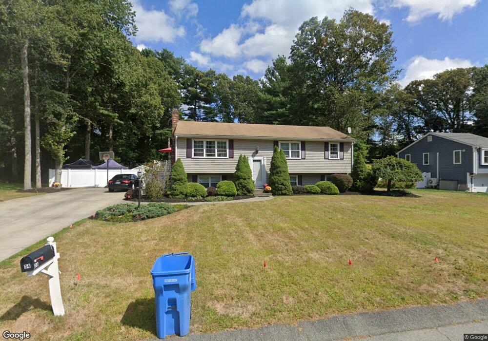
34 Cranberry Rd Whitman, MA 02382
Estimated Value: $595,000 - $652,000
3
Beds
2
Baths
1,056
Sq Ft
$585/Sq Ft
Est. Value
About This Home
This home is located at 34 Cranberry Rd, Whitman, MA 02382 and is currently estimated at $617,801, approximately $585 per square foot. 34 Cranberry Rd is a home located in Plymouth County with nearby schools including St Bridget School.
Ownership History
Date
Name
Owned For
Owner Type
Purchase Details
Closed on
Mar 28, 2016
Sold by
Loring Nicholas R and Angelini Sunisa D
Bought by
Loring Nicholas R and Loring Sunisa D
Current Estimated Value
Purchase Details
Closed on
Mar 19, 2010
Sold by
Fhlmc
Bought by
Loring Nicholas R and Angelini Sunisa D
Home Financials for this Owner
Home Financials are based on the most recent Mortgage that was taken out on this home.
Original Mortgage
$243,016
Interest Rate
5.05%
Mortgage Type
Purchase Money Mortgage
Purchase Details
Closed on
Feb 17, 2010
Sold by
Lucas Mary E and Chase Home Finance Llc
Bought by
Fhlmc
Home Financials for this Owner
Home Financials are based on the most recent Mortgage that was taken out on this home.
Original Mortgage
$243,016
Interest Rate
5.05%
Mortgage Type
Purchase Money Mortgage
Create a Home Valuation Report for This Property
The Home Valuation Report is an in-depth analysis detailing your home's value as well as a comparison with similar homes in the area
Home Values in the Area
Average Home Value in this Area
Purchase History
| Date | Buyer | Sale Price | Title Company |
|---|---|---|---|
| Loring Nicholas R | -- | -- | |
| Loring Nicholas R | $247,500 | -- | |
| Fhlmc | $330,235 | -- |
Source: Public Records
Mortgage History
| Date | Status | Borrower | Loan Amount |
|---|---|---|---|
| Previous Owner | Loring Nicholas R | $243,016 |
Source: Public Records
Tax History
| Year | Tax Paid | Tax Assessment Tax Assessment Total Assessment is a certain percentage of the fair market value that is determined by local assessors to be the total taxable value of land and additions on the property. | Land | Improvement |
|---|---|---|---|---|
| 2025 | $6,996 | $533,200 | $244,000 | $289,200 |
| 2024 | $6,161 | $483,600 | $236,200 | $247,400 |
| 2023 | $5,789 | $426,600 | $215,100 | $211,500 |
| 2022 | $5,675 | $389,800 | $195,200 | $194,600 |
| 2021 | $5,735 | $370,000 | $171,900 | $198,100 |
| 2020 | $5,541 | $349,600 | $163,000 | $186,600 |
| 2019 | $5,318 | $345,800 | $163,000 | $182,800 |
| 2018 | $5,138 | $320,900 | $155,300 | $165,600 |
| 2017 | $4,839 | $320,900 | $155,300 | $165,600 |
| 2016 | $4,716 | $302,500 | $149,700 | $152,800 |
| 2015 | $4,513 | $289,100 | $144,200 | $144,900 |
Source: Public Records
Map
Nearby Homes
- 608 Plymouth St
- 291 Raynor Ave
- 74 Benson St
- 61 Suffolk St
- 170 Pleasant St
- 5 Alpine St
- 340 Centre Ave Unit 44
- 34 Park Ave
- 10 Birch Bottom Cir
- 110 South Ave
- 87 Summer St
- 289 Commercial St
- 1142 Washington St
- 147 South Ave
- 48 Sullivan Terrace
- 7 Carlys Way
- 8 Laurel St
- 48 Day St
- 99 Washington St
- 214 Winter St
- 44 Cranberry Rd
- 24 Cranberry Rd
- 25 Blueberry Path
- 33 Blueberry Path
- 15 Blueberry Path
- 41 Cranberry Rd
- 50 Cranberry Rd
- 14 Cranberry Rd
- 21 Cranberry Rd
- 43 Bayberry Rd
- 80 Cranberry Rd
- 53 Cranberry Rd
- 7 Cranberry Rd
- 51 Bayberry Rd
- 6 Bayberry Rd
- 92 Cranberry Rd
- 5 Bayberry Rd
- 75 Cranberry Rd
- 28 Blueberry Path
- 65 Cranberry Rd
Your Personal Tour Guide
Ask me questions while you tour the home.