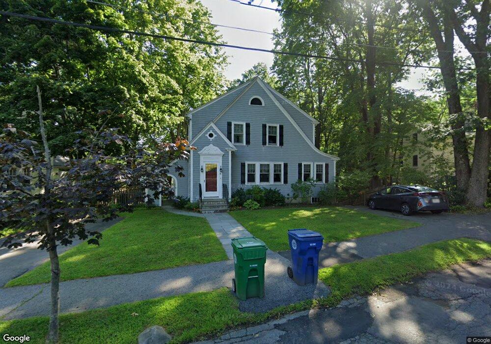
34 Day St Auburndale, MA 02466
Auburndale NeighborhoodEstimated Value: $1,280,650 - $1,803,000
3
Beds
2
Baths
1,910
Sq Ft
$816/Sq Ft
Est. Value
About This Home
This home is located at 34 Day St, Auburndale, MA 02466 and is currently estimated at $1,559,413, approximately $816 per square foot. 34 Day St is a home located in Middlesex County with nearby schools including Peirce Elementary School, Williams Elementary School, and F.A. Day Middle School.
Create a Home Valuation Report for This Property
The Home Valuation Report is an in-depth analysis detailing your home's value as well as a comparison with similar homes in the area
Home Values in the Area
Average Home Value in this Area
Tax History Compared to Growth
Tax History
| Year | Tax Paid | Tax Assessment Tax Assessment Total Assessment is a certain percentage of the fair market value that is determined by local assessors to be the total taxable value of land and additions on the property. | Land | Improvement |
|---|---|---|---|---|
| 2025 | $9,659 | $985,600 | $827,100 | $158,500 |
| 2024 | $9,339 | $956,900 | $803,000 | $153,900 |
| 2023 | $8,874 | $871,700 | $601,900 | $269,800 |
| 2022 | $8,491 | $807,100 | $557,300 | $249,800 |
| 2021 | $8,193 | $761,400 | $525,800 | $235,600 |
| 2020 | $7,949 | $761,400 | $525,800 | $235,600 |
| 2019 | $7,725 | $739,200 | $510,500 | $228,700 |
| 2018 | $7,414 | $685,200 | $467,200 | $218,000 |
| 2017 | $7,188 | $646,400 | $440,800 | $205,600 |
| 2016 | $6,875 | $604,100 | $412,000 | $192,100 |
| 2015 | $6,555 | $564,600 | $385,000 | $179,600 |
Source: Public Records
Map
Nearby Homes
- 1754 Washington St
- 163 Day St
- 283 Woodland Rd
- 1639 Washington St
- 68 Mignon Rd
- 17 Gilbert St
- 51 Bourne St
- 157 Stanton Ave
- 10 Ruane Rd
- 39 Hawthorne Ave
- 0 Duncan Rd Unit 72925240
- 13 Weir St
- 179 Auburn St
- 194 Auburn St
- 1488 Washington St Unit 1488
- 224 Auburn St Unit 224
- 226 Auburn St Unit 226
- 18 Sewall St
- 17 Crescent St
- 62-64 Rowe St Unit B