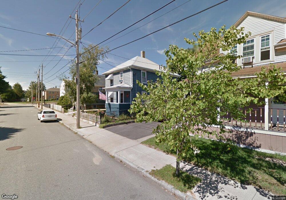
34 Frost St Fall River, MA 02721
Maplewood NeighborhoodEstimated Value: $386,845 - $438,000
3
Beds
1
Bath
1,440
Sq Ft
$282/Sq Ft
Est. Value
About This Home
This home is located at 34 Frost St, Fall River, MA 02721 and is currently estimated at $406,461, approximately $282 per square foot. 34 Frost St is a home located in Bristol County with nearby schools including Letourneau Elementary School, Talbot Innovation School, and B M C Durfee High School.
Ownership History
Date
Name
Owned For
Owner Type
Purchase Details
Closed on
Aug 26, 2025
Sold by
Valliere Ronald E and Valliere Robin D
Bought by
Ronald E E and Ronald Robin D
Current Estimated Value
Purchase Details
Closed on
Jun 25, 1990
Sold by
King Carol
Bought by
Valliere Ronald E
Create a Home Valuation Report for This Property
The Home Valuation Report is an in-depth analysis detailing your home's value as well as a comparison with similar homes in the area
Home Values in the Area
Average Home Value in this Area
Purchase History
| Date | Buyer | Sale Price | Title Company |
|---|---|---|---|
| Ronald E E | -- | -- | |
| Ronald E E | -- | -- | |
| Valliere Ronald E | $111,000 | -- | |
| Valliere Ronald E | $111,000 | -- |
Source: Public Records
Mortgage History
| Date | Status | Borrower | Loan Amount |
|---|---|---|---|
| Previous Owner | Valliere Ronald E | $106,800 | |
| Previous Owner | Valliere Ronald E | $104,000 | |
| Previous Owner | Valliere Ronald E | $15,700 |
Source: Public Records
Tax History Compared to Growth
Tax History
| Year | Tax Paid | Tax Assessment Tax Assessment Total Assessment is a certain percentage of the fair market value that is determined by local assessors to be the total taxable value of land and additions on the property. | Land | Improvement |
|---|---|---|---|---|
| 2025 | $3,319 | $289,900 | $125,500 | $164,400 |
| 2024 | $3,130 | $272,400 | $120,800 | $151,600 |
| 2023 | $3,002 | $244,700 | $103,500 | $141,200 |
| 2022 | $2,673 | $211,800 | $94,100 | $117,700 |
| 2021 | $2,600 | $188,000 | $87,100 | $100,900 |
| 2020 | $2,565 | $177,500 | $83,300 | $94,200 |
| 2019 | $2,473 | $169,600 | $79,400 | $90,200 |
| 2018 | $2,408 | $164,700 | $77,900 | $86,800 |
| 2017 | $2,306 | $164,700 | $79,500 | $85,200 |
| 2016 | $2,222 | $163,000 | $82,800 | $80,200 |
| 2015 | $2,091 | $159,900 | $79,700 | $80,200 |
| 2014 | $2,064 | $164,100 | $83,900 | $80,200 |
Source: Public Records
Map
Nearby Homes
- 415 Anthony St
- 478 Tucker St
- 125 Carl St
- 59 Denver St
- 539 Aetna St
- 495 Chicago St
- 59 Wayne St
- 1553 Rodman St
- 1441 Stafford Rd
- 191 Glasgow St Unit 2
- 191 Glasgow St Unit 1
- 239 Glasgow St Unit 8
- 80 Lane St
- 228 Dickinson St
- 256 Rhode Island Ave
- 323 S Oxford St
- 185 Stevens St
- 248 Jefferson St
- 217 Napoleon St
- 306 Mott St
- 22 Frost St
- 46 Frost St
- 53 Grattan St
- 954 Stafford Rd Unit 2
- 954 Stafford Rd
- 944 Stafford Rd Unit 1
- 60 Frost St
- 988 Stafford Rd
- 37 Grattan St
- 77 Grattan St
- 39 Frost St
- 940 Stafford Rd
- 93 Grattan St
- 63 Frost St
- 76 Frost St
- 1008-1012 Stafford Rd Unit 3
- 1008-1012 Stafford Rd Unit 2
- 1008 Stafford Rd
- 1008 Stafford Rd Unit 3
- 924 Stafford Rd