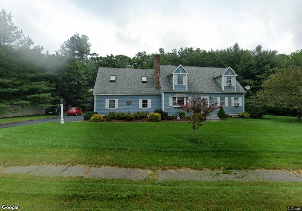
34 General Hobbs Rd Jefferson, MA 01522
Estimated Value: $652,295 - $721,000
4
Beds
2
Baths
2,436
Sq Ft
$280/Sq Ft
Est. Value
About This Home
This home is located at 34 General Hobbs Rd, Jefferson, MA 01522 and is currently estimated at $683,074, approximately $280 per square foot. 34 General Hobbs Rd is a home located in Worcester County with nearby schools including Wachusett Regional High School and Holden Christian Academy.
Ownership History
Date
Name
Owned For
Owner Type
Purchase Details
Closed on
Nov 22, 1991
Sold by
High Plain Est Inc
Bought by
Schell Carl P and Karen D Schell
Current Estimated Value
Create a Home Valuation Report for This Property
The Home Valuation Report is an in-depth analysis detailing your home's value as well as a comparison with similar homes in the area
Home Values in the Area
Average Home Value in this Area
Purchase History
| Date | Buyer | Sale Price | Title Company |
|---|---|---|---|
| Schell Carl P | $40,000 | -- |
Source: Public Records
Mortgage History
| Date | Status | Borrower | Loan Amount |
|---|---|---|---|
| Open | Schell Carl P | $150,000 | |
| Closed | Schell Carl P | $60,500 | |
| Closed | Schell Carl P | $5,000 |
Source: Public Records
Tax History Compared to Growth
Tax History
| Year | Tax Paid | Tax Assessment Tax Assessment Total Assessment is a certain percentage of the fair market value that is determined by local assessors to be the total taxable value of land and additions on the property. | Land | Improvement |
|---|---|---|---|---|
| 2025 | $7,848 | $566,200 | $200,800 | $365,400 |
| 2024 | $7,733 | $546,500 | $195,000 | $351,500 |
| 2023 | $7,279 | $485,600 | $169,400 | $316,200 |
| 2022 | $6,912 | $417,400 | $132,200 | $285,200 |
| 2021 | $6,701 | $385,100 | $126,000 | $259,100 |
| 2020 | $6,412 | $377,200 | $120,200 | $257,000 |
| 2019 | $6,165 | $353,300 | $120,200 | $233,100 |
| 2018 | $6,281 | $356,700 | $114,400 | $242,300 |
| 2017 | $5,821 | $330,900 | $114,400 | $216,500 |
| 2016 | $5,456 | $316,300 | $109,100 | $207,200 |
| 2015 | $5,561 | $306,900 | $109,100 | $197,800 |
| 2014 | $5,447 | $306,900 | $109,100 | $197,800 |
Source: Public Records
Map
Nearby Homes
- Lot 1 Manning St
- 0 North St
- 60 Duxbury Dr
- 287 Laurel St
- 35 Laurel Hill Ln
- 56 Highland Ave
- 3 Oakridge Rd
- 141 Lovell Rd
- 33 Meadow Wood Dr
- 40 Princeton St
- 206 Wachusett St
- 197 High St
- 1818 Main St Unit 204
- 8 (Lot 1) Holmes Dr
- 16 N Main St
- 84 Kendall Rd
- 100 Avery Heights Dr
- 124 Bailey Rd
- 26 Avery Heights Dr
- 127 N Main St
- 21-2 General Hobbs Rd Unit 2-21
- 16 General Hobbs Rd Unit 4
- 16 General Hobbs Rd Unit 3
- 16 General Hobbs Rd Unit 2
- 16 General Hobbs Rd Unit 1
- 33 General Hobbs Rd
- 44 General Hobbs Rd
- 21 General Hobbs Rd Unit 4
- 21 General Hobbs Rd Unit 3
- 21 General Hobbs Rd Unit 2
- 21 General Hobbs Rd Unit 1
- 45 General Hobbs Rd
- 125-4 Manning St Unit 4
- 125-4 Manning St Unit 4 125
- 139-1 Manning St Unit 1 139
- 139-1 Manning St Unit 1
- 11 General Hobbs Rd Unit 4
- 11 General Hobbs Rd Unit 3
- 11 General Hobbs Rd Unit 2
- 11 General Hobbs Rd Unit 1