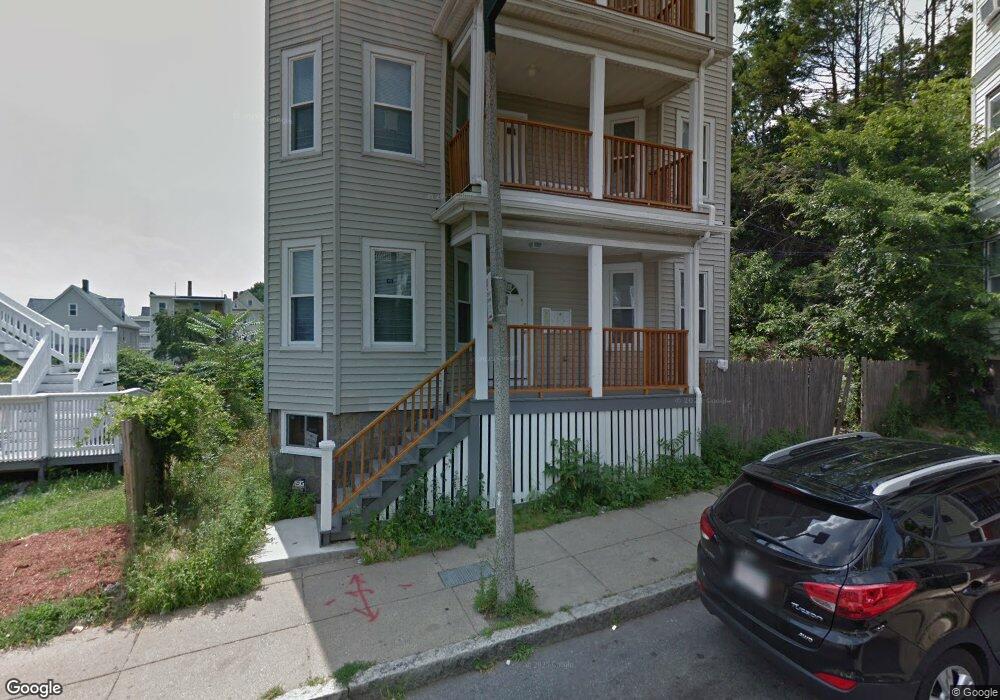
34 Hendry St Dorchester, MA 02122
Uphams Corner-Jones Hill NeighborhoodEstimated Value: $695,608 - $910,000
9
Beds
3
Baths
3,462
Sq Ft
$232/Sq Ft
Est. Value
About This Home
This home is located at 34 Hendry St, Dorchester, MA 02122 and is currently estimated at $803,902, approximately $232 per square foot. 34 Hendry St is a home located in Suffolk County with nearby schools including Helen Y. Davis Leadership Academy Charter Public School and Uncommon Schools Roxbury Prep Dorchester Campus.
Ownership History
Date
Name
Owned For
Owner Type
Purchase Details
Closed on
Aug 26, 2011
Sold by
Db Neighborhood Homes
Bought by
Dossantos Maria J
Current Estimated Value
Home Financials for this Owner
Home Financials are based on the most recent Mortgage that was taken out on this home.
Original Mortgage
$221,000
Outstanding Balance
$153,277
Interest Rate
4.53%
Mortgage Type
Purchase Money Mortgage
Estimated Equity
$650,625
Purchase Details
Closed on
Dec 9, 2009
Sold by
Miraglia Grace L
Bought by
Db Neighborhoood Home
Home Financials for this Owner
Home Financials are based on the most recent Mortgage that was taken out on this home.
Original Mortgage
$1,750,000
Interest Rate
5.02%
Mortgage Type
Purchase Money Mortgage
Create a Home Valuation Report for This Property
The Home Valuation Report is an in-depth analysis detailing your home's value as well as a comparison with similar homes in the area
Home Values in the Area
Average Home Value in this Area
Purchase History
| Date | Buyer | Sale Price | Title Company |
|---|---|---|---|
| Dossantos Maria J | $295,000 | -- | |
| Db Neighborhoood Home | $169,000 | -- |
Source: Public Records
Mortgage History
| Date | Status | Borrower | Loan Amount |
|---|---|---|---|
| Open | Dossantos Maria J | $221,000 | |
| Previous Owner | Db Neighborhoood Home | $1,750,000 |
Source: Public Records
Tax History Compared to Growth
Tax History
| Year | Tax Paid | Tax Assessment Tax Assessment Total Assessment is a certain percentage of the fair market value that is determined by local assessors to be the total taxable value of land and additions on the property. | Land | Improvement |
|---|---|---|---|---|
| 2025 | $6,443 | $556,400 | $183,612 | $372,788 |
| 2024 | $5,776 | $529,900 | $143,073 | $386,827 |
| 2023 | $5,420 | $504,700 | $136,269 | $368,431 |
| 2022 | $5,230 | $480,700 | $129,789 | $350,911 |
| 2021 | $4,885 | $457,800 | $0 | $457,800 |
| 2020 | $4,604 | $436,000 | $0 | $436,000 |
| 2019 | $4,376 | $415,200 | $160,000 | $255,200 |
| 2018 | $4,144 | $395,400 | $160,000 | $235,400 |
| 2017 | $3,988 | $376,600 | $160,000 | $216,600 |
| 2016 | $3,946 | $358,700 | $160,000 | $198,700 |
| 2015 | $4,137 | $341,600 | $138,700 | $202,900 |
| 2014 | $4,092 | $325,300 | $138,700 | $186,600 |
Source: Public Records
Map
Nearby Homes
- 35-37 Clarkson St
- 22 Ronan St
- 3 Ware St
- 52 Bellevue St Unit 1
- 52 Bellevue St Unit 2
- 20 Rill St
- 70-72 Clarkson St
- 60 Stanley St Unit 301
- 60 Stanley St Unit 302
- 60 Stanley St
- 60 Stanley St Unit 101
- 76 Bellevue St
- 19 Mount Ida Rd
- 70 Hamilton St
- 33 Adams St Unit 1
- 22 High St Unit 203
- 22 High St Unit 201
- 22 High St Unit 103
- 22 High St Unit PH12
- 22 High St Unit PH13
- 3 Clarkson St
- 7 Fernald Terrace
- 8 Fernald Terrace
- 37 Hendry St
- 6 Fernald Terrace
- 6 Fernald Terrace Unit 2
- 5 Fernald Terrace
- 33 Hendry St
- 9 Fernald Terrace
- 9 Clarkson St Unit 9
- 9 Clarkson St Unit A
- 9 Clarkson St
- 7 Clarkson St
- 7 Clarkson St Unit A
- 5 Clarkson St
- 5 Clarkson St Unit A
- 7 Clarkson St Unit 2
- 7 Clarkson St Unit 1
- 5 Clarkson St Unit 2
- 5 Clarkson St Unit 1