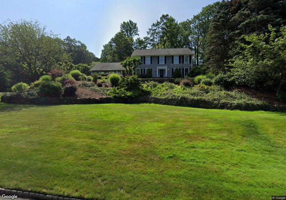
34 Mabro Dr Denville, NJ 07834
Estimated Value: $943,156 - $1,133,000
--
Bed
--
Bath
3,254
Sq Ft
$330/Sq Ft
Est. Value
About This Home
This home is located at 34 Mabro Dr, Denville, NJ 07834 and is currently estimated at $1,074,789, approximately $330 per square foot. 34 Mabro Dr is a home located in Morris County with nearby schools including Lakeview Elementary School and Valleyview Middle School.
Ownership History
Date
Name
Owned For
Owner Type
Purchase Details
Closed on
Jan 13, 2000
Sold by
Elsman James M and Elsman Alison P
Bought by
Elsman James M and Elsman Alison P
Current Estimated Value
Purchase Details
Closed on
Nov 25, 1998
Sold by
Yapp David W and Yapp Lois H
Bought by
Elsman James M and Elsman Alison P
Home Financials for this Owner
Home Financials are based on the most recent Mortgage that was taken out on this home.
Original Mortgage
$200,000
Outstanding Balance
$45,508
Interest Rate
6.8%
Estimated Equity
$1,029,281
Purchase Details
Closed on
Oct 14, 1997
Sold by
Porter Glendon R and Porter Frances C
Bought by
Yapp David W and Yapp Lois H
Home Financials for this Owner
Home Financials are based on the most recent Mortgage that was taken out on this home.
Original Mortgage
$333,000
Interest Rate
7.46%
Create a Home Valuation Report for This Property
The Home Valuation Report is an in-depth analysis detailing your home's value as well as a comparison with similar homes in the area
Home Values in the Area
Average Home Value in this Area
Purchase History
| Date | Buyer | Sale Price | Title Company |
|---|---|---|---|
| Elsman James M | -- | -- | |
| Elsman James M | $399,000 | -- | |
| Yapp David W | $370,100 | Commonwealth Land Title Ins |
Source: Public Records
Mortgage History
| Date | Status | Borrower | Loan Amount |
|---|---|---|---|
| Open | Elsman James M | $200,000 | |
| Previous Owner | Yapp David W | $333,000 |
Source: Public Records
Tax History Compared to Growth
Tax History
| Year | Tax Paid | Tax Assessment Tax Assessment Total Assessment is a certain percentage of the fair market value that is determined by local assessors to be the total taxable value of land and additions on the property. | Land | Improvement |
|---|---|---|---|---|
| 2025 | $16,514 | $599,200 | $222,600 | $376,600 |
| 2024 | $15,849 | $599,200 | $222,600 | $376,600 |
| 2023 | $15,849 | $599,200 | $222,600 | $376,600 |
| 2022 | $15,178 | $599,200 | $222,600 | $376,600 |
| 2021 | $15,178 | $599,200 | $222,600 | $376,600 |
| 2020 | $15,052 | $599,200 | $222,600 | $376,600 |
| 2019 | $14,896 | $599,200 | $222,600 | $376,600 |
| 2018 | $14,758 | $599,200 | $222,600 | $376,600 |
| 2017 | $14,638 | $599,200 | $222,600 | $376,600 |
| 2016 | $14,297 | $599,200 | $222,600 | $376,600 |
| 2015 | $15,760 | $505,300 | $166,800 | $338,500 |
| 2014 | $15,447 | $505,300 | $166,800 | $338,500 |
Source: Public Records
Map
Nearby Homes
- 18 Rosewood Ln
- 44 Shongum Rd
- 4 Waterview Ln
- 6 Knoll Top Ct
- 21 Puddingstone Rd
- 41 Beverly St
- 10 Robin Dr
- 41 Shongum Rd
- 9 Mary Farm Rd
- 58 Autumn Ridge Rd
- 20 Longhill Rd
- 76 Henning Terrace
- 160 W Hanover Ave
- 64 Henning Terrace
- 82 Mountainside Dr
- 52 Wiley Ct
- 6 Quarry Ct
- 637 Old Dover Rd
- 24 Henning Terrace
- 10 Campo Rd