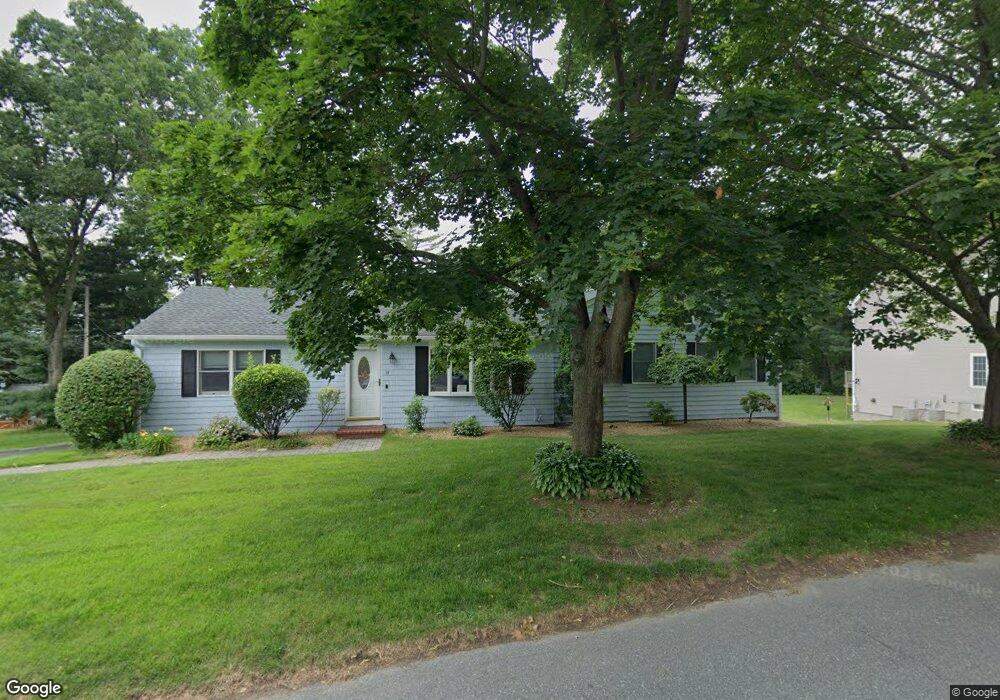
34 Macarthur Dr Millbury, MA 01527
Estimated Value: $535,000 - $752,857
2
Beds
2
Baths
1,436
Sq Ft
$452/Sq Ft
Est. Value
About This Home
This home is located at 34 Macarthur Dr, Millbury, MA 01527 and is currently estimated at $648,464, approximately $451 per square foot. 34 Macarthur Dr is a home located in Worcester County with nearby schools including Elmwood Street Elementary School, Raymond E. Shaw Elementary School, and Millbury Junior/Senior High School.
Ownership History
Date
Name
Owned For
Owner Type
Purchase Details
Closed on
Aug 31, 1998
Sold by
Erickson Mary E
Bought by
Allard Richard H
Current Estimated Value
Home Financials for this Owner
Home Financials are based on the most recent Mortgage that was taken out on this home.
Original Mortgage
$116,889
Interest Rate
6.9%
Mortgage Type
Purchase Money Mortgage
Create a Home Valuation Report for This Property
The Home Valuation Report is an in-depth analysis detailing your home's value as well as a comparison with similar homes in the area
Home Values in the Area
Average Home Value in this Area
Purchase History
| Date | Buyer | Sale Price | Title Company |
|---|---|---|---|
| Allard Richard H | $129,876 | -- | |
| Allard Richard H | $129,876 | -- |
Source: Public Records
Mortgage History
| Date | Status | Borrower | Loan Amount |
|---|---|---|---|
| Open | Allard Richard H | $147,000 | |
| Closed | Allard Richard H | $147,200 | |
| Closed | Allard Richard H | $116,889 |
Source: Public Records
Tax History Compared to Growth
Tax History
| Year | Tax Paid | Tax Assessment Tax Assessment Total Assessment is a certain percentage of the fair market value that is determined by local assessors to be the total taxable value of land and additions on the property. | Land | Improvement |
|---|---|---|---|---|
| 2025 | $9,523 | $711,174 | $369,674 | $341,500 |
| 2024 | $8,734 | $660,142 | $342,342 | $317,800 |
| 2023 | $6,528 | $451,755 | $177,555 | $274,200 |
| 2022 | $6,376 | $425,055 | $177,555 | $247,500 |
| 2021 | $6,313 | $409,155 | $177,555 | $231,600 |
| 2020 | $5,727 | $373,600 | $148,000 | $225,600 |
| 2019 | $5,484 | $346,000 | $134,500 | $211,500 |
| 2018 | $5,232 | $320,200 | $134,500 | $185,700 |
| 2017 | $5,049 | $307,300 | $134,500 | $172,800 |
| 2016 | $4,773 | $290,000 | $134,500 | $155,500 |
| 2015 | $4,847 | $294,500 | $142,800 | $151,700 |
| 2014 | $4,145 | $242,400 | $103,500 | $138,900 |
Source: Public Records
Map
Nearby Homes
- 90 Macarthur Dr
- 3 May St
- 86 Wheelock Ave
- 2 Diane St
- 11 Westview Ave
- 12 Irene Ct
- 1 Pineland Ave
- 1 Broadmeadow Ave
- 12 Alstead Path
- 46 John Dr Unit 46
- 5 Edward Dr
- 330 Millbury Ave
- 21 Lordvale Blvd Unit 406
- 28 Lincoln Ln
- 5 Lincoln Ln Unit 5
- 11 Maplewood Rd
- 123 Riverlin St
- 76 Samuel Dr
- 27 A-B Grafton St
- 64 Millbury Ave
- 28 Macarthur Dr
- 38 Macarthur Dr
- 31 Macarthur Dr
- 40 Macarthur Dr
- 35 Macarthur Dr
- 27 Macarthur Dr
- 41 Macarthur Dr
- 42 Macarthur Dr
- 56 Tiffany Cir
- 55 Tiffany Cir
- 54 Tiffany Cir
- 53 Tiffany Cir
- 25 Macarthur Dr
- 44 Macarthur Dr
- 43 Macarthur Dr
- 6 Rollie Shepard Dr
- 8 Rollie Shepard Dr
- 46 Macarthur Dr
- 10 Rollie Shepard Dr
- 1 Montgomery Dr