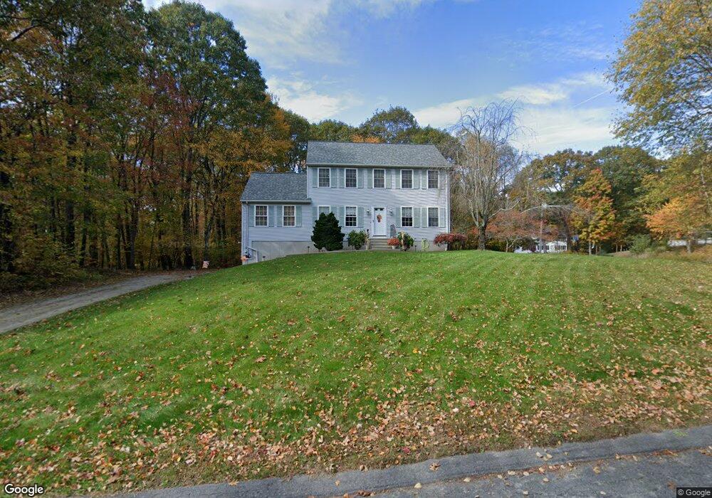
34 Marilyn Dr Douglas, MA 01516
Estimated Value: $571,331 - $648,000
3
Beds
3
Baths
1,944
Sq Ft
$320/Sq Ft
Est. Value
About This Home
This home is located at 34 Marilyn Dr, Douglas, MA 01516 and is currently estimated at $622,083, approximately $320 per square foot. 34 Marilyn Dr is a home located in Worcester County with nearby schools including Douglas Primary School, Douglas Middle School, and Douglas High School.
Ownership History
Date
Name
Owned For
Owner Type
Purchase Details
Closed on
May 7, 1998
Sold by
Heritage Park Dev Corp
Bought by
Alves Daniel S and Alves Ann Marie
Current Estimated Value
Home Financials for this Owner
Home Financials are based on the most recent Mortgage that was taken out on this home.
Original Mortgage
$162,500
Outstanding Balance
$31,613
Interest Rate
7.05%
Mortgage Type
Purchase Money Mortgage
Estimated Equity
$590,470
Create a Home Valuation Report for This Property
The Home Valuation Report is an in-depth analysis detailing your home's value as well as a comparison with similar homes in the area
Home Values in the Area
Average Home Value in this Area
Purchase History
| Date | Buyer | Sale Price | Title Company |
|---|---|---|---|
| Alves Daniel S | $171,150 | -- |
Source: Public Records
Mortgage History
| Date | Status | Borrower | Loan Amount |
|---|---|---|---|
| Open | Alves Daniel S | $162,500 |
Source: Public Records
Tax History
| Year | Tax Paid | Tax Assessment Tax Assessment Total Assessment is a certain percentage of the fair market value that is determined by local assessors to be the total taxable value of land and additions on the property. | Land | Improvement |
|---|---|---|---|---|
| 2025 | $66 | $501,300 | $130,800 | $370,500 |
| 2024 | $6,446 | $476,800 | $118,900 | $357,900 |
| 2023 | $6,334 | $441,100 | $118,900 | $322,200 |
| 2022 | $6,190 | $378,800 | $98,400 | $280,400 |
| 2021 | $6,053 | $362,000 | $93,700 | $268,300 |
| 2020 | $4,473 | $348,600 | $93,700 | $254,900 |
| 2019 | $5,738 | $327,900 | $93,700 | $234,200 |
| 2018 | $5,128 | $319,100 | $93,700 | $225,400 |
| 2017 | $4,911 | $293,700 | $91,200 | $202,500 |
| 2016 | $4,779 | $284,100 | $91,200 | $192,900 |
| 2015 | $4,676 | $284,100 | $91,200 | $192,900 |
Source: Public Records
Map
Nearby Homes
- 279 S East Main St Unit Lot 2
- 13 Perry St
- 1 White Ct
- 0 White Ct (Lot 3 - Left Side)
- 296 Yew St
- 20 Vine St
- 99 Maple St
- 240 South St
- 10 Essex St
- 405 West St
- 38 Hemlock St
- 145 Turner Farm Rd
- 139 Turner Farm Rd
- 48 Walnut St
- 127 Turner Farm Rd
- 136 Turner Farm Rd
- 126 Turner Farm Rd
- 22 Eagle Dr Unit 22
- 114 Turner Farm Rd
- 11 Old Farm Rd
- Lot 5 Tucker Hill Rd Unit 11
- Lot 6 Tucker Hill Rd
- Lot 10 Tucker Hill Rd Unit 67
- 10 Sandra Cir
- Lot 12 Tucker Hill Rd
- Lot 13 Tucker Hill Rd
- Lot 25 Tucker Hill Rd
- 3 Sandra Cir
- 2 Tucker Cir
- 1 Tucker Cir
- 29 Marilyn Dr
- 7 Sandra Cir
- 36 Marilyn Dr
- 4 Tucker Cir
- 25 Marilyn Dr
- 30 Marilyn Dr
- 26 Marilyn Dr
- 7 Tucker Cir
- Lot 7 Tucker Hill Rd
- 22 Marilyn Dr
Your Personal Tour Guide
Ask me questions while you tour the home.