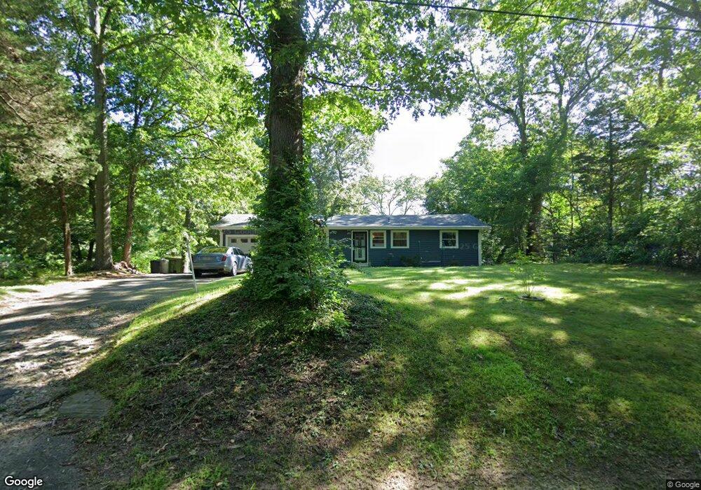
34 Menunketesuck Dr Clinton, CT 06413
Estimated Value: $343,000 - $410,000
2
Beds
2
Baths
1,008
Sq Ft
$374/Sq Ft
Est. Value
About This Home
This home is located at 34 Menunketesuck Dr, Clinton, CT 06413 and is currently estimated at $376,676, approximately $373 per square foot. 34 Menunketesuck Dr is a home located in Middlesex County with nearby schools including Lewin G. Joel Jr. School, The Morgan School, and Oxford Academy.
Ownership History
Date
Name
Owned For
Owner Type
Purchase Details
Closed on
Apr 30, 1999
Sold by
Magoveny John C
Bought by
Harris Louis J
Current Estimated Value
Home Financials for this Owner
Home Financials are based on the most recent Mortgage that was taken out on this home.
Original Mortgage
$121,600
Interest Rate
6.95%
Purchase Details
Closed on
Jan 19, 1993
Sold by
Fuhr Evelyn
Bought by
Magoveny John C
Create a Home Valuation Report for This Property
The Home Valuation Report is an in-depth analysis detailing your home's value as well as a comparison with similar homes in the area
Home Values in the Area
Average Home Value in this Area
Purchase History
| Date | Buyer | Sale Price | Title Company |
|---|---|---|---|
| Harris Louis J | $128,000 | -- | |
| Harris Louis J | $128,000 | -- | |
| Magoveny John C | $125,000 | -- | |
| Magoveny John C | $125,000 | -- |
Source: Public Records
Mortgage History
| Date | Status | Borrower | Loan Amount |
|---|---|---|---|
| Open | Magoveny John C | $190,000 | |
| Closed | Magoveny John C | $171,750 | |
| Closed | Magoveny John C | $121,600 |
Source: Public Records
Tax History
| Year | Tax Paid | Tax Assessment Tax Assessment Total Assessment is a certain percentage of the fair market value that is determined by local assessors to be the total taxable value of land and additions on the property. | Land | Improvement |
|---|---|---|---|---|
| 2025 | $4,036 | $129,600 | $52,300 | $77,300 |
| 2024 | $3,922 | $129,600 | $52,300 | $77,300 |
| 2023 | $3,866 | $129,600 | $52,300 | $77,300 |
| 2022 | $3,866 | $129,600 | $52,300 | $77,300 |
| 2021 | $3,824 | $128,200 | $55,100 | $73,100 |
| 2020 | $4,006 | $128,200 | $55,100 | $73,100 |
| 2019 | $4,006 | $128,200 | $55,100 | $73,100 |
| 2018 | $3,915 | $128,200 | $55,100 | $73,100 |
| 2017 | $3,834 | $128,200 | $55,100 | $73,100 |
| 2016 | $3,479 | $128,200 | $55,100 | $73,100 |
| 2015 | $3,716 | $138,800 | $63,800 | $75,000 |
| 2014 | $3,646 | $138,800 | $63,800 | $75,000 |
Source: Public Records
Map
Nearby Homes
- 37 Nolin Rd
- 407 Grove Beach Rd N
- 6 Evergreen Dr
- 59 Old Post Rd Unit F1
- 5 Meadow Point Rd
- 19 Evergreen Dr
- 40 Beach Rd
- 5 Robin Ln
- 86 Grove Beach Rd N
- 81 Founders Village Unit 81
- 31 Founders Village
- 14 Chestnut Dr
- 39 Founders Village Unit 39
- 0 Fairy Dell Rd
- 2 Plymouth Ct Unit 2
- 151 E Main St Unit 12
- 0 151 - 153 East Main St Unit 15
- 0 151 - 153 East Main St Unit 14
- 0 151 - 153 East Main St Unit 17
- 0 151 - 153 East Main St Unit 16
- 32 Menunketesuck Dr
- 36 Menunketesuck Dr
- 30 Menunketesuck Dr
- 28 Menunketesuck Dr
- 35 Menunketesuck Dr
- 29 Wildwood Park Rd
- 314 Chapman Mill Pond Rd
- 314 Chapman Mill Pond Rd Unit 15
- 314 Chapman Mill Pond Rd Unit 14
- 314 Chapman Mill Pond Rd Unit 3
- 314 Chapman Mill Pond Rd Unit 11
- 314 Chapman Mill Pond Rd Unit 10
- 314 Chapman Mill Pond Rd Unit 13
- 314 Chapman Mill Pond Rd Unit 6
- 314 Chapman Mill Pond Rd Unit 2
- 314 Chapman Mill Pond Rd Unit 16
- 314 Chapman Mill Pond Rd Unit 9
- 314 Chapman Mill Pond Rd Unit 4
- 26 Menunketesuck Dr
- 20 Wildwood Park Rd
Your Personal Tour Guide
Ask me questions while you tour the home.