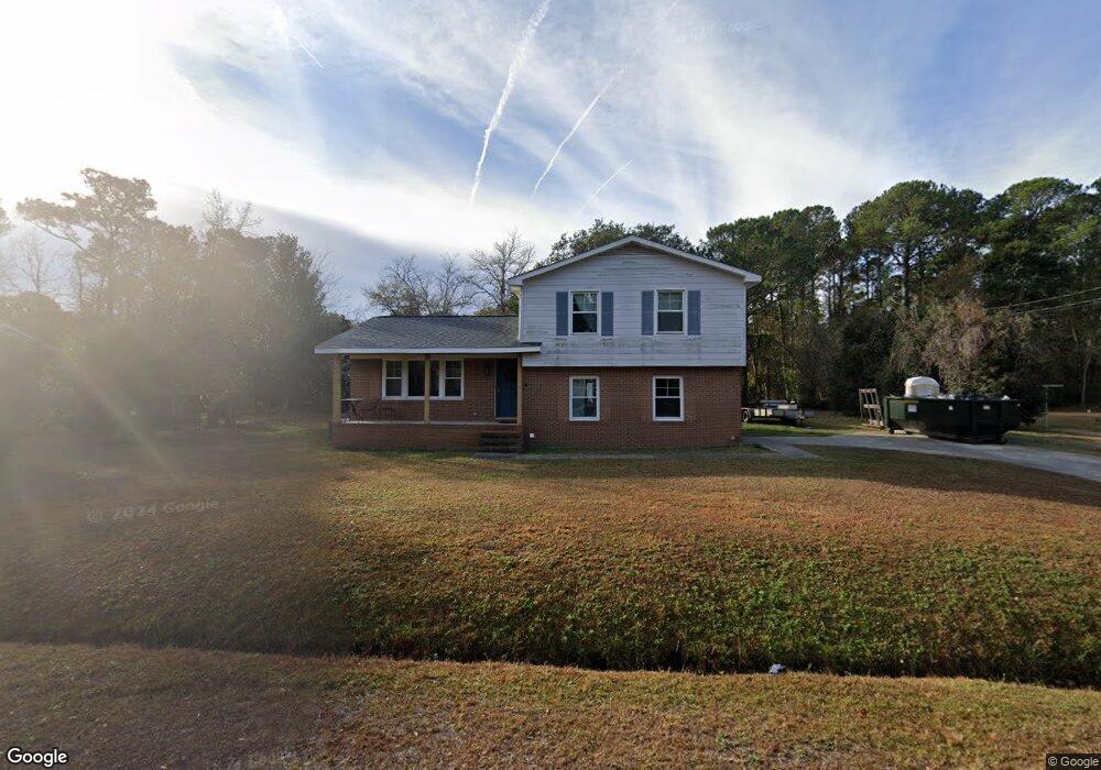
34 Pelican Point Rd Unit 32 Wilmington, NC 28409
Estimated Value: $358,000 - $494,000
3
Beds
2
Baths
1,469
Sq Ft
$273/Sq Ft
Est. Value
About This Home
This home is located at 34 Pelican Point Rd Unit 32, Wilmington, NC 28409 and is currently estimated at $401,542, approximately $273 per square foot. 34 Pelican Point Rd Unit 32 is a home located in New Hanover County with nearby schools including Masonboro Elementary School, Myrtle Grove Middle School, and John T. Hoggard High School.
Ownership History
Date
Name
Owned For
Owner Type
Purchase Details
Closed on
Aug 12, 2002
Sold by
Hatley Deborah Teague Michael
Bought by
Kimble Melissa
Current Estimated Value
Purchase Details
Closed on
Feb 26, 1999
Sold by
Ryninger Robert L Deborah C
Bought by
Teague Deborah Diane
Purchase Details
Closed on
Jun 29, 1994
Sold by
Lower John J Mary T
Bought by
Ryninger Robert L Deborah C
Purchase Details
Closed on
Feb 1, 1981
Sold by
Lewis Lester Leroy
Bought by
Lower John J Mary T
Purchase Details
Closed on
Jan 1, 1973
Bought by
Lewis Lester Leroy
Create a Home Valuation Report for This Property
The Home Valuation Report is an in-depth analysis detailing your home's value as well as a comparison with similar homes in the area
Home Values in the Area
Average Home Value in this Area
Purchase History
| Date | Buyer | Sale Price | Title Company |
|---|---|---|---|
| Kimble Melissa | $124,500 | -- | |
| Teague Deborah Diane | $120,000 | -- | |
| Ryninger Robert L Deborah C | $86,000 | -- | |
| Lower John J Mary T | $48,400 | -- | |
| Lewis Lester Leroy | $30,500 | -- |
Source: Public Records
Tax History Compared to Growth
Tax History
| Year | Tax Paid | Tax Assessment Tax Assessment Total Assessment is a certain percentage of the fair market value that is determined by local assessors to be the total taxable value of land and additions on the property. | Land | Improvement |
|---|---|---|---|---|
| 2024 | $1,123 | $200,900 | $108,300 | $92,600 |
| 2023 | $1,123 | $200,900 | $108,300 | $92,600 |
| 2022 | $1,128 | $200,900 | $108,300 | $92,600 |
| 2021 | $1,112 | $200,900 | $108,300 | $92,600 |
| 2020 | $1,032 | $163,100 | $55,000 | $108,100 |
| 2019 | $1,032 | $163,100 | $55,000 | $108,100 |
| 2018 | $1,032 | $163,100 | $55,000 | $108,100 |
| 2017 | $1,056 | $163,100 | $55,000 | $108,100 |
| 2016 | $1,111 | $160,300 | $60,500 | $99,800 |
| 2015 | $1,032 | $160,300 | $60,500 | $99,800 |
| 2014 | $1,015 | $160,300 | $60,500 | $99,800 |
Source: Public Records
Map
Nearby Homes
- 4326 Lauralis Bluff Ct
- 4511 Masonboro Loop Rd
- 4315 Cranesbill Ct
- 134 S Channel Haven Dr
- 610 Trails End Rd
- 4641 Masonboro Loop Rd
- 138 Navaho Trail
- 126 Mohawk Trail
- 4204 Purviance Ct
- 4100 Purviance Ct
- 300 Cabbage Inlet Ln
- 5800 Neelys Ct
- 609 Mason Knoll Ct
- 110 Cabbage Inlet Ln
- 3239 Kellerton Place
- 3250 Kellerton Place
- 5800 Seabuoy Cir
- 5008 Mako Dr
- 5107 Long Pointe Rd
- 5103 Long Pointe Rd
- 30 Pelican Point Rd
- 38 Pelican Point Rd Unit 33
- 133 Sound View Dr
- 26 E Pelican Point Rd S
- 42 Pelican Point Rd
- 26 Pelican Point Rd Unit 30
- 141 Sound View Dr
- 37 Pelican Point Rd
- 33 Pelican Point Rd
- 134 Sound View Dr
- 126 Sound View Dr
- 29 Pelican Point Rd
- 45 Pelican Point Rd
- 145 Sound View Dr
- 46 Pelican Point Rd
- 22 Pelican Point Rd
- 49 Pelican Point Rd
- 25 Pelican Point Rd
- 125 Sound View Dr
- 131 Whipporwill Ln