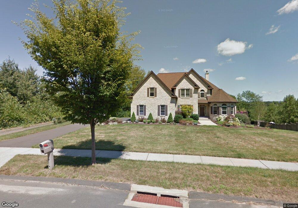
34 Pheasant Dr Middletown, CT 06457
Estimated Value: $585,000 - $773,000
2
Beds
3
Baths
2,915
Sq Ft
$226/Sq Ft
Est. Value
About This Home
This home is located at 34 Pheasant Dr, Middletown, CT 06457 and is currently estimated at $659,034, approximately $226 per square foot. 34 Pheasant Dr is a home with nearby schools including Wesley School, Middletown High School, and St John Paul II School.
Ownership History
Date
Name
Owned For
Owner Type
Purchase Details
Closed on
Dec 18, 2002
Sold by
Harmon Grace K and Wimler Isabel K
Bought by
Cds Dev Llc
Current Estimated Value
Home Financials for this Owner
Home Financials are based on the most recent Mortgage that was taken out on this home.
Original Mortgage
$449,100
Interest Rate
8%
Create a Home Valuation Report for This Property
The Home Valuation Report is an in-depth analysis detailing your home's value as well as a comparison with similar homes in the area
Home Values in the Area
Average Home Value in this Area
Purchase History
| Date | Buyer | Sale Price | Title Company |
|---|---|---|---|
| Cds Dev Llc | $499,000 | -- |
Source: Public Records
Mortgage History
| Date | Status | Borrower | Loan Amount |
|---|---|---|---|
| Closed | Cds Dev Llc | $449,100 |
Source: Public Records
Tax History
| Year | Tax Paid | Tax Assessment Tax Assessment Total Assessment is a certain percentage of the fair market value that is determined by local assessors to be the total taxable value of land and additions on the property. | Land | Improvement |
|---|---|---|---|---|
| 2025 | $14,011 | $378,560 | $89,220 | $289,340 |
| 2024 | $12,788 | $361,130 | $89,220 | $271,910 |
| 2023 | $12,138 | $361,130 | $89,220 | $271,910 |
| 2022 | $11,374 | $275,710 | $66,090 | $209,620 |
| 2021 | $6,088 | $254,310 | $66,090 | $188,220 |
| 2020 | $5,978 | $254,310 | $66,090 | $188,220 |
| 2019 | $5,879 | $254,310 | $66,090 | $188,220 |
| 2018 | $10,117 | $254,310 | $66,090 | $188,220 |
| 2017 | $9,788 | $253,050 | $81,660 | $171,390 |
| 2016 | $9,592 | $253,050 | $81,660 | $171,390 |
| 2015 | $9,380 | $253,050 | $81,660 | $171,390 |
| 2014 | $9,371 | $253,050 | $81,660 | $171,390 |
Source: Public Records
Map
Nearby Homes
- Lot 3 Coleman Rd
- 122 Baldwin Dr
- 15 Blue Spruce St
- 7 Blue Bell Ln
- 70 Jack English Dr
- Lot 2 Coleman Rd
- 50 Cedar St
- 2 Yellow Orange Cir
- 672 Laurel Grove Rd
- 1 Jefferson Ave
- 63 Millbrook Rd
- 58 Durant Terrace
- 45 Mckenna Dr
- 1 Russell St Unit 11
- 6 Hillside Ct
- 0 Round Hill Lot 17 Rd
- 6 Bidwell Terrace
- 28 Kent Ct
- 183 Aston Ln
- 18 Talcott Ridge Dr
- 32 Pheasant Dr
- 38 Pheasant Dr
- 20 Pheasant Dr
- lot 20 Pheasant Dr
- 24 Pheasant Dr
- 48 Pheasant Dr
- 14 Pheasant Dr
- 66 Cranberry Ln
- 80 Cranberry Ln
- 56 Cranberry Ln
- 43 Pheasant Dr
- 58 Pheasant Dr
- 122 Cranberry Ln
- 46 Cranberry Ln
- 132 Cranberry Ln
- 36 Cranberry Ln
- 19 Pheasant Dr
- Lot 19 Pheasant Dr
- 3 Pheasant Dr
- 67 Pheasant Dr
Your Personal Tour Guide
Ask me questions while you tour the home.