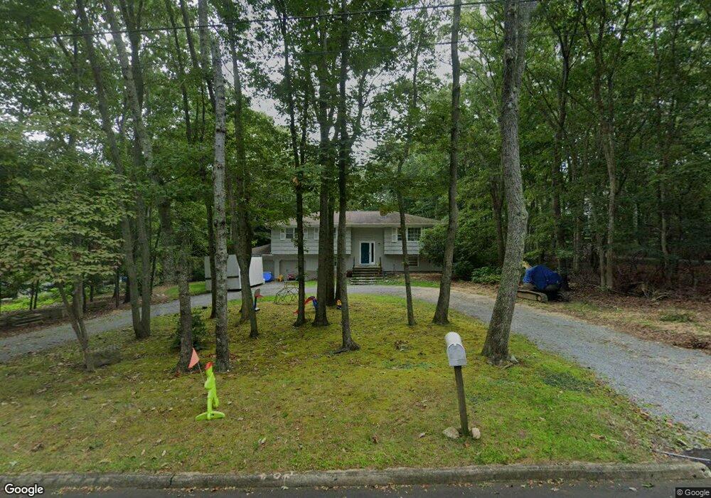
34 Pheasant Rd Sag Harbor, NY 11963
Estimated Value: $1,407,000 - $1,917,000
4
Beds
2
Baths
1,154
Sq Ft
$1,490/Sq Ft
Est. Value
About This Home
This home is located at 34 Pheasant Rd, Sag Harbor, NY 11963 and is currently estimated at $1,719,510, approximately $1,490 per square foot. 34 Pheasant Rd is a home located in Suffolk County with nearby schools including Sag Harbor Elementary School, Pierson Middle/High School, and Ross Lower School.
Ownership History
Date
Name
Owned For
Owner Type
Purchase Details
Closed on
Jun 3, 2020
Sold by
Cpt Realty Llc
Bought by
Whelan David J and Whelan Mary M
Current Estimated Value
Purchase Details
Closed on
Jul 26, 2016
Sold by
George Milton M
Bought by
Cpt Realty Llc
Home Financials for this Owner
Home Financials are based on the most recent Mortgage that was taken out on this home.
Original Mortgage
$550,000
Interest Rate
3.41%
Mortgage Type
Commercial
Create a Home Valuation Report for This Property
The Home Valuation Report is an in-depth analysis detailing your home's value as well as a comparison with similar homes in the area
Home Values in the Area
Average Home Value in this Area
Purchase History
| Date | Buyer | Sale Price | Title Company |
|---|---|---|---|
| Whelan David J | $900,000 | None Available | |
| Cpt Realty Llc | $750,000 | Advantage Title |
Source: Public Records
Mortgage History
| Date | Status | Borrower | Loan Amount |
|---|---|---|---|
| Previous Owner | Cpt Realty Llc | $550,000 |
Source: Public Records
Tax History
| Year | Tax Paid | Tax Assessment Tax Assessment Total Assessment is a certain percentage of the fair market value that is determined by local assessors to be the total taxable value of land and additions on the property. | Land | Improvement |
|---|---|---|---|---|
| 2024 | -- | $863,600 | $613,700 | $249,900 |
| 2023 | -- | $863,600 | $613,700 | $249,900 |
| 2022 | $4,493 | $863,600 | $613,700 | $249,900 |
| 2021 | $4,493 | $947,300 | $697,400 | $249,900 |
| 2020 | $6,178 | $947,300 | $697,400 | $249,900 |
| 2019 | $6,178 | $0 | $0 | $0 |
| 2018 | -- | $750,400 | $543,000 | $207,400 |
| 2017 | $5,231 | $708,900 | $514,500 | $194,400 |
| 2016 | $4,637 | $693,200 | $514,500 | $178,700 |
| 2015 | -- | $654,700 | $485,900 | $168,800 |
| 2014 | -- | $654,700 | $485,900 | $168,800 |
Source: Public Records
Map
Nearby Homes
- 254 Harbor Watch Ct
- 45 Harbor Watch Ct
- 59 Highview Dr
- 4528 Noyac Rd
- 4529 Noyac Rd
- 7 Sims Ave
- 1350 Brick Kiln Rd
- 210 Redwood Rd
- 414 Main St
- 221 Redwood Rd
- 1363 Brick Kiln Rd
- 15 Laurel Ln
- 352 Main St
- 33 Whalers Dr
- 11 Clay Pit Rd
- 48 Island View Dr W
- 330 Main St
- 73 Laurel Ln
- 64 Island View Dr W
- 57 Jermain Ave
- 40 Pheasant Rd
- 28 Pheasant Rd
- 24 Pheasant Rd
- 37 Pheasant Rd
- 240 Harbor Watch Ct
- 7 Partridge Dr
- 48 Pheasant Rd
- 41 Pheasant Rd
- 258 Harbor Watch Ct
- 18 Pheasant Rd
- 226 Harbor Watch Ct
- 4 Partridge Dr
- 262 Harbor Watch Ct
- 8 Partridge Dr
- 15 Partridge Dr
- 25 Partridge Dr
- 51 Pheasant Rd
- 14 Pheasant Rd
- 210 Harbor Watch Ct
- 54 Pheasant Rd
Your Personal Tour Guide
Ask me questions while you tour the home.