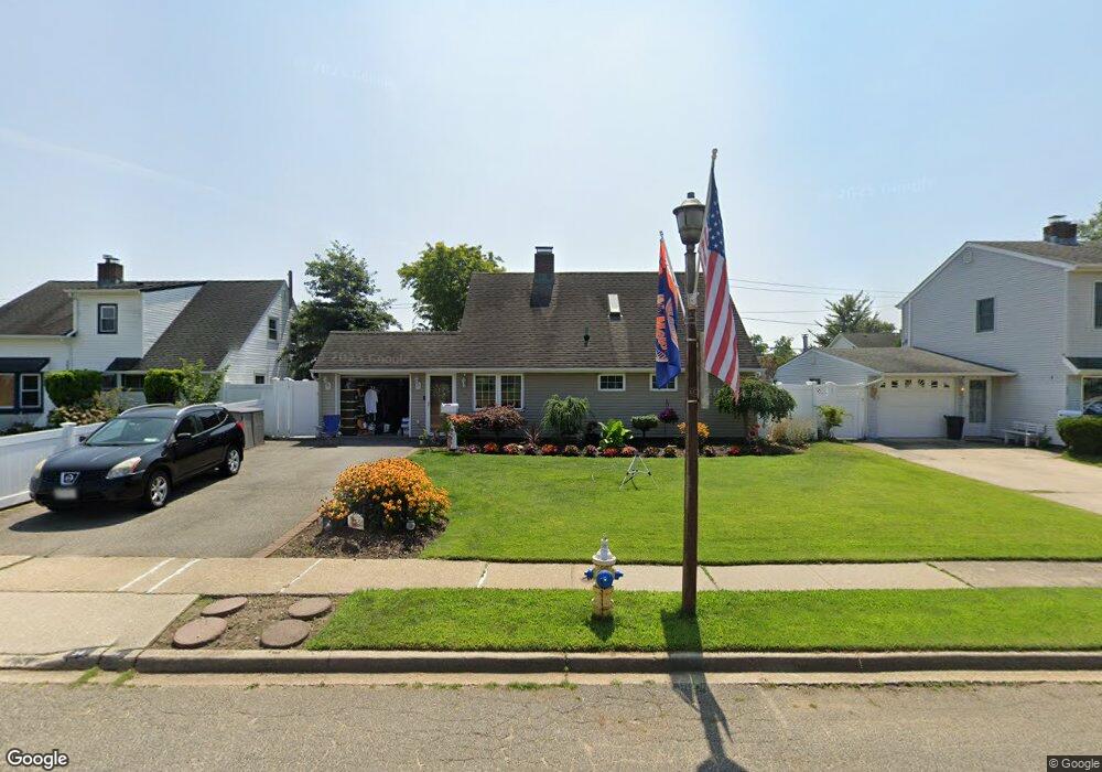
34 Polaris Dr Levittown, NY 11756
Estimated Value: $603,826 - $627,000
--
Bed
1
Bath
1,256
Sq Ft
$490/Sq Ft
Est. Value
About This Home
This home is located at 34 Polaris Dr, Levittown, NY 11756 and is currently estimated at $615,413, approximately $489 per square foot. 34 Polaris Dr is a home located in Nassau County with nearby schools including J Fred Sparke Elementary School, Michael F. Stokes Elementary School, and Island Trees Middle School.
Ownership History
Date
Name
Owned For
Owner Type
Purchase Details
Closed on
Jan 23, 2002
Sold by
Long Island Holding Co
Bought by
Fazziola Alfred
Current Estimated Value
Purchase Details
Closed on
Jul 24, 2001
Sold by
Dunne Lynn
Bought by
Long Island Holding Co Ll
Purchase Details
Closed on
Jul 11, 2001
Sold by
Arulaid Kaarel
Bought by
Dunne Lynn
Create a Home Valuation Report for This Property
The Home Valuation Report is an in-depth analysis detailing your home's value as well as a comparison with similar homes in the area
Home Values in the Area
Average Home Value in this Area
Purchase History
| Date | Buyer | Sale Price | Title Company |
|---|---|---|---|
| Fazziola Alfred | $273,000 | Vito Napolitano | |
| Long Island Holding Co Ll | $169,000 | Nathan Levner, Esq. | |
| Dunne Lynn | $130,000 | Michael D Solomon |
Source: Public Records
Tax History Compared to Growth
Tax History
| Year | Tax Paid | Tax Assessment Tax Assessment Total Assessment is a certain percentage of the fair market value that is determined by local assessors to be the total taxable value of land and additions on the property. | Land | Improvement |
|---|---|---|---|---|
| 2025 | $9,477 | $419 | $222 | $197 |
| 2024 | $3,419 | $419 | $222 | $197 |
| 2023 | $8,576 | $419 | $222 | $197 |
| 2022 | $8,576 | $419 | $222 | $197 |
| 2021 | $11,180 | $400 | $212 | $188 |
| 2020 | $8,089 | $520 | $493 | $27 |
| 2019 | $7,526 | $557 | $409 | $148 |
| 2018 | $7,677 | $719 | $0 | $0 |
| 2017 | $5,463 | $719 | $528 | $191 |
| 2016 | $9,114 | $719 | $528 | $191 |
| 2015 | $3,368 | $719 | $528 | $191 |
| 2014 | $3,368 | $719 | $528 | $191 |
| 2013 | $3,097 | $719 | $528 | $191 |
Source: Public Records
Map
Nearby Homes
- 41 Meridian Rd
- 79 Constellation Rd
- 34 Marksman Ln
- 12 Meridian Rd
- 142 Blacksmith Rd E
- 37 Marksman Ln
- 6 Mason Ct
- 48 Bloomingdale Rd
- 1 Mason Ct
- 17 Trumpet Ln
- 8 Trumpet Ln
- 3 Snapdragon Ln
- 4 Wagon Ln
- 111 Blacksmith Rd E
- 94 Mallard Rd
- 125 Meridian Rd
- 7 Lowland Rd
- 3520 Mallard Rd
- 22 Lowland Rd
- 190 Meridian Rd
- 38 Polaris Dr
- 32 Polaris Dr
- 31 Constellation Rd
- 29 Constellation Rd
- 35 Constellation Rd
- 28 Polaris Dr
- 40 Polaris Dr
- 37 Constellation Rd
- 25 Constellation Rd
- 44 Polaris Dr
- 26 Polaris Dr
- 41 Constellation Rd
- 23 Constellation Rd
- 24 Polaris Dr
- 48 Polaris Dr
- 19 Constellation Rd
- 43 Constellation Rd
- 1 Astronomy Ln
- 20 Polaris Dr
- 17 Constellation Rd