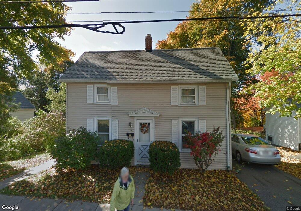
34 Porter St Woburn, MA 01801
Downtown Woburn NeighborhoodEstimated Value: $712,312 - $862,000
3
Beds
2
Baths
2,084
Sq Ft
$392/Sq Ft
Est. Value
About This Home
This home is located at 34 Porter St, Woburn, MA 01801 and is currently estimated at $816,578, approximately $391 per square foot. 34 Porter St is a home located in Middlesex County with nearby schools including Malcolm White Elementary School, Daniel L. Joyce Middle School, and Woburn High School.
Create a Home Valuation Report for This Property
The Home Valuation Report is an in-depth analysis detailing your home's value as well as a comparison with similar homes in the area
Home Values in the Area
Average Home Value in this Area
Tax History
| Year | Tax Paid | Tax Assessment Tax Assessment Total Assessment is a certain percentage of the fair market value that is determined by local assessors to be the total taxable value of land and additions on the property. | Land | Improvement |
|---|---|---|---|---|
| 2025 | $5,098 | $596,900 | $313,600 | $283,300 |
| 2024 | $4,534 | $562,500 | $298,700 | $263,800 |
| 2023 | $4,554 | $523,500 | $271,500 | $252,000 |
| 2022 | $4,366 | $467,400 | $236,100 | $231,300 |
| 2021 | $4,012 | $430,000 | $224,800 | $205,200 |
| 2020 | $3,995 | $428,700 | $224,800 | $203,900 |
| 2019 | $3,937 | $414,400 | $214,200 | $200,200 |
| 2018 | $3,705 | $374,600 | $196,500 | $178,100 |
| 2017 | $3,512 | $353,300 | $187,100 | $166,200 |
| 2016 | $3,349 | $333,200 | $174,900 | $158,300 |
| 2015 | $3,218 | $316,400 | $163,400 | $153,000 |
| 2014 | $3,137 | $300,500 | $163,400 | $137,100 |
Source: Public Records
Map
Nearby Homes
- 6 Porter St
- 15 Sturgis St
- 230 Main St Unit 4
- 27 Arlington Rd Unit 2
- 31 Arlington Rd Unit 1-6
- 35 Prospect St Unit 215
- 52 Pleasant St
- 0 Mount Pleasant St
- 7 Prospect St
- 35 Montvale Ave Unit 8
- 31 Montvale Ave Unit 2
- 14 Garfield Ave
- 28 Arlington St
- 477 Main St
- 21 Eastern Ave
- 136 Sylvester Ave
- 8 Russell Rd Unit 10
- 80 N Warren St Unit 31
- 149 Horn Pond Brook Rd
- 9 Charles Rd
Your Personal Tour Guide
Ask me questions while you tour the home.