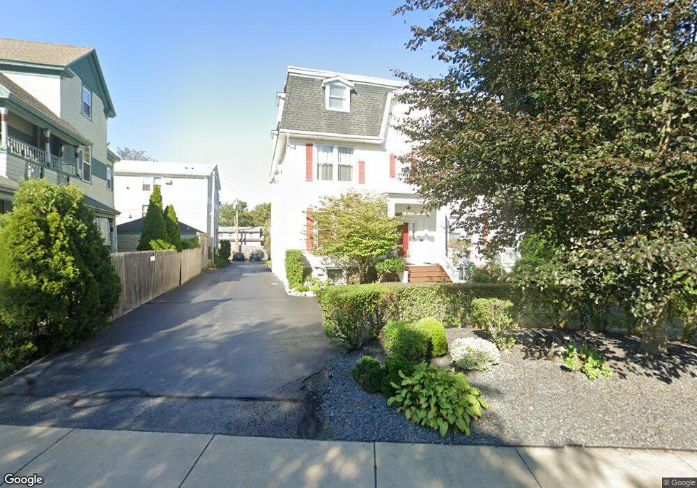
34 Rhode Island Ave Newport, RI 02840
Kay-Catherine NeighborhoodEstimated Value: $3,804,238
9
Beds
9
Baths
6,388
Sq Ft
$596/Sq Ft
Est. Value
About This Home
This home is located at 34 Rhode Island Ave, Newport, RI 02840 and is currently estimated at $3,804,238, approximately $595 per square foot. 34 Rhode Island Ave is a home located in Newport County with nearby schools including Rogers High School, St Michael's Country Day School, and All Saints STEAM Academy.
Ownership History
Date
Name
Owned For
Owner Type
Purchase Details
Closed on
Apr 6, 2001
Sold by
Wudyka Edwin T and Wudyka Katherine
Bought by
Mahoud James and Mahoud Cynthia
Current Estimated Value
Create a Home Valuation Report for This Property
The Home Valuation Report is an in-depth analysis detailing your home's value as well as a comparison with similar homes in the area
Home Values in the Area
Average Home Value in this Area
Purchase History
| Date | Buyer | Sale Price | Title Company |
|---|---|---|---|
| Mahoud James | $911,000 | -- | |
| Mahoud James | $911,000 | -- |
Source: Public Records
Mortgage History
| Date | Status | Borrower | Loan Amount |
|---|---|---|---|
| Previous Owner | Mahoud James | $75,000 |
Source: Public Records
Tax History Compared to Growth
Tax History
| Year | Tax Paid | Tax Assessment Tax Assessment Total Assessment is a certain percentage of the fair market value that is determined by local assessors to be the total taxable value of land and additions on the property. | Land | Improvement |
|---|---|---|---|---|
| 2025 | $17,262 | $1,602,800 | $330,500 | $1,272,300 |
| 2024 | $16,728 | $1,599,200 | $330,500 | $1,268,700 |
| 2023 | $18,052 | $1,213,200 | $233,600 | $979,600 |
| 2022 | $17,482 | $1,213,200 | $233,600 | $979,600 |
| 2021 | $16,973 | $1,213,200 | $233,600 | $979,600 |
| 2020 | $18,814 | $1,220,100 | $172,600 | $1,047,500 |
| 2019 | $18,814 | $1,220,100 | $172,600 | $1,047,500 |
| 2018 | $18,277 | $1,220,100 | $172,600 | $1,047,500 |
| 2017 | $14,583 | $937,800 | $142,300 | $795,500 |
| 2016 | $14,217 | $937,800 | $142,300 | $795,500 |
| 2015 | $13,870 | $937,800 | $142,300 | $795,500 |
| 2014 | $14,224 | $850,700 | $142,300 | $708,400 |
Source: Public Records
Map
Nearby Homes
- 17 Lincoln St
- 78 Rhode Island Ave Unit 6
- 78 Rhode Island Ave Unit 8
- 5 Gardiner St
- 198 Gibbs Ave
- 103 Champlin Place N
- 8 Champlin St
- 4 Newport Ave Unit B2
- 55 Hunter Ave
- 42 Mann Ave
- 128 Eustis Ave
- 23 Mann Ave Unit 4
- 1 Pell St
- 5 Pell St
- 5 Bowser Ct
- 1 Arnold Ave
- 33 Kay St
- 53 Warner St
- 102 Broadway Unit 2B
- 125 Van Zandt Ave Unit 307
- 36 Rhode Island Ave
- 32 Rhode Island Ave
- 32 Rhode Island Ave Unit 3
- 1 Griswald Place
- 8 Hope St
- 38 Rhode Island Ave
- 38 Rhode Island Ave Unit 6
- 38 Rhode Island Ave Unit 5
- 38 Rhode Island Ave Unit 1
- 38 Rhode Island Ave Unit 3
- 2 Griswald Place
- 30 Rhode Island Ave
- 10 Hope St
- 10 Hope St Unit 1
- 10 Hope St Unit 2
- 28R Rhode Island Ave
- 28 Rhode Island Ave
- 41 Powel Ave
- 39 Powel Ave Unit CH
- 39 Powel Ave Unit 2