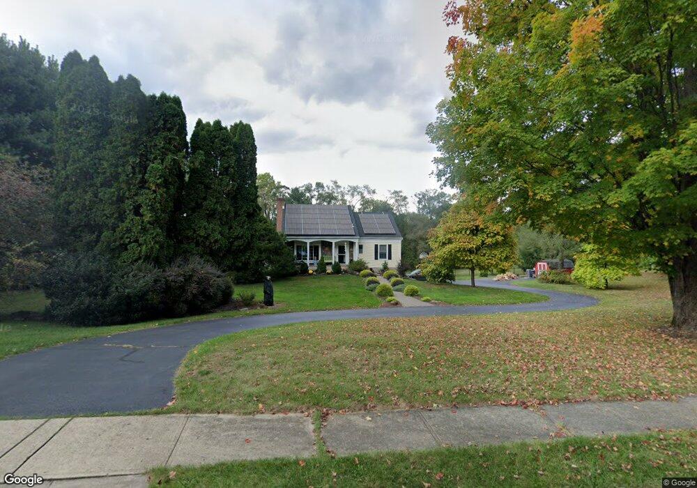
34 Robin Ct Hampton, NJ 08827
Estimated Value: $526,465 - $616,000
Studio
--
Bath
1,740
Sq Ft
$336/Sq Ft
Est. Value
About This Home
This home is located at 34 Robin Ct, Hampton, NJ 08827 and is currently estimated at $584,366, approximately $335 per square foot. 34 Robin Ct is a home located in Hunterdon County with nearby schools including Thomas.B. Conley Elementary School, Ethel Hoppock Middle School, and North Hunterdon High School.
Ownership History
Date
Name
Owned For
Owner Type
Purchase Details
Closed on
Mar 27, 2019
Sold by
Westra Harmen and Westra Holly
Bought by
Gordon Scott and Gordon Joanne
Current Estimated Value
Purchase Details
Closed on
Sep 30, 2005
Sold by
Diehl Homer R and Diehl Helen L
Bought by
Westra Harmen and Westra Holly
Home Financials for this Owner
Home Financials are based on the most recent Mortgage that was taken out on this home.
Original Mortgage
$240,000
Interest Rate
5.81%
Mortgage Type
Fannie Mae Freddie Mac
Create a Home Valuation Report for This Property
The Home Valuation Report is an in-depth analysis detailing your home's value as well as a comparison with similar homes in the area
Home Values in the Area
Average Home Value in this Area
Purchase History
| Date | Buyer | Sale Price | Title Company |
|---|---|---|---|
| Gordon Scott | $382,500 | Noble Title Agency Inc | |
| Westra Harmen | $425,000 | -- |
Source: Public Records
Mortgage History
| Date | Status | Borrower | Loan Amount |
|---|---|---|---|
| Previous Owner | Westra Harmen | $240,000 |
Source: Public Records
Tax History
| Year | Tax Paid | Tax Assessment Tax Assessment Total Assessment is a certain percentage of the fair market value that is determined by local assessors to be the total taxable value of land and additions on the property. | Land | Improvement |
|---|---|---|---|---|
| 2025 | $9,858 | $494,300 | $157,700 | $336,600 |
| 2024 | $9,486 | $302,500 | $106,800 | $195,700 |
Source: Public Records
Map
Nearby Homes
- 1 Dove Hollow Ln
- 2 Stony Brook Ln
- 205 Hogan Ct
- 434 Charlestown Rd
- 11 Devonald Dr
- 5 Hillside Terrace
- 193 Asbury West Portal Rd
- 40 Blossom Rd
- 49 Valley Rd
- 20 Riddle Ct
- 16 Steeplechase Ln
- 192 Bryans Rd
- 215 Asbury Anderson Rd
- 505 Lannon Ln
- 36 Lower Skillman St
- 102 Hoffman Ln
- 218 State Route 31
- 2015 Spruce Hills Dr Unit 2015
- 1214 Spruce Hills Dr Unit 1214
- 182 State Route 31
- 37 Robin Ct
- 129 Rounseville Rd
- 32 Robin Ct
- 33 Robin Ct
- 35 Robin Ct
- 131 Rounseville Rd
- 127 Rounseville Rd
- 125 Rounseville Rd
- 130 Rounsaville Rd
- 133 Rounseville Rd
- 27 Thrush Ln
- 126 Rounseville Rd
- 30 Robin Ct
- 480 Charlestown Rd
- 476 Charlestown Rd
- 134 Rounseville Rd
- 123 Rounseville Rd
- 482 Charlestown Rd
- 31 Robin Ct
- 28 Thrush Ln
Your Personal Tour Guide
Ask me questions while you tour the home.