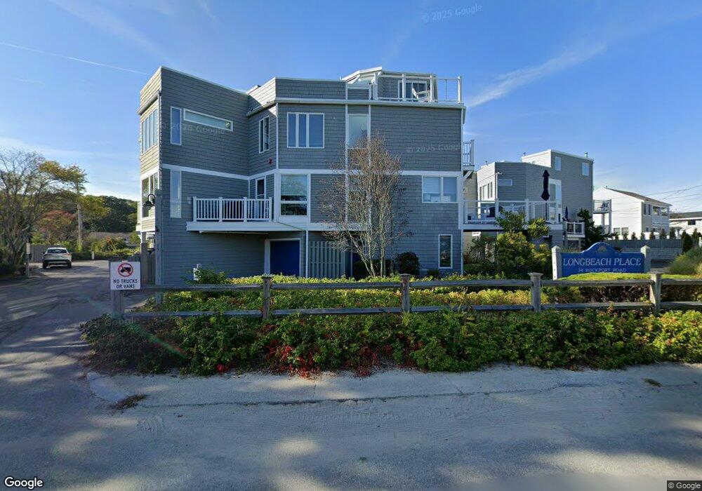
34 Rockport Rd Unit 9 Gloucester, MA 01930
East Gloucester NeighborhoodEstimated Value: $954,000 - $1,055,000
3
Beds
2
Baths
1,617
Sq Ft
$625/Sq Ft
Est. Value
About This Home
This home is located at 34 Rockport Rd Unit 9, Gloucester, MA 01930 and is currently estimated at $1,009,953, approximately $624 per square foot. 34 Rockport Rd Unit 9 is a home located in Essex County with nearby schools including East Gloucester Elementary School, Ralph B O'maley Middle School, and Gloucester High School.
Ownership History
Date
Name
Owned For
Owner Type
Purchase Details
Closed on
Mar 29, 2016
Sold by
Burns Ronald J and Burns Norma A
Bought by
Burns Ft
Current Estimated Value
Create a Home Valuation Report for This Property
The Home Valuation Report is an in-depth analysis detailing your home's value as well as a comparison with similar homes in the area
Home Values in the Area
Average Home Value in this Area
Purchase History
| Date | Buyer | Sale Price | Title Company |
|---|---|---|---|
| Burns Ft | -- | -- |
Source: Public Records
Tax History
| Year | Tax Paid | Tax Assessment Tax Assessment Total Assessment is a certain percentage of the fair market value that is determined by local assessors to be the total taxable value of land and additions on the property. | Land | Improvement |
|---|---|---|---|---|
| 2025 | $9,089 | $935,100 | $0 | $935,100 |
| 2024 | $8,523 | $875,900 | $0 | $875,900 |
| 2023 | $8,170 | $771,500 | $0 | $771,500 |
| 2022 | $7,749 | $660,600 | $0 | $660,600 |
| 2021 | $7,393 | $594,300 | $0 | $594,300 |
| 2020 | $7,328 | $594,300 | $0 | $594,300 |
| 2019 | $7,379 | $581,500 | $0 | $581,500 |
| 2018 | $6,958 | $538,100 | $0 | $538,100 |
| 2017 | $6,923 | $524,900 | $0 | $524,900 |
| 2016 | $6,850 | $503,300 | $0 | $503,300 |
| 2015 | $6,720 | $492,300 | $0 | $492,300 |
Source: Public Records
Map
Nearby Homes
- 25 Salt Island Rd
- 78 Thatcher Rd Unit 6
- 148 Long Beach
- 32 Witham St Unit B
- 70 Old Nugent Farm Rd
- 33 Highview Rd
- 26 Marina Dr
- 175 South St
- 87 Atlantic Rd Unit 2
- 5 Wise Place
- 3 Mondello Square
- 36 Eastern Ave
- 177 Main St
- 34R Summer St
- 48 Eden Rd
- 1 Charte Ct
- 197 E Main St Unit 1
- 139A Prospect St
- 15 Mount Vernon St
- 1 Jewett St Unit 2
- 34 Rockport Rd Unit 14
- 34 Rockport Rd Unit 13
- 34 Rockport Rd Unit 12
- 34 Rockport Rd Unit 11
- 34 Rockport Rd Unit 10
- 34 Rockport Rd Unit 8
- 34 Rockport Rd Unit 7
- 34 Rockport Rd Unit 6
- 34 Rockport Rd Unit 5
- 34 Rockport Rd Unit 4
- 34 Rockport Rd Unit 3
- 34 Rockport Rd Unit 2
- 34 Rockport Rd Unit 1
- 34 Rockport Road: Winter Unit 6
- 34 Rockport Road: Winter Rental Unit 6
- 34 Rockport Rd-Winter Rental Unit 6
- 32 Rockport Rd
- 40 Rockport Rd
- 2 Longbranch Ave
- 10 Beachland Ave
Your Personal Tour Guide
Ask me questions while you tour the home.