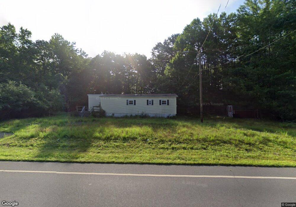
34 S Wrangleboro Rd Absecon, NJ 08201
Estimated Value: $102,000 - $281,514
3
Beds
2
Baths
1,008
Sq Ft
$194/Sq Ft
Est. Value
About This Home
This home is located at 34 S Wrangleboro Rd, Absecon, NJ 08201 and is currently estimated at $195,379, approximately $193 per square foot. 34 S Wrangleboro Rd is a home located in Atlantic County with nearby schools including Absegami High School, Cedar Creek High School, and Oakcrest High School.
Ownership History
Date
Name
Owned For
Owner Type
Purchase Details
Closed on
Jan 20, 2023
Sold by
Asm Properties Llc
Bought by
Belmont Henry and Belmont Latesha
Current Estimated Value
Purchase Details
Closed on
May 26, 2022
Sold by
Lai Benjamin
Bought by
Asm Properties Llc
Purchase Details
Closed on
Jun 7, 2019
Sold by
Kenask Victor J and Kenask Theresa S
Bought by
Lai Benjamin
Purchase Details
Closed on
Jun 14, 2004
Sold by
Ridgway John A
Bought by
Kenask Victor J and Kenask Theresa S
Purchase Details
Closed on
Dec 13, 2000
Sold by
Mccausland Thomas and Mccausland Debbie
Bought by
Township Of Galloway
Create a Home Valuation Report for This Property
The Home Valuation Report is an in-depth analysis detailing your home's value as well as a comparison with similar homes in the area
Home Values in the Area
Average Home Value in this Area
Purchase History
| Date | Buyer | Sale Price | Title Company |
|---|---|---|---|
| Belmont Henry | $85,000 | Foundation Title | |
| Asm Properties Llc | $65,000 | Dougherty Joseph R | |
| Lai Benjamin | $45,000 | Surety Title Company | |
| Kenask Victor J | -- | -- | |
| Township Of Galloway | $3,800 | -- |
Source: Public Records
Tax History Compared to Growth
Tax History
| Year | Tax Paid | Tax Assessment Tax Assessment Total Assessment is a certain percentage of the fair market value that is determined by local assessors to be the total taxable value of land and additions on the property. | Land | Improvement |
|---|---|---|---|---|
| 2025 | $2,937 | $88,000 | $63,600 | $24,400 |
| 2024 | $2,937 | $88,000 | $63,600 | $24,400 |
| 2023 | $3,680 | $88,000 | $63,600 | $24,400 |
| 2022 | $3,680 | $114,600 | $63,600 | $51,000 |
| 2021 | $3,606 | $114,600 | $63,600 | $51,000 |
| 2020 | $3,549 | $114,600 | $63,600 | $51,000 |
| 2019 | $3,484 | $114,600 | $63,600 | $51,000 |
| 2018 | $3,533 | $114,600 | $63,600 | $51,000 |
| 2017 | $3,533 | $114,600 | $63,600 | $51,000 |
| 2016 | $3,502 | $114,600 | $63,600 | $51,000 |
| 2015 | $3,486 | $114,600 | $63,600 | $51,000 |
| 2014 | $3,370 | $114,600 | $63,600 | $51,000 |
Source: Public Records
Map
Nearby Homes
- 181 Rumson Dr Unit 1084
- 19 Mohave Dr Unit 19
- 140 Rumson Dr Unit 140
- 207 Tipperary Place
- 24 Iroquois Dr Unit 24
- 127 Iroquois Dr Unit F1
- 9 Wicklow Terrace
- 66 Iroquois Dr Unit 24
- 69 Iroquois Dr
- 69 Iroquois Dr Unit 15
- 63 Apache Ct
- 4 Navajo Ct
- 166 Blackburn St
- 5 Fulham St
- 52 Navajo Ct Unit C1
- 22 Colonial Ct
- 37 Colonial Ct Unit H1
- 12 Colonial Ct
- 68 Colonial Ct
- 213 Patriots Ct Unit 29B