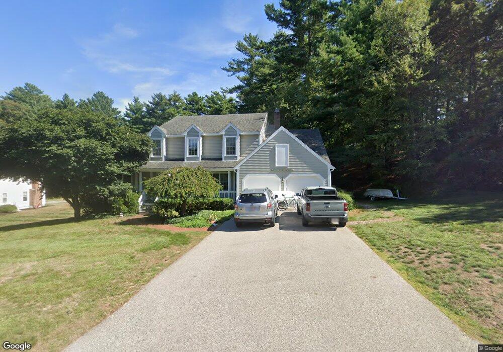
34 Tack Factory Pond Dr Scituate, MA 02066
Estimated Value: $1,134,000 - $1,313,000
4
Beds
4
Baths
2,164
Sq Ft
$568/Sq Ft
Est. Value
About This Home
This home is located at 34 Tack Factory Pond Dr, Scituate, MA 02066 and is currently estimated at $1,228,635, approximately $567 per square foot. 34 Tack Factory Pond Dr is a home located in Plymouth County with nearby schools including Cushing Elementary School, Lester J. Gates Middle School, and Scituate High School.
Ownership History
Date
Name
Owned For
Owner Type
Purchase Details
Closed on
Jun 27, 2003
Sold by
Strong Mary H
Bought by
Moore James F and Moore Laura N
Current Estimated Value
Home Financials for this Owner
Home Financials are based on the most recent Mortgage that was taken out on this home.
Original Mortgage
$375,000
Outstanding Balance
$162,672
Interest Rate
5.53%
Mortgage Type
Purchase Money Mortgage
Estimated Equity
$1,065,963
Purchase Details
Closed on
Jan 17, 1992
Sold by
1St American Fin Ser C
Bought by
Strong John D and Strong Mary H
Create a Home Valuation Report for This Property
The Home Valuation Report is an in-depth analysis detailing your home's value as well as a comparison with similar homes in the area
Home Values in the Area
Average Home Value in this Area
Purchase History
| Date | Buyer | Sale Price | Title Company |
|---|---|---|---|
| Moore James F | $645,000 | -- | |
| Strong John D | $63,000 | -- |
Source: Public Records
Mortgage History
| Date | Status | Borrower | Loan Amount |
|---|---|---|---|
| Open | Strong John D | $375,000 | |
| Previous Owner | Strong John D | $445,000 |
Source: Public Records
Tax History Compared to Growth
Tax History
| Year | Tax Paid | Tax Assessment Tax Assessment Total Assessment is a certain percentage of the fair market value that is determined by local assessors to be the total taxable value of land and additions on the property. | Land | Improvement |
|---|---|---|---|---|
| 2025 | $9,755 | $976,500 | $489,600 | $486,900 |
| 2024 | $9,619 | $928,500 | $445,100 | $483,400 |
| 2023 | $9,133 | $820,600 | $367,800 | $452,800 |
| 2022 | $8,924 | $707,100 | $322,700 | $384,400 |
| 2021 | $8,450 | $649,800 | $307,300 | $342,500 |
| 2020 | $8,448 | $625,800 | $295,500 | $330,300 |
| 2019 | $8,314 | $605,100 | $289,700 | $315,400 |
| 2018 | $8,085 | $579,600 | $286,800 | $292,800 |
| 2017 | $7,845 | $556,800 | $274,900 | $281,900 |
| 2016 | $7,703 | $544,800 | $262,900 | $281,900 |
| 2015 | $7,137 | $544,800 | $262,900 | $281,900 |
Source: Public Records
Map
Nearby Homes
- 116 Old Forge Rd
- 131 Maple St
- 575 First Parish Rd
- 2 Webster Farm Way
- 25 Webster Farm Way
- 23 Webster Farm Way
- 252 Winter St
- 16 Cranberry Ln
- 3 Webster Farm Way
- 5 Webster Farm Way
- 12 Sassamon Rd
- 17 Old Oaken Bucket Rd
- 49 Cornet Stetson Rd
- 293 Cross St
- 115 Elm St
- 32 Fairview Ave
- 111 Elm St
- 25 Gendarme Place
- 19 Ford Place Unit 3
- 19 Ford Place Unit 1
- 50 Tack Factory Pond Dr
- 20 Tack Factory Pond Dr
- 33 Tack Factory Pond Dr
- 57 Tack Factory Pond Dr
- 15 Tack Factory Pond Dr
- 60 Tack Factory Pond Dr
- 202 Old Oaken Bucket Rd Unit 204
- 214 Old Oaken Bucket Rd
- 208 Old Oaken Bucket Rd
- 77 Tack Factory Pond Dr
- 68 Tack Factory Pond Dr
- 23 Alewife Ln
- 7 Alewife Ln
- 80 Tack Factory Pond Dr
- 219 Old Oaken Bucket Rd
- 215 Old Oaken Bucket Rd
- 213 Old Oaken Bucket Rd
- 246 Old Oaken Bucket Rd
- 248 Old Oaken Bucket Rd
- 196 Old Oaken Bucket Rd