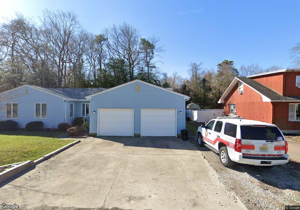
34 W Barnegat Ave Ocean Gate, NJ 08740
Estimated Value: $402,000 - $520,000
4
Beds
1
Bath
2,016
Sq Ft
$240/Sq Ft
Est. Value
About This Home
This home is located at 34 W Barnegat Ave, Ocean Gate, NJ 08740 and is currently estimated at $483,577, approximately $239 per square foot. 34 W Barnegat Ave is a home located in Ocean County with nearby schools including Ocean Gate Elementary School, Central Regional Middle School, and Central Regional High School.
Ownership History
Date
Name
Owned For
Owner Type
Purchase Details
Closed on
Sep 11, 2024
Sold by
Lynch Kathleen F
Bought by
Lynch Dana Susan
Current Estimated Value
Purchase Details
Closed on
Oct 12, 2005
Sold by
Pavoni Daniel and Pavoni Marilyn
Bought by
Lynch Kathleen
Purchase Details
Closed on
Jun 17, 2005
Sold by
Hayes Jeffrey and Hayes Tara
Bought by
Pavoni Daniel and Pavoni Marilyn
Purchase Details
Closed on
Oct 30, 2003
Sold by
Dispensiere Louis A
Bought by
Hayes Jeffrey
Create a Home Valuation Report for This Property
The Home Valuation Report is an in-depth analysis detailing your home's value as well as a comparison with similar homes in the area
Home Values in the Area
Average Home Value in this Area
Purchase History
| Date | Buyer | Sale Price | Title Company |
|---|---|---|---|
| Lynch Dana Susan | -- | None Listed On Document | |
| Lynch Dana Susan | -- | None Listed On Document | |
| Lynch Kathleen | $299,900 | New Jersey Title Ins Co | |
| Pavoni Daniel | $225,000 | -- | |
| Hayes Jeffrey | $165,000 | -- |
Source: Public Records
Tax History
| Year | Tax Paid | Tax Assessment Tax Assessment Total Assessment is a certain percentage of the fair market value that is determined by local assessors to be the total taxable value of land and additions on the property. | Land | Improvement |
|---|---|---|---|---|
| 2025 | $6,785 | $372,600 | $170,000 | $202,600 |
| 2024 | $5,443 | $372,600 | $170,000 | $202,600 |
| 2023 | $5,014 | $180,300 | $66,500 | $113,800 |
| 2022 | $5,014 | $180,300 | $66,500 | $113,800 |
| 2021 | $4,800 | $180,300 | $66,500 | $113,800 |
| 2020 | $4,837 | $180,300 | $66,500 | $113,800 |
| 2019 | $4,720 | $180,300 | $66,500 | $113,800 |
| 2018 | $4,556 | $180,300 | $66,500 | $113,800 |
| 2017 | $4,522 | $180,300 | $66,500 | $113,800 |
| 2016 | $4,486 | $180,300 | $66,500 | $113,800 |
| 2015 | $4,376 | $214,700 | $115,000 | $99,700 |
| 2014 | $4,395 | $214,700 | $115,000 | $99,700 |
Source: Public Records
Map
Nearby Homes
- 15 W Arverne Ave
- 117 W Arverne Ave
- 24 W Point Pleasant Ave
- 36 W Point Pleasant Ave
- 707 Navesink Ave
- 293 Louis Ave
- 32 E Long Branch Ave
- 803 Ocean Gate Dr
- 553 Ocean Gate Dr
- 37 E Lakewood Ave
- 3 Sheila Ct
- 129 E Long Branch Ave
- 207 Ocean Gate Ave
- 0 Jane Ave
- 2 Jane Ave
- 243 Lakewood Ave
- 318 E Cape May Ave
- 229 Point Pleasant Ave
- 39 Ivy Ct
- 90 Puffin Glade Unit 90
- 28 W Barnegat Ave
- 14 W Barnegat Ave Unit 16
- 0 Louis Ave
- 50 W Barnegat Ave
- 17 W Arverne Ave Unit 1
- 21 W Arverne Ave
- 31 W Arverne Ave
- 35 W Arverne Ave
- 1001 Ocean Gate Ave
- 104 W Barnegat Ave
- 4 Navesink Ave
- 11 W Arverne Ave
- 49 W Arverne Ave
- 126 Louis Ave
- 812 Ocean Gate Ave
- 178 Louis Ave
- 813 Navesink Ave
- 32 W Cape May Ave
- 24 W Cape May Ave
- 126 Louis Ave
Your Personal Tour Guide
Ask me questions while you tour the home.