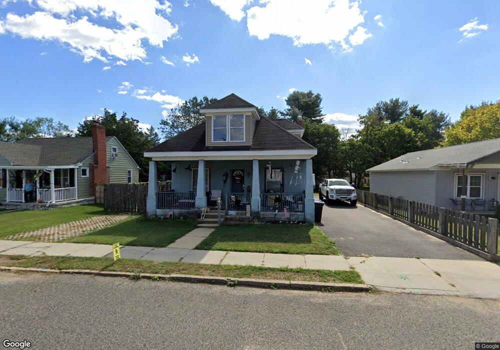
34 W Howard St Clayton, NJ 08312
Estimated Value: $249,000 - $318,000
--
Bed
--
Bath
1,798
Sq Ft
$167/Sq Ft
Est. Value
About This Home
This home is located at 34 W Howard St, Clayton, NJ 08312 and is currently estimated at $300,040, approximately $166 per square foot. 34 W Howard St is a home located in Gloucester County with nearby schools including Herma S. Simmons Elementary School, Clayton Middle School, and Clayton High School.
Ownership History
Date
Name
Owned For
Owner Type
Purchase Details
Closed on
Dec 2, 2005
Sold by
Ferrigno Ryan A and Ferrigno Stacy
Bought by
Traum Christopher and Traum Lindsay
Current Estimated Value
Purchase Details
Closed on
Nov 10, 2004
Sold by
Njhr 5 Llc
Bought by
Ferrigno Ryan A and Ferrigno Stacy
Home Financials for this Owner
Home Financials are based on the most recent Mortgage that was taken out on this home.
Original Mortgage
$104,900
Interest Rate
5.8%
Mortgage Type
Purchase Money Mortgage
Purchase Details
Closed on
Nov 26, 2002
Sold by
Pollock Donald L
Bought by
Njhr 5 Llc
Purchase Details
Closed on
Sep 13, 2001
Sold by
Hud
Bought by
Pollock Donald L
Purchase Details
Closed on
Oct 13, 2000
Sold by
Medina Medina Antoinette M Antoinette M and Medina Mr
Bought by
Hud
Create a Home Valuation Report for This Property
The Home Valuation Report is an in-depth analysis detailing your home's value as well as a comparison with similar homes in the area
Home Values in the Area
Average Home Value in this Area
Purchase History
| Date | Buyer | Sale Price | Title Company |
|---|---|---|---|
| Traum Christopher | $135,000 | Chicago Title Insurance Co | |
| Ferrigno Ryan A | $105,900 | Congress Title | |
| Njhr 5 Llc | -- | Congress Title | |
| Pollock Donald L | $31,200 | Fidelity National Title Ins | |
| Hud | -- | -- |
Source: Public Records
Mortgage History
| Date | Status | Borrower | Loan Amount |
|---|---|---|---|
| Previous Owner | Ferrigno Ryan A | $104,900 |
Source: Public Records
Tax History Compared to Growth
Tax History
| Year | Tax Paid | Tax Assessment Tax Assessment Total Assessment is a certain percentage of the fair market value that is determined by local assessors to be the total taxable value of land and additions on the property. | Land | Improvement |
|---|---|---|---|---|
| 2025 | $6,833 | $276,100 | $71,600 | $204,500 |
| 2024 | $6,595 | $276,100 | $71,600 | $204,500 |
| 2023 | $6,595 | $163,200 | $30,400 | $132,800 |
| 2022 | $6,523 | $163,200 | $30,400 | $132,800 |
| 2021 | $6,445 | $163,200 | $30,400 | $132,800 |
| 2020 | $6,458 | $163,200 | $30,400 | $132,800 |
| 2019 | $6,348 | $163,200 | $30,400 | $132,800 |
| 2018 | $6,259 | $163,200 | $30,400 | $132,800 |
| 2017 | $6,153 | $163,200 | $30,400 | $132,800 |
| 2016 | $6,087 | $163,200 | $30,400 | $132,800 |
| 2015 | $5,908 | $163,200 | $30,400 | $132,800 |
| 2014 | $5,636 | $163,200 | $30,400 | $132,800 |
Source: Public Records
Map
Nearby Homes
- 124 W Howard St
- 131 W Clinton St
- 100 Aura Rd Unit 112
- 100 Aura Rd Unit 212
- 100 Aura Rd Unit 311
- 100 Aura Rd Unit 111
- 100 Aura Rd Unit 110
- 216 E Howard St
- 238 W Center St
- 807 N New St
- 125 W Clayton Ave
- 180 S Dennis Dr
- 170 S Dennis Dr
- 320 E Clayton Ave
- 745 W Clayton Ave
- 760 W Clayton Ave
- 510 Coleman Dr
- 6 Dubois Ave
- 35 W Dehart Ave
- 7 Hawthorn Way
- 32 W Howard St
- 40 W Howard St
- 48 W Howard St
- 44 W Howard St
- 27 W Clinton St
- 39 W Clinton St
- 11 W Clinton St
- 45 W Clinton St
- 33 W Howard St
- 37 W Howard St
- 29 W Howard St
- 43 W Howard St
- 540 N Delsea Dr
- 21 W Howard St
- 516 N Delsea Dr
- 47 W Howard St
- 0 W Howard St
- 108 W Howard St
- 512 N Delsea Dr
- 114 W Howard St