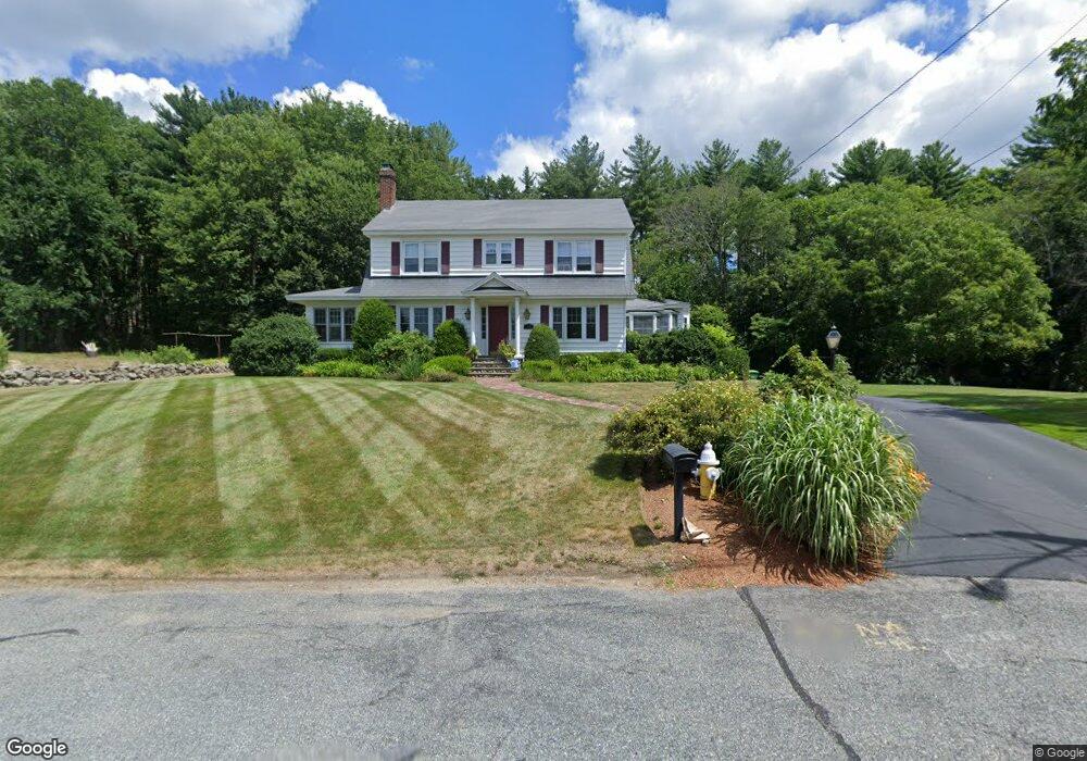
34 Wards Ln Northbridge, MA 01534
Estimated Value: $606,000 - $851,000
3
Beds
2
Baths
2,332
Sq Ft
$289/Sq Ft
Est. Value
About This Home
This home is located at 34 Wards Ln, Northbridge, MA 01534 and is currently estimated at $673,291, approximately $288 per square foot. 34 Wards Ln is a home located in Worcester County with nearby schools including Northbridge Elementary School, Northbridge Middle School, and Northbridge High School.
Ownership History
Date
Name
Owned For
Owner Type
Purchase Details
Closed on
Apr 13, 2007
Sold by
Salmon Andrew L
Bought by
Green Martin J and Mahoney Maura A
Current Estimated Value
Home Financials for this Owner
Home Financials are based on the most recent Mortgage that was taken out on this home.
Original Mortgage
$387,000
Outstanding Balance
$232,825
Interest Rate
6.24%
Mortgage Type
Purchase Money Mortgage
Estimated Equity
$440,466
Purchase Details
Closed on
Jun 29, 2005
Sold by
Salmon Dan and Salmon Daniel J
Bought by
Salmon Andrew L
Home Financials for this Owner
Home Financials are based on the most recent Mortgage that was taken out on this home.
Original Mortgage
$315,000
Interest Rate
5.73%
Mortgage Type
Purchase Money Mortgage
Create a Home Valuation Report for This Property
The Home Valuation Report is an in-depth analysis detailing your home's value as well as a comparison with similar homes in the area
Home Values in the Area
Average Home Value in this Area
Purchase History
| Date | Buyer | Sale Price | Title Company |
|---|---|---|---|
| Green Martin J | $430,000 | -- | |
| Green Martin J | $430,000 | -- | |
| Salmon Andrew L | $345,000 | -- | |
| Salmon Andrew L | $345,000 | -- |
Source: Public Records
Mortgage History
| Date | Status | Borrower | Loan Amount |
|---|---|---|---|
| Open | Green Martin J | $387,000 | |
| Closed | Salmon Andrew L | $387,000 | |
| Previous Owner | Salmon Andrew L | $315,000 |
Source: Public Records
Tax History Compared to Growth
Tax History
| Year | Tax Paid | Tax Assessment Tax Assessment Total Assessment is a certain percentage of the fair market value that is determined by local assessors to be the total taxable value of land and additions on the property. | Land | Improvement |
|---|---|---|---|---|
| 2025 | $6,138 | $520,600 | $143,600 | $377,000 |
| 2024 | $5,949 | $492,100 | $143,600 | $348,500 |
| 2023 | $5,842 | $450,800 | $136,000 | $314,800 |
| 2022 | $5,522 | $401,000 | $104,700 | $296,300 |
| 2021 | $3,078 | $398,100 | $99,600 | $298,500 |
| 2020 | $2,878 | $384,500 | $99,600 | $284,900 |
| 2019 | $2,782 | $362,700 | $99,600 | $263,100 |
| 2018 | $4,502 | $347,900 | $94,800 | $253,100 |
| 2017 | $4,438 | $328,000 | $94,800 | $233,200 |
| 2016 | $4,192 | $304,900 | $81,400 | $223,500 |
| 2015 | $4,080 | $304,900 | $81,400 | $223,500 |
| 2014 | $4,043 | $304,900 | $81,400 | $223,500 |
Source: Public Records
Map
Nearby Homes
- 79-81 Upton St
- 2767 Providence Rd
- 86 Mikes Way Unit 86
- 84 Mikes Way Unit 84
- 19 Milford Rd
- 151 Fowler Rd
- 395 Providence Rd Unit 4
- 369 Cooper Rd
- 61 Tulip Cir
- 89 Buttercup Ln Unit 255
- 58 Buttercup Ln
- 150 Sprague St
- 1880 Providence Rd
- 557 Fowler Rd
- 119 Susanne Dr
- 1825 Quaker St
- 0 Puddon St
- 1076 Hill St
- 3 Driscoll Ln
- 27 Fowler St
- 34 Ward's Ln
- 14 Raymond Ave
- 25 Wards Ln
- 18 Wards Ln
- 13 Wards Ln
- 28 Raymond Ave
- 25 Raymond Ave
- 12 Ward's Ln
- 12 Wards Ln
- 2572 Providence Rd
- 42 Raymond Ave
- 35 Raymond Ave
- 2584 Providence Rd
- 2586 Providence Rd
- 2542 Providence Rd
- 2528 Providence Rd
- 2538 Providence Rd
- 2557 Providence Rd
- 47 Raymond Ave
- 2518 Providence Rd