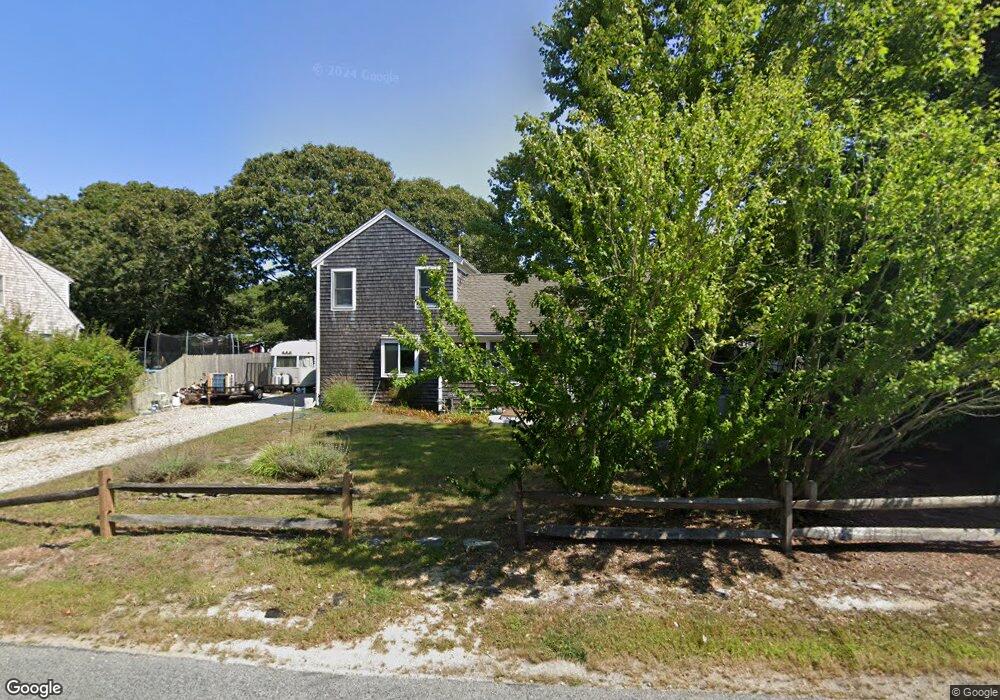
34 Weir Rd Yarmouth Port, MA 02675
Yarmouth Port NeighborhoodEstimated Value: $556,142 - $842,000
2
Beds
1
Bath
804
Sq Ft
$817/Sq Ft
Est. Value
About This Home
This home is located at 34 Weir Rd, Yarmouth Port, MA 02675 and is currently estimated at $656,786, approximately $816 per square foot. 34 Weir Rd is a home located in Barnstable County with nearby schools including Dennis-Yarmouth Regional High School, St. Pius X. School, and Trinity Christian Academy of Cape Cod.
Ownership History
Date
Name
Owned For
Owner Type
Purchase Details
Closed on
Apr 22, 2010
Sold by
Fnma
Bought by
Jenkins Nathan and Jenkins Elizabeth
Current Estimated Value
Home Financials for this Owner
Home Financials are based on the most recent Mortgage that was taken out on this home.
Original Mortgage
$131,665
Outstanding Balance
$87,693
Interest Rate
5%
Mortgage Type
Purchase Money Mortgage
Estimated Equity
$569,093
Purchase Details
Closed on
Jan 14, 2010
Sold by
Carr Mark
Bought by
Federal National Mortgage Association
Create a Home Valuation Report for This Property
The Home Valuation Report is an in-depth analysis detailing your home's value as well as a comparison with similar homes in the area
Home Values in the Area
Average Home Value in this Area
Purchase History
| Date | Buyer | Sale Price | Title Company |
|---|---|---|---|
| Jenkins Nathan | $154,900 | -- | |
| Federal National Mortgage Association | $224,933 | -- |
Source: Public Records
Mortgage History
| Date | Status | Borrower | Loan Amount |
|---|---|---|---|
| Open | Jenkins Nathan | $131,665 |
Source: Public Records
Tax History Compared to Growth
Tax History
| Year | Tax Paid | Tax Assessment Tax Assessment Total Assessment is a certain percentage of the fair market value that is determined by local assessors to be the total taxable value of land and additions on the property. | Land | Improvement |
|---|---|---|---|---|
| 2025 | $3,130 | $442,100 | $130,800 | $311,300 |
| 2024 | $3,284 | $445,000 | $137,800 | $307,200 |
| 2023 | $3,198 | $394,300 | $122,800 | $271,500 |
| 2022 | $2,998 | $326,600 | $110,600 | $216,000 |
| 2021 | $2,806 | $293,500 | $110,600 | $182,900 |
| 2020 | $2,737 | $273,700 | $110,600 | $163,100 |
| 2019 | $2,284 | $226,100 | $110,600 | $115,500 |
| 2018 | $1,871 | $181,800 | $90,100 | $91,700 |
| 2017 | $1,822 | $181,800 | $90,100 | $91,700 |
| 2016 | $1,733 | $173,600 | $81,900 | $91,700 |
| 2015 | $1,629 | $162,300 | $81,900 | $80,400 |
Source: Public Records
Map
Nearby Homes
- 24 Minnetuxet Way
- 1 Barnacle Rd
- 933-935 W Yarmouth Rd
- 8 Rowley Ln
- 23 Dauphine Dr
- 209 Union St
- 882 W Yarmouth Rd
- 32 Deveau Ln
- 86 Pompano Rd
- 25 Oak Glen
- 25 Oak Glen Village Unit 25
- 371 Route 6a
- 2 Pine Grove
- 7 Forest Gate Unit 7
- 43 Canterbury Rd
- 30 W Woods Cir Unit 30
- 30 W Woods
- 17 Kates Path Unit A
- 44 Stratford Ln
- 34 Kates Path
- 38 Weir Rd
- 28 Weir Rd
- 7 Katharyn Michael Rd
- 5 Katharyn Michael Rd
- 5 Katharyn Michael Rd Unit 34A
- 5 Katharyn Michael Rd Unit A
- 3 Katharyn Michael Rd
- 1 Katharyn Michael Rd
- 31 Weir Rd
- 42 Weir Rd
- 37 Weir Rd
- 5 Kathryn Michael Rd Unit 5
- 11 Kathryn Michael Rd
- 9 Katharyn Michael Rd
- 10 Kathryn Michael Unit 10
- 10 Kathryn Michael Unit B
- 7 Kathryn Michael
- 11 Katharyn Michael Rd
- 4 Katharyn Michael Rd
- 4 Katharyn Michael Rd Unit 25B