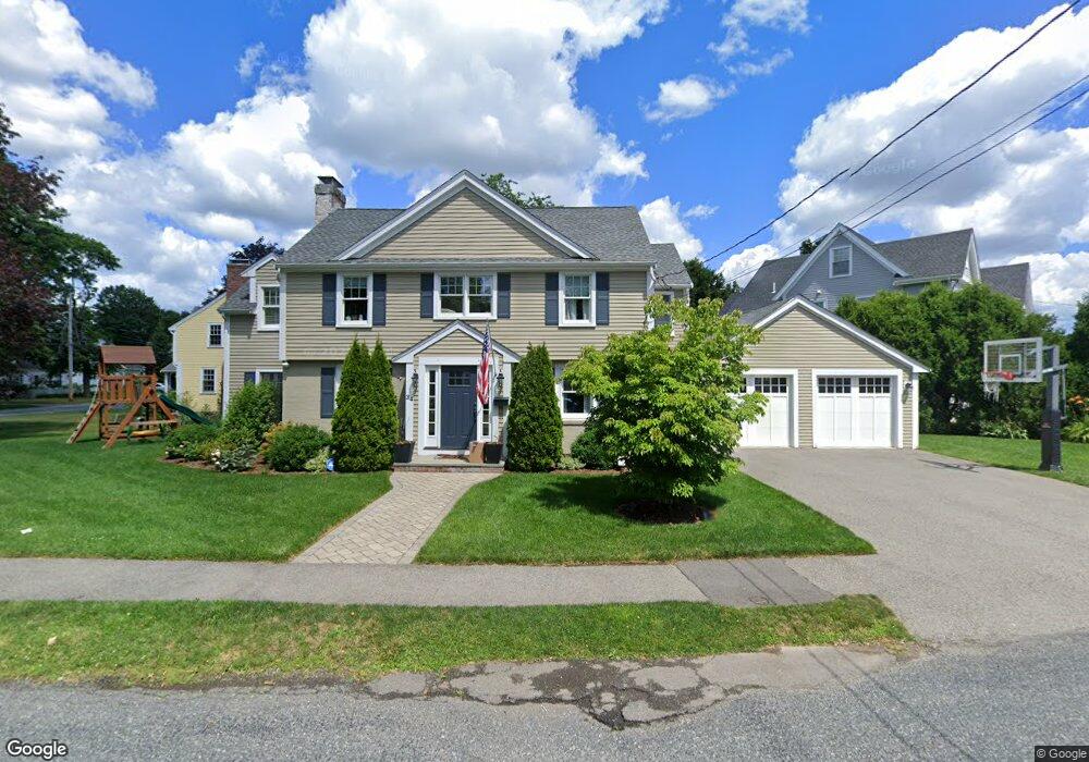
34 Whittier Rd Needham, MA 02492
Estimated Value: $1,359,000 - $2,168,000
4
Beds
5
Baths
1,726
Sq Ft
$1,100/Sq Ft
Est. Value
About This Home
This home is located at 34 Whittier Rd, Needham, MA 02492 and is currently estimated at $1,898,504, approximately $1,099 per square foot. 34 Whittier Rd is a home located in Norfolk County with nearby schools including Broadmeadow Elementary School, High Rock Middle School, and Pollard Middle School.
Ownership History
Date
Name
Owned For
Owner Type
Purchase Details
Closed on
Feb 24, 2020
Sold by
Montgomery and Montgomery Hofer C
Bought by
Banu Michael H and Banu Tori
Current Estimated Value
Home Financials for this Owner
Home Financials are based on the most recent Mortgage that was taken out on this home.
Original Mortgage
$154,000
Interest Rate
3.3%
Mortgage Type
New Conventional
Purchase Details
Closed on
Aug 16, 2013
Sold by
Slicklen Builders Inc
Bought by
Hofer Cjmontgomery and Hofer Jill R
Purchase Details
Closed on
Nov 1, 2012
Sold by
Grady Michael S and Grady Ellen M
Bought by
Slicklen Builders Inc
Create a Home Valuation Report for This Property
The Home Valuation Report is an in-depth analysis detailing your home's value as well as a comparison with similar homes in the area
Home Values in the Area
Average Home Value in this Area
Purchase History
| Date | Buyer | Sale Price | Title Company |
|---|---|---|---|
| Banu Michael H | $1,540,000 | None Available | |
| Hofer Cjmontgomery | $1,139,000 | -- | |
| Hofer Cjmontgomery | $1,139,000 | -- | |
| Hofer Cjmontgomery | $1,139,000 | -- | |
| Slicklen Builders Inc | $609,000 | -- | |
| Slicklen Builders Inc | $609,000 | -- | |
| Slicklen Builders Inc | $609,000 | -- |
Source: Public Records
Mortgage History
| Date | Status | Borrower | Loan Amount |
|---|---|---|---|
| Previous Owner | Banu Michael H | $154,000 | |
| Previous Owner | Slicklen Builders Inc | $315,000 |
Source: Public Records
Tax History
| Year | Tax Paid | Tax Assessment Tax Assessment Total Assessment is a certain percentage of the fair market value that is determined by local assessors to be the total taxable value of land and additions on the property. | Land | Improvement |
|---|---|---|---|---|
| 2025 | $18,104 | $1,707,900 | $784,300 | $923,600 |
| 2024 | $20,605 | $1,645,800 | $569,600 | $1,076,200 |
| 2023 | $20,225 | $1,551,000 | $569,600 | $981,400 |
| 2022 | $19,588 | $1,465,100 | $527,400 | $937,700 |
| 2021 | $17,981 | $1,380,000 | $527,400 | $852,600 |
| 2020 | $16,824 | $1,347,000 | $527,600 | $819,400 |
| 2019 | $15,958 | $1,288,000 | $479,600 | $808,400 |
| 2018 | $14,068 | $1,184,200 | $479,600 | $704,600 |
| 2017 | $13,040 | $1,096,700 | $479,600 | $617,100 |
| 2016 | $12,656 | $1,096,700 | $479,600 | $617,100 |
| 2015 | $12,382 | $1,096,700 | $479,600 | $617,100 |
| 2014 | $11,782 | $1,012,200 | $417,000 | $595,200 |
Source: Public Records
Map
Nearby Homes
- 60 Douglas Rd
- 28 Green St
- 883 Greendale Ave
- 1204 Greendale Ave Unit 128
- 1202 Greendale Ave Unit 124
- 31 Birds Hill Ave
- 78 Birds Hill Ave
- 50 Sterling Rd
- 37 Cottage Cir
- 37 Cottage Cir Unit 37
- 1212 Greendale Ave Unit 300
- 1206 Greendale Ave Unit 217
- 1206 Greendale Ave Unit 201
- 126 Prince St
- 242 Valley Rd
- 103 Aletha Rd
- 176 Highgate St
- 100 Bradford St
- 60 Sutton Rd
- 1034 Webster St
Your Personal Tour Guide
Ask me questions while you tour the home.