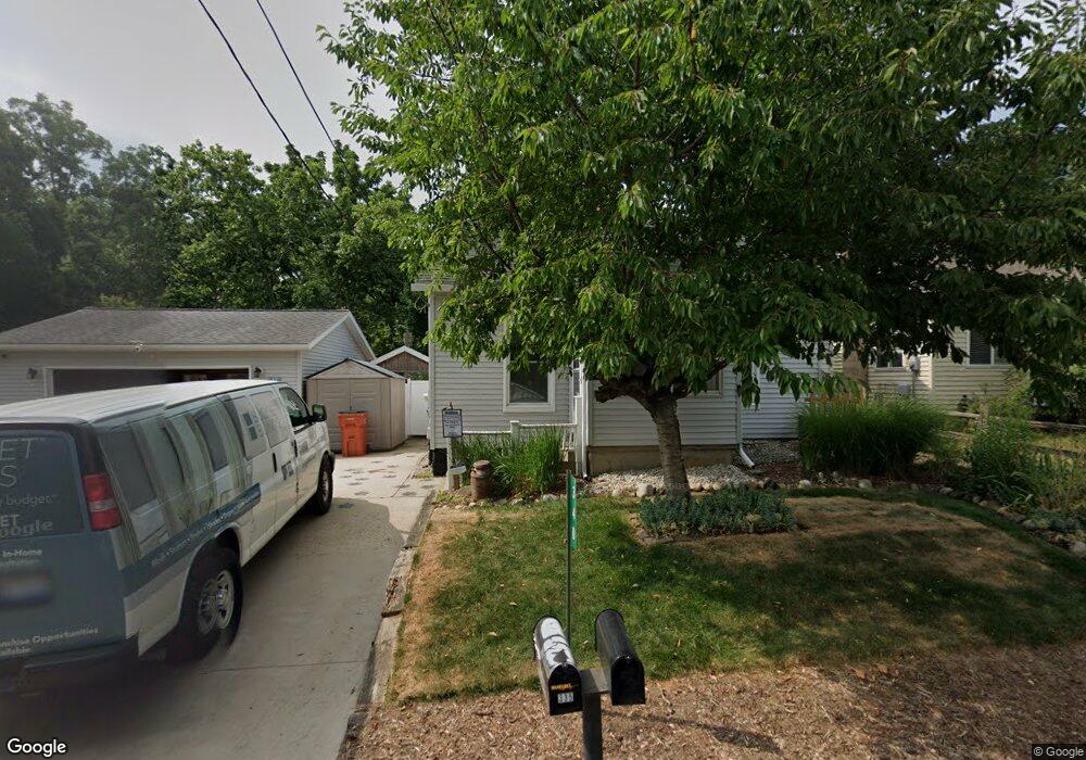
340 Bertha St NW Comstock Park, MI 49321
Estimated Value: $169,000 - $279,042
1
Bed
1
Bath
1
Sq Ft
$231,261/Sq Ft
Est. Value
About This Home
This home is located at 340 Bertha St NW, Comstock Park, MI 49321 and is currently estimated at $231,261, approximately $231,261 per square foot. 340 Bertha St NW is a home located in Kent County with nearby schools including Stoney Creek Elementary School, Pine Island Elementary School, and Mill Creek Middle School.
Ownership History
Date
Name
Owned For
Owner Type
Purchase Details
Closed on
Nov 4, 2014
Sold by
Sims Patricia Joe and Sims Patricia J
Bought by
Sims Patricia Joe and Patricia Joe Sims Revocable Li
Current Estimated Value
Purchase Details
Closed on
Sep 21, 2011
Sold by
Sims Patricia J
Bought by
Sims Patricia J
Purchase Details
Closed on
Dec 29, 1993
Bought by
Sims Taylor>Sims and Sims Patricia J
Purchase Details
Closed on
Oct 31, 1990
Bought by
Sims Durst>Taylor and Sims Patricia J
Create a Home Valuation Report for This Property
The Home Valuation Report is an in-depth analysis detailing your home's value as well as a comparison with similar homes in the area
Home Values in the Area
Average Home Value in this Area
Purchase History
| Date | Buyer | Sale Price | Title Company |
|---|---|---|---|
| Sims Patricia Joe | -- | None Available | |
| Sims Patricia J | -- | None Available | |
| Sims Taylor>Sims | $42,500 | -- | |
| Sims Durst>Taylor | $38,000 | -- |
Source: Public Records
Tax History Compared to Growth
Tax History
| Year | Tax Paid | Tax Assessment Tax Assessment Total Assessment is a certain percentage of the fair market value that is determined by local assessors to be the total taxable value of land and additions on the property. | Land | Improvement |
|---|---|---|---|---|
| 2025 | $1,499 | $128,700 | $0 | $0 |
| 2024 | $1,499 | $102,100 | $0 | $0 |
| 2023 | $1,432 | $84,500 | $0 | $0 |
| 2022 | $1,780 | $80,900 | $0 | $0 |
| 2021 | $1,736 | $71,300 | $0 | $0 |
| 2020 | $1,315 | $66,500 | $0 | $0 |
| 2019 | $1,555 | $49,600 | $0 | $0 |
| 2018 | $1,525 | $49,600 | $0 | $0 |
| 2017 | $1,482 | $46,900 | $0 | $0 |
| 2016 | $1,436 | $48,200 | $0 | $0 |
| 2015 | -- | $48,200 | $0 | $0 |
| 2013 | -- | $45,200 | $0 | $0 |
Source: Public Records
Map
Nearby Homes
- 319 Greenridge Dr NW
- 236 4 Mile Rd NW
- 3343 Springbrook Dr NW
- 134 Mabel St NW
- 211 York View Place NW
- 276 Mabel St NW Unit 54
- 583 Kingsbury St NW
- Wilshire Plan at The Range
- Remington Plan at The Range
- Linden Plan at The Range
- Enclave Plan at The Range
- Croswell Plan at The Range
- Cascade Plan at The Range
- Carson Plan at The Range
- Avery Plan at The Range
- Ashton Plan at The Range
- Andover Plan at The Range
- 981 Ellerston St NW
- 408 Elmdale St NE
- 4010 Woodrush Ln NW Unit 40
- 344 Bertha St NW
- 336 Bertha St NW
- 346 Bertha St NW
- 326 Bertha St NW
- 412 Bertha St NW
- 322 Bertha St NW
- 335 Bertha St NW
- 325 Bertha St NW
- 314 Bertha St NW
- 352 Brady St NW
- 421 Bertha St NW
- 340 Brady St NW
- 424 Bertha St NW
- 336 Brady St NW
- 408 Brady St NW
- 310 Bertha St NW
- 315 Bertha St NW
- 423 Bertha St NW
- 429 Bertha St NW
- 420 Brady St NW