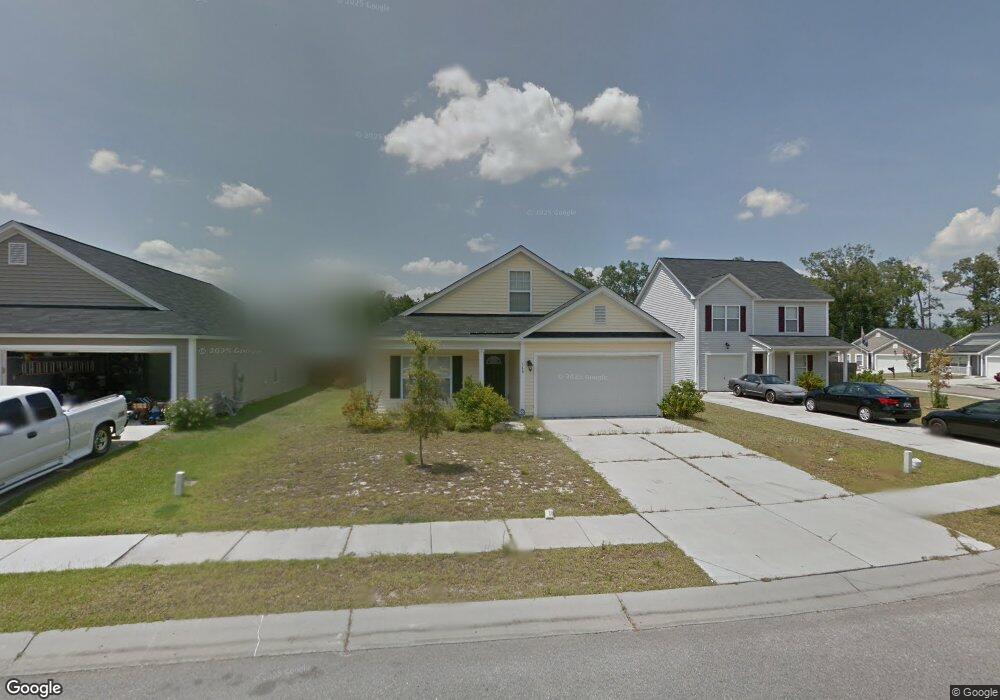
340 Briarbend Rd Goose Creek, SC 29445
Estimated Value: $356,000 - $388,000
About This Home
This property is professionally managed by AMH, a leading single-family rental company. We expect to make this property available for showings soon. We work to simplify your rental experience by offering self-guided tours and a streamlined leasing process you can complete all online, all on your own schedule. Once moved in, we provide maintenance support that you can rely on, so you can enjoy your weekends stress-free. We look forward to welcoming you home! Utilities, taxes, and other fees may apply. Please verify and confirm all information before signing a lease. If you have questions, don’t hesitate to contact us at the telephone number on this property listing. All lease applications, documentation, and initial payments for this property, must be submitted directly through or by phone. The photos, renderings, or other images of the properties on our website, are for illustrative purposes only, and may vary from the features, amenities, or phase of construction. We do not advertise properties on Craigslist, Facebook Marketplace, or other classified advertising websites. If you believe one of our residences is listed there, please notify us. For further description of applicable fees, please go to our website.
Ownership History
Purchase Details
Purchase Details
Home Financials for this Owner
Home Financials are based on the most recent Mortgage that was taken out on this home.Purchase Details
Home Values in the Area
Average Home Value in this Area
Purchase History
| Date | Buyer | Sale Price | Title Company |
|---|---|---|---|
| American Homes 4 Rent Properties Ten Llc | $150,000 | -- | |
| Langdon Devin B | $176,000 | -- | |
| Beazer Homes Corp | $608,400 | -- |
Mortgage History
| Date | Status | Borrower | Loan Amount |
|---|---|---|---|
| Previous Owner | Langdon Devin B | $179,784 |
Property History
| Date | Event | Price | List to Sale | Price per Sq Ft |
|---|---|---|---|---|
| 08/04/2025 08/04/25 | Off Market | $2,545 | -- | -- |
| 07/17/2025 07/17/25 | Price Changed | $2,545 | -1.5% | $1 / Sq Ft |
| 07/17/2025 07/17/25 | Price Changed | $2,585 | -0.2% | $1 / Sq Ft |
| 07/09/2025 07/09/25 | For Rent | $2,590 | -- | -- |
Tax History Compared to Growth
Tax History
| Year | Tax Paid | Tax Assessment Tax Assessment Total Assessment is a certain percentage of the fair market value that is determined by local assessors to be the total taxable value of land and additions on the property. | Land | Improvement |
|---|---|---|---|---|
| 2025 | $4,165 | $242,547 | $41,347 | $201,200 |
| 2024 | $4,165 | $14,553 | $2,481 | $12,072 |
| 2023 | $4,165 | $14,553 | $2,481 | $12,072 |
| 2022 | $3,940 | $12,654 | $2,366 | $10,288 |
| 2021 | $4,043 | $12,660 | $2,366 | $10,288 |
| 2020 | $3,954 | $12,654 | $2,366 | $10,288 |
| 2019 | $3,900 | $12,654 | $2,366 | $10,288 |
| 2018 | $3,602 | $11,004 | $2,160 | $8,844 |
| 2017 | $3,593 | $11,004 | $2,160 | $8,844 |
| 2016 | $3,436 | $10,490 | $2,160 | $8,330 |
| 2015 | $3,294 | $10,490 | $2,160 | $8,330 |
| 2014 | $5,186 | $8,830 | $2,160 | $6,670 |
| 2013 | -- | $8,830 | $2,160 | $6,670 |
Map
- 339 Briarbend Rd
- 346 Briarbend Rd
- 73 Oak Grove Rd
- 30 Bonnie Burn Rd
- 37 Delaware Rd
- 31 Delaware Rd
- 20 Bonnie Burn Rd
- 126 Woodward Rd
- 18 Teaneck Rd
- 338 Flyway Rd
- 25 Delaware Rd
- 192 Woodward Rd
- 315 Flyway Rd
- 380 Flyway Rd
- 00 Liberty Hall Rd
- 30 Oak Grove Rd
- 112 Wright Ln
- 13 Rumson Rd
- 102 Wright Ln
- 0 Wright Ln
- 338 Briarbend Rd
- 336 Briarbend Rd
- 360 Briarbend Rd
- 354 Briarbend Rd
- 362 Briarbend Rd
- 334 Briarbend Rd
- 364 Briarbend Rd
- 337 Briarbend Rd
- 343 Briarbend Rd
- 341 Briarbend Rd
- 335 Briarbend Rd
- 345 Briarbend Rd
- 366 Briarbend Rd
- 347 Briarbend Rd
- 333 Briarbend Rd
- 349 Briarbend Rd
- 368 Briarbend Rd
- 351 Briarbend Rd
- 331 Briarbend Rd
- 361 Briarbend Rd