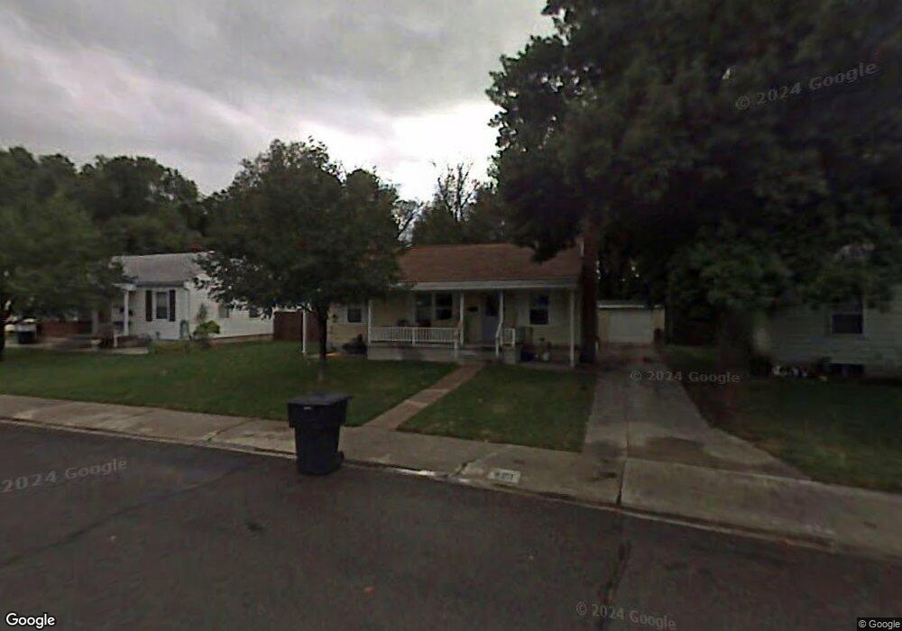
340 Brookside Dr Springville, UT 84663
East Hobble Creek NeighborhoodEstimated Value: $407,000 - $433,000
4
Beds
2
Baths
1,928
Sq Ft
$216/Sq Ft
Est. Value
About This Home
This home is located at 340 Brookside Dr, Springville, UT 84663 and is currently estimated at $416,189, approximately $215 per square foot. 340 Brookside Dr is a home located in Utah County with nearby schools including Brookside School, Springville Junior High School, and Springville High School.
Ownership History
Date
Name
Owned For
Owner Type
Purchase Details
Closed on
May 13, 2002
Sold by
Murray Blaine S and Murray Dawn A
Bought by
Bailey Teri L and Watkins Tracey L
Current Estimated Value
Home Financials for this Owner
Home Financials are based on the most recent Mortgage that was taken out on this home.
Original Mortgage
$119,500
Outstanding Balance
$51,170
Interest Rate
7.13%
Estimated Equity
$365,019
Purchase Details
Closed on
Jun 18, 2001
Sold by
Allen Ralph L and Allen Fern
Bought by
Murray Blaine S and Murray Dawn A
Home Financials for this Owner
Home Financials are based on the most recent Mortgage that was taken out on this home.
Original Mortgage
$110,000
Interest Rate
7.15%
Mortgage Type
Seller Take Back
Purchase Details
Closed on
Jun 11, 2001
Sold by
Ostler Glen E and Ostler Leann M
Bought by
Allen Ralph L and Allen Fern
Home Financials for this Owner
Home Financials are based on the most recent Mortgage that was taken out on this home.
Original Mortgage
$110,000
Interest Rate
7.15%
Mortgage Type
Seller Take Back
Create a Home Valuation Report for This Property
The Home Valuation Report is an in-depth analysis detailing your home's value as well as a comparison with similar homes in the area
Home Values in the Area
Average Home Value in this Area
Purchase History
| Date | Buyer | Sale Price | Title Company |
|---|---|---|---|
| Bailey Teri L | -- | Century Title | |
| Murray Blaine S | -- | Century Title | |
| Allen Ralph L | -- | Century Title |
Source: Public Records
Mortgage History
| Date | Status | Borrower | Loan Amount |
|---|---|---|---|
| Open | Bailey Teri L | $119,500 | |
| Previous Owner | Murray Blaine S | $110,000 |
Source: Public Records
Tax History
| Year | Tax Paid | Tax Assessment Tax Assessment Total Assessment is a certain percentage of the fair market value that is determined by local assessors to be the total taxable value of land and additions on the property. | Land | Improvement |
|---|---|---|---|---|
| 2025 | $1,933 | $212,630 | -- | -- |
| 2024 | $1,933 | $198,055 | $0 | $0 |
| 2023 | $1,845 | $189,200 | $0 | $0 |
| 2022 | $1,945 | $195,910 | $0 | $0 |
| 2021 | $1,748 | $274,000 | $92,300 | $181,700 |
| 2020 | $1,610 | $244,700 | $76,900 | $167,800 |
| 2019 | $1,484 | $229,600 | $76,900 | $152,700 |
| 2018 | $1,409 | $208,000 | $73,400 | $134,600 |
| 2017 | $1,247 | $97,790 | $0 | $0 |
| 2016 | $1,123 | $86,295 | $0 | $0 |
| 2015 | $1,054 | $82,830 | $0 | $0 |
| 2014 | $1,051 | $82,060 | $0 | $0 |
Source: Public Records
Map
Nearby Homes
- 883 E 700 S
- 645 Swenson Ave Unit 5
- 645 Swenson Ave Unit 3
- 647 Swenson Ave Unit 3
- 677 E 800 South St
- 802 S Brookside Dr
- 805 E 400 S
- 445 E 535 S
- 579 E 800 St S
- 629 E 800 St S
- 585 S 400 E
- 949 S 1060 E
- 1062 E 350 S
- 1130 Hillcrest Dr
- 511 S 300 E Unit 2
- 1185 Hillcrest Dr
- 942 Sage Creek Cir
- 625 S 200 E
- 1361 E 400 S
- 616 E Aaron Ave
- 354 Brookside Dr
- 354 S Brookside Dr
- 322 Brookside Dr
- 368 Brookside Dr
- 685 S 800 E
- 382 Brookside Dr
- 331 Brookside Dr
- 355 Brookside Dr
- 833 E 700 S
- 301 Brookside Dr
- 292 Brookside Dr
- 367 Brookside Dr
- 392 S Brookside Dr
- 392 Brookside Dr
- 689 S 800 E
- 379 Brookside Dr
- 279 Brookside Dr
- 276 Brookside Dr
- 408 Brookside Dr
- 389 Brookside Dr
Your Personal Tour Guide
Ask me questions while you tour the home.