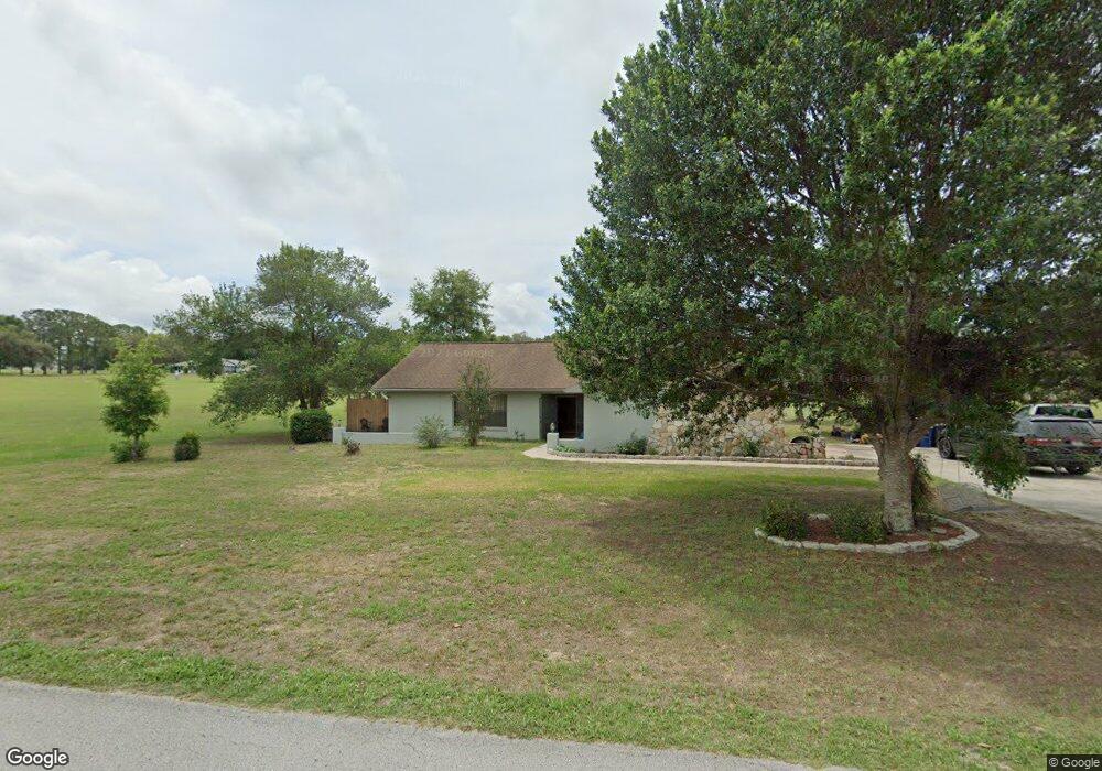
340 E Boston St Hernando, FL 34442
Estimated Value: $323,000 - $352,017
3
Beds
2
Baths
1,802
Sq Ft
$190/Sq Ft
Est. Value
About This Home
This home is located at 340 E Boston St, Hernando, FL 34442 and is currently estimated at $343,004, approximately $190 per square foot. 340 E Boston St is a home located in Citrus County with nearby schools including Forest Ridge Elementary School, Lecanto Middle School, and Lecanto High School.
Ownership History
Date
Name
Owned For
Owner Type
Purchase Details
Closed on
Sep 22, 2009
Sold by
Ranft Edward F and Ranft Adelaida M
Bought by
Dey Cynthia L
Current Estimated Value
Home Financials for this Owner
Home Financials are based on the most recent Mortgage that was taken out on this home.
Original Mortgage
$127,645
Outstanding Balance
$82,927
Interest Rate
5.22%
Mortgage Type
FHA
Estimated Equity
$260,077
Purchase Details
Closed on
May 1, 1999
Bought by
Dey Cynthia L
Purchase Details
Closed on
Mar 1, 1988
Bought by
Dey Cynthia L
Create a Home Valuation Report for This Property
The Home Valuation Report is an in-depth analysis detailing your home's value as well as a comparison with similar homes in the area
Home Values in the Area
Average Home Value in this Area
Purchase History
| Date | Buyer | Sale Price | Title Company |
|---|---|---|---|
| Dey Cynthia L | $130,000 | Benchmark Title | |
| Dey Cynthia L | $102,000 | -- | |
| Dey Cynthia L | $25,900 | -- |
Source: Public Records
Mortgage History
| Date | Status | Borrower | Loan Amount |
|---|---|---|---|
| Open | Dey Cynthia L | $127,645 |
Source: Public Records
Tax History
| Year | Tax Paid | Tax Assessment Tax Assessment Total Assessment is a certain percentage of the fair market value that is determined by local assessors to be the total taxable value of land and additions on the property. | Land | Improvement |
|---|---|---|---|---|
| 2025 | $1,371 | $125,850 | -- | -- |
| 2024 | $1,330 | $122,303 | -- | -- |
| 2023 | $1,330 | $118,741 | $0 | $0 |
| 2022 | $1,245 | $115,283 | $0 | $0 |
| 2021 | $1,194 | $111,925 | $0 | $0 |
| 2020 | $1,130 | $160,930 | $15,950 | $144,980 |
| 2019 | $1,111 | $149,903 | $12,500 | $137,403 |
| 2018 | $1,080 | $133,392 | $11,480 | $121,912 |
| 2017 | $1,072 | $103,708 | $11,480 | $92,228 |
| 2016 | $1,079 | $101,575 | $11,510 | $90,065 |
| 2015 | $1,091 | $100,869 | $8,410 | $92,459 |
| 2014 | $1,109 | $100,068 | $9,874 | $90,194 |
Source: Public Records
Map
Nearby Homes
- 230 E Boston St
- 2334 N Alachua Point
- 2347 N Putnam Point
- 183 E Boston St
- 65 E Boston St
- 650 E Charleston Ct
- 2320 N Hendry Point
- 700 E Boston St
- 50 W Glen Arbor Ln
- 2257 N Hickory Glen Point
- 705 E Dakota Ct
- 51 W Doerr Path
- 2322 N Saint Johns Point
- 74 E Dusty Ct
- 23 W Mickey Mantle Path
- 802 E Hillsborough Ct
- 656 E Alaska Ln
- 3076 N Clements Ave
- 560 E Falconry Ct
- 738 E Epsom Ct
- 2280 N Hardee Point
- 2279 N Glades Point
- 2282 N Hardee Point
- 390 E Boston
- 319 E Cumberland Ct
- 371 E Cumberland Ct
- 2281 N Glades Point
- 2281 N Hardee Point
- 2284 N Hardee Point
- 2278 N Glades Point
- 2283 N Hardee Point
- 295 E Cumberland Ct
- 2286 N Hardee Point
- 2285 N Hardee Point
- 420 E Boston St
- 229 E Leon Loop
- 2287 N Hardee Point
- 227 E Leon Loop
- 343 E Cumberland Ct
- 200 E Cumberland Ct
Your Personal Tour Guide
Ask me questions while you tour the home.