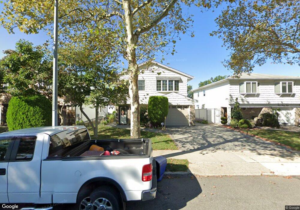
340 Elverton Ave Staten Island, NY 10308
Great Kills NeighborhoodEstimated Value: $830,000 - $929,000
Studio
--
Bath
2,218
Sq Ft
$400/Sq Ft
Est. Value
About This Home
This home is located at 340 Elverton Ave, Staten Island, NY 10308 and is currently estimated at $886,601, approximately $399 per square foot. 340 Elverton Ave is a home located in Richmond County with nearby schools including P.S. 32 The Gifford School, I.S. 075 Frank D. Paulo, and Susan E Wagner High School.
Ownership History
Date
Name
Owned For
Owner Type
Purchase Details
Closed on
Oct 2, 2017
Sold by
Gorrin Lorraine A
Bought by
Gorrin Lorraine A
Current Estimated Value
Home Financials for this Owner
Home Financials are based on the most recent Mortgage that was taken out on this home.
Original Mortgage
$400,000
Interest Rate
3.86%
Mortgage Type
New Conventional
Create a Home Valuation Report for This Property
The Home Valuation Report is an in-depth analysis detailing your home's value as well as a comparison with similar homes in the area
Home Values in the Area
Average Home Value in this Area
Purchase History
| Date | Buyer | Sale Price | Title Company |
|---|---|---|---|
| Gorrin Lorraine A | $500,000 | The Security Title Guarntee |
Source: Public Records
Mortgage History
| Date | Status | Borrower | Loan Amount |
|---|---|---|---|
| Closed | Gorrin Lorraine A | $400,000 |
Source: Public Records
Tax History
| Year | Tax Paid | Tax Assessment Tax Assessment Total Assessment is a certain percentage of the fair market value that is determined by local assessors to be the total taxable value of land and additions on the property. | Land | Improvement |
|---|---|---|---|---|
| 2025 | $9,076 | $55,980 | $9,638 | $46,342 |
| 2024 | $9,076 | $47,640 | $11,325 | $36,315 |
| 2023 | $8,742 | $43,044 | $9,789 | $33,255 |
| 2022 | $8,107 | $48,600 | $11,940 | $36,660 |
| 2021 | $8,243 | $44,220 | $11,940 | $32,280 |
| 2020 | $7,971 | $40,320 | $11,940 | $28,380 |
| 2019 | $7,877 | $38,040 | $11,940 | $26,100 |
| 2018 | $7,312 | $35,870 | $10,865 | $25,005 |
| 2017 | $6,599 | $33,840 | $11,940 | $21,900 |
| 2016 | $6,215 | $32,640 | $11,940 | $20,700 |
| 2015 | $5,717 | $31,380 | $9,960 | $21,420 |
| 2014 | $5,717 | $31,380 | $9,960 | $21,420 |
Source: Public Records
Map
Nearby Homes
- 354 Doane Ave
- 307 Leverett Ave
- 270 Leverett Ave
- 20 Michael Ct
- 193 Brookfield Ave
- 287 Abingdon Ave
- 309 Abingdon Ave
- 12 Lexington Ln
- 24 Eric Ln
- 360 Barlow Ave Unit 1
- 360 Barlow Ave Unit 40A
- 360 Barlow Ave Unit 29
- 360 Barlow Ave Unit 32
- 360 Barlow Ave Unit 24
- 168 Leverett Ave
- 450 Doane Ave
- 280 Miles Ave
- 67 Genesee Ave
- 87 Pemberton Ave
- 53 Gibson Ave
- 344 Elverton Ave
- 336 Elverton Ave
- 348 Elverton Ave
- 332 Elverton Ave
- 333 Doane Ave
- 337 Doane Ave
- 329 Doane Ave
- 352 Elverton Ave
- 328 Elverton Ave
- 341 Doane Ave
- 325 Doane Ave
- 345 Doane Ave
- 358 Elverton Ave
- 324 Elverton Ave
- 321 Doane Ave
- 349 Doane Ave
- 320 Elverton Ave
- 362 Elverton Ave
- 317 Doane Ave
- 353 Doane Ave
Your Personal Tour Guide
Ask me questions while you tour the home.