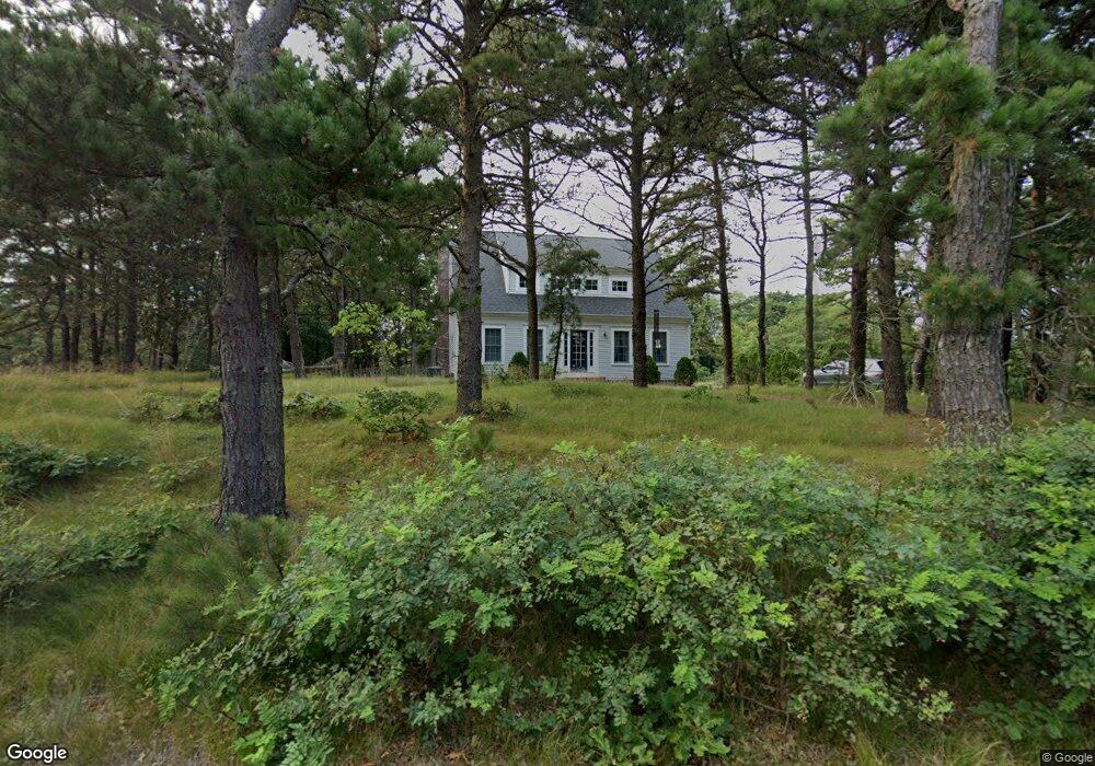
340 Lieutenant Island Rd Wellfleet, MA 02667
Estimated Value: $969,000 - $1,140,000
3
Beds
2
Baths
1,854
Sq Ft
$566/Sq Ft
Est. Value
About This Home
This home is located at 340 Lieutenant Island Rd, Wellfleet, MA 02667 and is currently estimated at $1,049,597, approximately $566 per square foot. 340 Lieutenant Island Rd is a home located in Barnstable County with nearby schools including Wellfleet Elementary School, Nauset Regional Middle School, and Nauset Regional High School.
Ownership History
Date
Name
Owned For
Owner Type
Purchase Details
Closed on
Jun 16, 2006
Sold by
Venell Jane Law
Bought by
Guillemette Glenn J and Guillemette Patricia A
Current Estimated Value
Home Financials for this Owner
Home Financials are based on the most recent Mortgage that was taken out on this home.
Original Mortgage
$150,000
Interest Rate
6.62%
Mortgage Type
Purchase Money Mortgage
Create a Home Valuation Report for This Property
The Home Valuation Report is an in-depth analysis detailing your home's value as well as a comparison with similar homes in the area
Home Values in the Area
Average Home Value in this Area
Purchase History
| Date | Buyer | Sale Price | Title Company |
|---|---|---|---|
| Guillemette Glenn J | $340,000 | -- | |
| Guillemette Glenn J | $340,000 | -- |
Source: Public Records
Mortgage History
| Date | Status | Borrower | Loan Amount |
|---|---|---|---|
| Open | Guillemette Glenn J | $135,000 | |
| Closed | Guillemette Glenn J | $150,000 |
Source: Public Records
Tax History Compared to Growth
Tax History
| Year | Tax Paid | Tax Assessment Tax Assessment Total Assessment is a certain percentage of the fair market value that is determined by local assessors to be the total taxable value of land and additions on the property. | Land | Improvement |
|---|---|---|---|---|
| 2025 | $7,220 | $1,015,500 | $415,100 | $600,400 |
| 2024 | $6,728 | $985,100 | $395,300 | $589,800 |
| 2023 | $5,889 | $846,100 | $335,000 | $511,100 |
| 2022 | $5,171 | $664,600 | $293,900 | $370,700 |
| 2021 | $3,393 | $593,900 | $262,400 | $331,500 |
| 2020 | $4,538 | $585,500 | $265,600 | $319,900 |
| 2019 | $4,412 | $570,800 | $265,600 | $305,200 |
| 2018 | $2,625 | $568,300 | $265,600 | $302,700 |
| 2017 | $3,814 | $562,500 | $265,600 | $296,900 |
| 2016 | $3,807 | $557,400 | $263,000 | $294,400 |
| 2015 | $3,743 | $552,100 | $260,300 | $291,800 |
Source: Public Records
Map
Nearby Homes
- 90 Blue Heron Rd
- 40 Leilla Rich Dr
- 90 Ring Rd
- 55 Harvard St
- 95 Barker St
- 25 1st Ave
- 210 West Rd Unit B9
- 210 West Rd Unit M-16
- 190 Meadow Ave W
- 245 Paine Hollow Rd
- 60 Long Ave Unit E
- 41-43 9th St
- 80 4th St
- 176 Village Ln
- 90 Paine Hollow Rd
- 11 Whelpley Rd
- 140 Harvest Rd
- 1937 State Hwy Rte 6 Unit 8
- 1937 State Highway Route 6 Unit E
- 1937 State Highway Route 6 Unit E
- 350 Lieutenant Island Rd
- 30 Compass Hill Rd
- 320 Lieutenant Island Rd
- 355 Lieutenant Island Rd
- 50 Bayberry Ln
- 15 Old Salt Ln
- 365 Lieut Island (Not On Island) Rd
- 65 Compass Hill Rd
- 20 Old Salt Ln
- 5 Compass Hill Rd
- 300 Lieutenant Island Rd
- 365 Lieutenant Island Rd
- 25 Old Salt Ln
- 85 Compass Hill Rd
- 386 Lieutenant Island Rd
- 385 Lieutenant Island Rd
- 330 Lieutenant Island Rd
- 290 Lieutenant Island Rd
- 35 Old Salt Ln
- 95 Compass Hill Rd