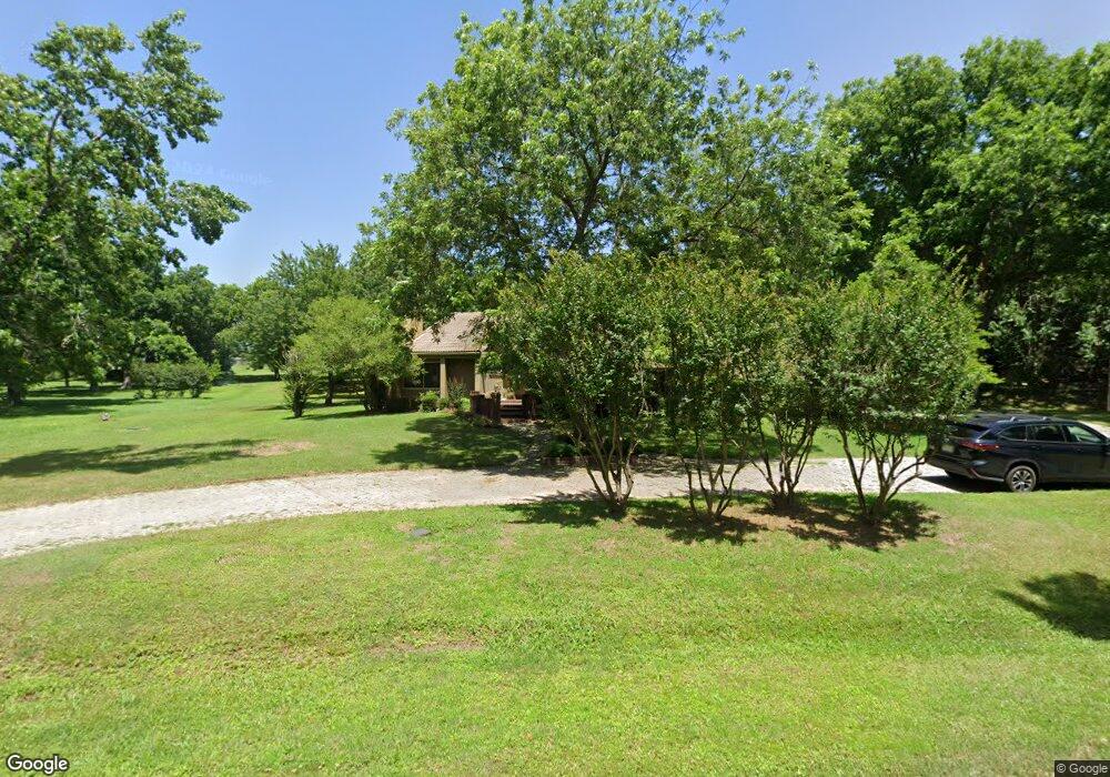
340 Montclair Dr Sherman, TX 75092
Estimated Value: $500,000 - $608,000
3
Beds
4
Baths
2,935
Sq Ft
$194/Sq Ft
Est. Value
About This Home
This home is located at 340 Montclair Dr, Sherman, TX 75092 and is currently estimated at $568,735, approximately $193 per square foot. 340 Montclair Dr is a home located in Grayson County with nearby schools including S&S Consolidated Elementary School, S&S Consolidated Middle School, and S. & S. Cons H.S..
Ownership History
Date
Name
Owned For
Owner Type
Purchase Details
Closed on
May 24, 2004
Sold by
Wronski Michael T
Bought by
Pappas Gregory J and Pappas Daniella C
Current Estimated Value
Home Financials for this Owner
Home Financials are based on the most recent Mortgage that was taken out on this home.
Original Mortgage
$180,000
Outstanding Balance
$86,231
Interest Rate
5.81%
Mortgage Type
Purchase Money Mortgage
Estimated Equity
$482,504
Create a Home Valuation Report for This Property
The Home Valuation Report is an in-depth analysis detailing your home's value as well as a comparison with similar homes in the area
Home Values in the Area
Average Home Value in this Area
Purchase History
| Date | Buyer | Sale Price | Title Company |
|---|---|---|---|
| Pappas Gregory J | -- | -- |
Source: Public Records
Mortgage History
| Date | Status | Borrower | Loan Amount |
|---|---|---|---|
| Open | Pappas Gregory J | $180,000 |
Source: Public Records
Tax History Compared to Growth
Tax History
| Year | Tax Paid | Tax Assessment Tax Assessment Total Assessment is a certain percentage of the fair market value that is determined by local assessors to be the total taxable value of land and additions on the property. | Land | Improvement |
|---|---|---|---|---|
| 2025 | $9,075 | $578,789 | -- | -- |
| 2024 | $10,509 | $526,172 | $0 | $0 |
| 2023 | $8,193 | $478,338 | $0 | $0 |
| 2022 | $9,339 | $434,853 | $0 | $0 |
| 2021 | $9,433 | $401,583 | $104,483 | $297,100 |
| 2020 | $8,789 | $405,071 | $104,483 | $300,588 |
| 2019 | $8,326 | $376,001 | $68,616 | $307,385 |
| 2018 | $7,036 | $297,011 | $21,856 | $275,155 |
| 2017 | $6,399 | $279,124 | $20,400 | $258,724 |
| 2016 | $5,817 | $279,124 | $20,400 | $258,724 |
| 2015 | $3,908 | $225,090 | $21,856 | $203,234 |
| 2014 | $3,760 | $210,295 | $21,856 | $188,439 |
Source: Public Records
Map
Nearby Homes
- 1706 Norwood St
- 2802 Spring Lake Dr
- 1913 Heritage Knoll Dr
- 1912 Heritage Knoll Dr
- 1720 Heritage Knoll Dr
- 2217 Norwood St
- 2710 Stonecrest Dr
- 2715 Stonecrest Dr
- 2705 Spring Lake Dr
- 2714 Stonecrest Dr
- TBD Heritage Knoll -26 Lots
- 1809 Heritage Creek Dr
- 1605 Heritage Creek Dr
- 2806 Spring Lake Dr
- 1617 Heritage Creek Dr
- The Knollwood Plan at Heritage Crossing
- The Howe Plan at Heritage Crossing
- The Plano at Heritage Crossing
- The Waco Plan at Heritage Crossing
- The Gunter Plan at Heritage Crossing
- 3505 Montclaire Dr
- 3505 Montclair Dr
- 935 Carriage Estates Rd
- 300 Montclair Dr
- 354 Montclair Dr
- 3520 Montclaire Dr
- 973 Carriage Estates Rd
- 1610 Carriage Estates Rd
- 1618 Carriage Estates Rd
- 266 Montclair Dr
- 1704 Carriage Estates Rd
- 154 Montclair Dr
- 1708 Carriage Estates Rd
- 319 Montclair Dr
- 190 Montclair Dr
- 130 Montclair Dr
- 1602 Carriage Estates Rd
- 811 Carriage Estates Rd
- 942 Carriage Estates Rd
- 3500 Montclair Dr