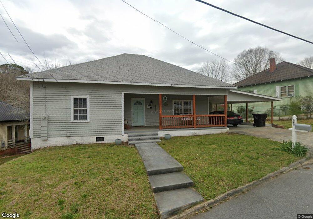
340 Mulberry St Roanoke, AL 36274
Estimated Value: $85,000 - $141,000
--
Bed
--
Bath
1,198
Sq Ft
$89/Sq Ft
Est. Value
About This Home
This home is located at 340 Mulberry St, Roanoke, AL 36274 and is currently estimated at $106,406, approximately $88 per square foot. 340 Mulberry St is a home with nearby schools including Knight Enloe Elementary School, Handley Middle School, and Handley High School.
Ownership History
Date
Name
Owned For
Owner Type
Purchase Details
Closed on
Sep 23, 2022
Sold by
Brown William L and Brown Cynthia A
Bought by
Addison Pamela
Current Estimated Value
Purchase Details
Closed on
Jul 2, 2021
Sold by
Brown William L and Brown Cynthia A
Bought by
Brown William L and Brown Cynthia A
Purchase Details
Closed on
Jul 7, 2014
Sold by
Deborah Jean Deborah Jean
Bought by
Junco Bryan Miguel
Purchase Details
Closed on
May 4, 2007
Sold by
Windsor John and Windsor Bobbie
Bought by
Junco Deborah Jean
Create a Home Valuation Report for This Property
The Home Valuation Report is an in-depth analysis detailing your home's value as well as a comparison with similar homes in the area
Home Values in the Area
Average Home Value in this Area
Purchase History
| Date | Buyer | Sale Price | Title Company |
|---|---|---|---|
| Addison Pamela | $110,000 | -- | |
| Addison Pamela | $110,000 | None Listed On Document | |
| Brown William L | -- | Law Firm Of Kesa M Johnston Ll | |
| Junco Bryan Miguel | -- | -- | |
| Junco Deborah Jean | -- | -- |
Source: Public Records
Tax History Compared to Growth
Tax History
| Year | Tax Paid | Tax Assessment Tax Assessment Total Assessment is a certain percentage of the fair market value that is determined by local assessors to be the total taxable value of land and additions on the property. | Land | Improvement |
|---|---|---|---|---|
| 2024 | $321 | $7,640 | $140 | $7,500 |
| 2023 | $321 | $6,080 | $340 | $5,740 |
| 2022 | $264 | $6,080 | $340 | $5,740 |
| 2021 | $247 | $6,080 | $340 | $5,740 |
| 2020 | $255 | $6,080 | $340 | $5,740 |
| 2018 | $65 | $2,940 | $160 | $2,780 |
| 2017 | $70 | $3,200 | $160 | $3,040 |
| 2016 | $63 | $2,860 | $160 | $2,700 |
| 2015 | $120 | $28,338 | $0 | $0 |
| 2014 | $256 | $30,451 | $0 | $0 |
| 2013 | -- | $30,451 | $0 | $0 |
Source: Public Records
Map
Nearby Homes
- 0 Hwy 431 Unit 10582424
- 534 Knight Ave
- 737 Franklin St
- 536 West Ave
- 0 Lucille Cir Unit 21430345
- 0 White St
- 63445 Alabama 22 Unit 70 Ac
- 1211 Main St
- 1335 Main St
- 306 Stewart Dr
- 0 Fincher Rd
- 230 Lafayette St
- 161 Lakeview Dr
- 1533 Main St
- 507 Cherry Ave
- 646 Mickle Dr
- 570 County Road 79
- 2950 Highway 431 Unit 7.5 Ac
- 818 Heflin Ave
- 206 Gilham Rd
- 348 Mulberry St
- 333 Mulberry St
- 352 Mulberry St
- 330 Mulberry St
- 330 Mulberry St
- 325 Mulberry St
- 319 Mulberry St
- 739 Central Ave
- 739 Central Ave
- 330 North Ave
- 611 Stone Ave
- 302 North Ave
- 708 Central Ave
- 412 Piedmont St
- 500 County Road 672
- 801 Central Ave
- 406 Piedmont St
- 322 Piedmont St
- 312 North Ave
- 306 North Ave