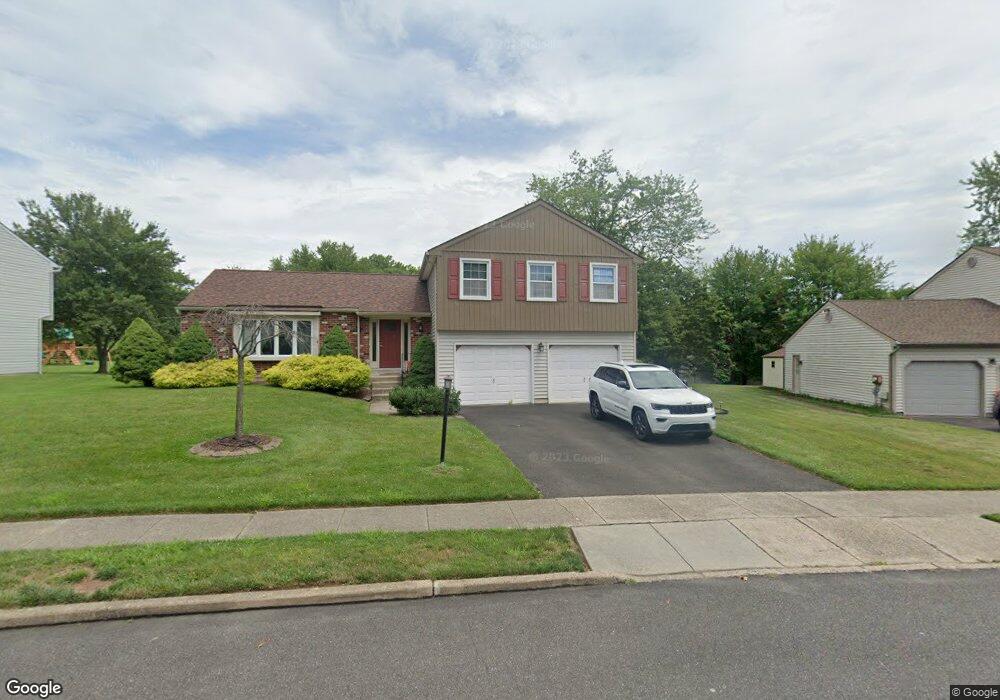
340 N Flint Ct Yardley, PA 19067
Estimated Value: $577,000 - $705,000
4
Beds
3
Baths
1,995
Sq Ft
$320/Sq Ft
Est. Value
About This Home
This home is located at 340 N Flint Ct, Yardley, PA 19067 and is currently estimated at $637,513, approximately $319 per square foot. 340 N Flint Ct is a home located in Bucks County with nearby schools including Eleanor Roosevelt Elementary School, Pennwood Middle School, and Pennsbury High School.
Ownership History
Date
Name
Owned For
Owner Type
Purchase Details
Closed on
Nov 26, 2024
Sold by
Meloni Nicholas Michael
Bought by
Meloni Nicholas Michael and Meloni Christine
Current Estimated Value
Purchase Details
Closed on
Mar 31, 2011
Sold by
Cartus Financial Corporation
Bought by
Meloni Nicholas and Meloni Erica M
Home Financials for this Owner
Home Financials are based on the most recent Mortgage that was taken out on this home.
Original Mortgage
$326,507
Interest Rate
4.75%
Mortgage Type
FHA
Purchase Details
Closed on
Mar 15, 2011
Sold by
Lambert Robert R and Lambert Cathrine L
Bought by
Cartus Financial Corporation
Home Financials for this Owner
Home Financials are based on the most recent Mortgage that was taken out on this home.
Original Mortgage
$326,507
Interest Rate
4.75%
Mortgage Type
FHA
Create a Home Valuation Report for This Property
The Home Valuation Report is an in-depth analysis detailing your home's value as well as a comparison with similar homes in the area
Home Values in the Area
Average Home Value in this Area
Purchase History
| Date | Buyer | Sale Price | Title Company |
|---|---|---|---|
| Meloni Nicholas Michael | -- | None Listed On Document | |
| Meloni Nicholas Michael | -- | None Listed On Document | |
| Meloni Nicholas | $335,000 | None Available | |
| Cartus Financial Corporation | $340,000 | None Available |
Source: Public Records
Mortgage History
| Date | Status | Borrower | Loan Amount |
|---|---|---|---|
| Previous Owner | Meloni Nicholas | $326,507 |
Source: Public Records
Tax History Compared to Growth
Tax History
| Year | Tax Paid | Tax Assessment Tax Assessment Total Assessment is a certain percentage of the fair market value that is determined by local assessors to be the total taxable value of land and additions on the property. | Land | Improvement |
|---|---|---|---|---|
| 2025 | $7,748 | $32,720 | $9,240 | $23,480 |
| 2024 | $7,748 | $32,720 | $9,240 | $23,480 |
| 2023 | $7,199 | $32,720 | $9,240 | $23,480 |
| 2022 | $7,199 | $32,720 | $9,240 | $23,480 |
| 2021 | $7,085 | $32,720 | $9,240 | $23,480 |
| 2020 | $7,085 | $32,720 | $9,240 | $23,480 |
| 2019 | $3,876 | $32,720 | $9,240 | $23,480 |
| 2018 | $6,823 | $32,720 | $9,240 | $23,480 |
| 2017 | $6,612 | $32,720 | $9,240 | $23,480 |
| 2016 | $6,535 | $32,720 | $9,240 | $23,480 |
| 2015 | -- | $32,720 | $9,240 | $23,480 |
| 2014 | -- | $32,720 | $9,240 | $23,480 |
Source: Public Records
Map
Nearby Homes
- 389 Twig Ln
- 250 Wild Orchid Ct
- 302 Frazer Dr
- 1265 Barclay Crescent
- 1090 Bancroft Ln
- 1561 Applewood Cir
- 432 Schindler Dr
- 1578 Willow Pond Dr
- 620 Grindan Dr
- 200 Clover Hill Ct
- 1517 Derbyshire Rd
- 184 Crestview Way
- 971 Weber Dr
- 290 Oxford Valley Rd
- 571 Heritage Oak Dr
- 1605 Covington Rd
- 229 Walton Dr
- 332 Dunhill Way
- 866 Weber Dr
- 44 Hedgerow Dr
- 360 N Flint Ct
- 320 N Flint Ct
- 365 N Fieldstone Ct
- 357 N Fieldstone Ct
- 373 N Fieldstone Ct
- 349 N Fieldstone Ct
- 341 N Fieldstone Ct
- 361 N Flint Ct
- 380 N Flint Ct
- 300 N Flint Ct
- 333 N Fieldstone Ct
- 331 N Flint Ct
- 317 N Fieldstone Ct
- 391 N Flint Ct
- 381 N Fieldstone Ct
- 309 N Fieldstone Ct
- 301 N Flint Ct
- 389 N Fieldstone Ct
- 301 N Fieldstone Ct
- 397 N Fieldstone Ct